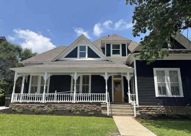
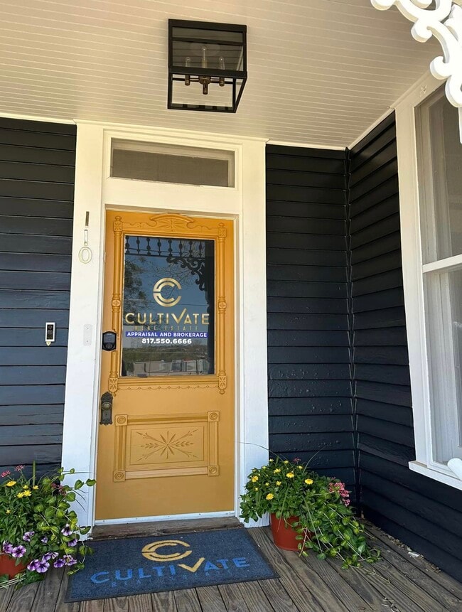
Property Record
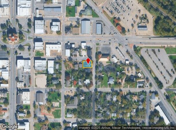
110 S Walnut St, Weatherford, TX 76086
Property Detail
110 S Walnut St
Dallas-Fort Worth-Arlington, TX
Weatherford Original Town
19035-031-001-10
ACRES: 0.176 LOT: 1R BLK: 31 SUBD: WEATHERFORD ORIGINAL TOWN F-72
Sfr
Parker
X
Texas
48367C0270E
1r
2024
0.18 AC
2025
Parker County
140201
Dallas/Ft Worth
2,464 SF
NEARBY LISTINGS FOR SALE OR LEASE
DEMOGRAPHICS near 110 S Walnut St
1 mile
3 mile
5 mile
2024 Total Population
7,742
33,618
49,847
2029 Population
9,949
43,440
64,454
Pop Growth 2024-2029
+ 28.51%
+ 29.22%
+ 29.30%
Average Age
39
40
40
2024 Total Households
3,107
13,209
19,198
HH Growth 2024-2029
+ 28.55%
+ 29.28%
+ 29.34%
Median Household Inc
$48,197
$63,502
$67,792
Avg Household Size
2.30
2.40
2.50
2024 Avg HH Vehicles
2.00
2.00
2.00
Median Home Value
$224,792
$246,808
$279,461
Median Year Built
1975
1993
1999
Nearby Places
Map Layers
Map Styles
 Street
 Aerial
Transit
 Traffic
 Biking
Places
Listings with unknown addresses are not visible on the map
- Restaurants
- Banks
- Shops
- Fitness
- Groceries
SALE & LEASE HISTORY
LISTING DATE
SALE/LEASE

Mar 15, 2019
For Sale
Jul 02, 2025
For Sale
Nearby Properties
Address
Land Use
TOTAL SIZE
Lot Size
Zoning
Address
Land Use
TOTAL SIZE
Lot Size
Zoning
341,996 SF
16.60 AC
Address
Land Use
TOTAL SIZE
Lot Size
Zoning
399,466 SF
11.50 AC
Address
Land Use
TOTAL SIZE
Lot Size
Zoning
64.64 AC
Address
Land Use
TOTAL SIZE
Lot Size
Zoning
279,600 SF
14.43 AC
Address
Land Use
TOTAL SIZE
Lot Size
Zoning
15.65 AC
Address
Land Use
TOTAL SIZE
Lot Size
Zoning
141,292 SF
13.88 AC
Address
Land Use
TOTAL SIZE
Lot Size
Zoning
167,850 SF
13.50 AC
Address
Land Use
TOTAL SIZE
Lot Size
Zoning
171,147 SF
8.77 AC
Address
Land Use
TOTAL SIZE
Lot Size
Zoning
138,495 SF
13.83 AC
Address
Land Use
TOTAL SIZE
Lot Size
Zoning
103,600 SF
6 AC
Address
Land Use
TOTAL SIZE
Lot Size
Zoning
75,854 SF
8.84 AC
Address
Land Use
TOTAL SIZE
Lot Size
Zoning
50,893 SF
10.37 AC
Address
Land Use
TOTAL SIZE
Lot Size
Zoning
110,206 SF
11.02 AC
Address
Land Use
TOTAL SIZE
Lot Size
Zoning
31.61 AC
Address
Land Use
TOTAL SIZE
Lot Size
Zoning
210,698 SF
26.61 AC
Address
Land Use
TOTAL SIZE
Lot Size
Zoning
6.95 AC
Address
Land Use
TOTAL SIZE
Lot Size
Zoning
75,968 SF
6.82 AC
Address
Land Use
TOTAL SIZE
Lot Size
Zoning
55,112 SF
4.68 AC
Address
Land Use
TOTAL SIZE
Lot Size
Zoning
104,188 SF
12.73 AC
Address
Land Use
TOTAL SIZE
Lot Size
Zoning
81,112 SF
7.34 AC
Address
Land Use
TOTAL SIZE
Lot Size
Zoning
23,886 SF
23.19 AC
Address
Land Use
TOTAL SIZE
Lot Size
Zoning
27,669 SF
3.58 AC
Address
Land Use
TOTAL SIZE
Lot Size
Zoning
134,934 SF
13.23 AC
Address
Land Use
TOTAL SIZE
Lot Size
Zoning
26,050 SF
5.44 AC
Address
Land Use
TOTAL SIZE
Lot Size
Zoning
123,606 SF
10.27 AC
Address
Land Use
TOTAL SIZE
Lot Size
Zoning
103,125 SF
18.25 AC
Address
Land Use
TOTAL SIZE
Lot Size
Zoning
50,446 SF
2.05 AC
Address
Land Use
TOTAL SIZE
Lot Size
Zoning
155,253 SF
9.31 AC
Address
Land Use
TOTAL SIZE
Lot Size
Zoning
103,631 SF
7.78 AC
Address
Land Use
TOTAL SIZE
Lot Size
Zoning
146,651 SF
7.73 AC
The World's #1 Commercial Real Estate Marketplace
Connect with us
© 2026 CoStar Group
The information above has been obtained from sources believed reliable. While we do not doubt its accuracy we have not verified it and make no guarantee, warranty or representation about it. It is your responsibility to independently confirm its accuracy and completeness. Any projections, opinions, assumptions, or estimates used are for example only and do not represent the current or future performance of the property. The value of this transaction to you depends on tax and other factors which should be evaluated by your tax, financial, and legal advisors. You and your advisors should conduct a careful, independent investigation of the property to determine to your satisfaction the suitability of the property for your needs.