Property Record
110 Sunset Dr, Deep Gap, NC 28618

Property Detail
110 Sunset Dr
Boone, NC
SR 421
2970-24-1374-000
WATAUGA
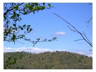
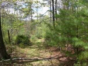
Residentialacreage
North Carolina
B and X Area of moderate flood hazard, usually the area between the limits of the 100-year and 500-year floods.
56 AC
2024
Hickory/Morganton
2025
Other Market Areas
920702
NEARBY LISTINGS FOR SALE OR LEASE
-
-
View all Deep Gap listings for sale on LoopNet.com
DEMOGRAPHICS near 110 Sunset Dr
1 mile
3 mile
5 mile
2025 Total Population
193
788
3,282
2030 Population
197
801
3,362
Pop Growth 2025-2030
+ 2.07%
+ 1.65%
+ 2.44%
Average Age
44
44
45
2025 Total Households
82
335
1,415
HH Growth 2025-2030
+ 2.44%
+ 1.79%
+ 2.61%
Median Household Inc
$53,333
$54,600
$47,500
Avg Household Size
2.30
2.30
2.30
2025 Avg HH Vehicles
2.00
2.00
2.00
Median Home Value
$347,826
$348,888
$336,560
Median Year Built
1991
1990
1991
Nearby Places
Map Layers
Map Styles
 Street
 Aerial
Layers
 Traffic
 Biking
Places
Listings with unknown addresses are not visible on the map
- Restaurants
- Banks
- Shops
- Fitness
- Groceries
Nearby Properties
Address
Land Use
TOTAL SIZE
Lot Size
Zoning
Address
Land Use
TOTAL SIZE
Lot Size
Zoning
378.30 AC
Address
Land Use
TOTAL SIZE
Lot Size
Zoning
3,816 SF
7.63 AC
Address
Land Use
TOTAL SIZE
Lot Size
Zoning
776 SF
3,412.02 AC
Address
Land Use
TOTAL SIZE
Lot Size
Zoning
3,433 SF
4.47 AC
Address
Land Use
TOTAL SIZE
Lot Size
Zoning
3,354 SF
1.36 AC
Address
Land Use
TOTAL SIZE
Lot Size
Zoning
82.30 AC
Address
Land Use
TOTAL SIZE
Lot Size
Zoning
5,440 SF
1.50 AC
Address
Land Use
TOTAL SIZE
Lot Size
Zoning
154.23 AC
Address
Land Use
TOTAL SIZE
Lot Size
Zoning
1,457 SF
3.53 AC
Address
Land Use
TOTAL SIZE
Lot Size
Zoning
138.82 AC
Address
Land Use
TOTAL SIZE
Lot Size
Zoning
Address
Land Use
TOTAL SIZE
Lot Size
Zoning
62.29 AC
Address
Land Use
TOTAL SIZE
Lot Size
Zoning
33.30 AC
Address
Land Use
TOTAL SIZE
Lot Size
Zoning
Address
Land Use
TOTAL SIZE
Lot Size
Zoning
109.08 AC
Address
Land Use
TOTAL SIZE
Lot Size
Zoning
10,728 SF
1 AC
Address
Land Use
TOTAL SIZE
Lot Size
Zoning
Address
Land Use
TOTAL SIZE
Lot Size
Zoning
1,024 SF
1.85 AC
Address
Land Use
TOTAL SIZE
Lot Size
Zoning
Address
Land Use
TOTAL SIZE
Lot Size
Zoning
53.14 AC
Address
Land Use
TOTAL SIZE
Lot Size
Zoning
40.89 AC
Address
Land Use
TOTAL SIZE
Lot Size
Zoning
40.89 AC
Address
Land Use
TOTAL SIZE
Lot Size
Zoning
36.50 AC
Address
Land Use
TOTAL SIZE
Lot Size
Zoning
44.97 AC
Address
Land Use
TOTAL SIZE
Lot Size
Zoning
4,550 SF
14.20 AC
Address
Land Use
TOTAL SIZE
Lot Size
Zoning
65.82 AC
Address
Land Use
TOTAL SIZE
Lot Size
Zoning
1,750 SF
4.38 AC
Address
Land Use
TOTAL SIZE
Lot Size
Zoning
1,414 SF
89.80 AC
Address
Land Use
TOTAL SIZE
Lot Size
Zoning
713.90 AC
The World's #1 Commercial Real Estate Marketplace
Connect with us
© 2026 CoStar Group
The information above has been obtained from sources believed reliable. While we do not doubt its accuracy we have not verified it and make no guarantee, warranty or representation about it. It is your responsibility to independently confirm its accuracy and completeness. Any projections, opinions, assumptions, or estimates used are for example only and do not represent the current or future performance of the property. The value of this transaction to you depends on tax and other factors which should be evaluated by your tax, financial, and legal advisors. You and your advisors should conduct a careful, independent investigation of the property to determine to your satisfaction the suitability of the property for your needs.