Property Record
110 W Borderland Rd, El Paso, TX 79932

Current Lease Availabilities
NEARBY LISTINGS FOR SALE OR LEASE
Property Detail
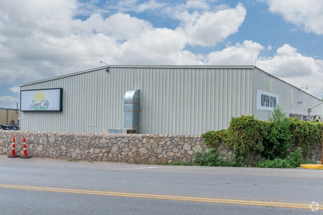
110 W Borderland Rd
El Paso, TX
Upper Valley
U819-999-0120-07F0
12 UPPER VALLEY TR7-F (1.645 AC) TR 7-G (10.508 AC) TR 7-G-1 (3.921 AC) TR 7-H-3 (2.567 AC) (18.641 AC)
Commercialnec
El Paso
2024
Texas
2025
18.64 AC
010218
West
201,546 SF
El Paso
DEMOGRAPHICS near 110 W Borderland Rd
1 Mile
3 Mile
5 Mile
2024 Total Population
8,644
60,033
119,236
2029 Population
8,821
60,986
121,267
Pop Growth 2024-2029
+ 2.05%
+ 1.59%
+ 1.70%
Average Age
34
36
37
2024 Total Households
2,829
20,117
40,881
HH Growth 2024-2029
+ 2.01%
+ 1.53%
+ 1.67%
Median Household Inc
$69,175
$76,832
$75,095
Avg Household Size
3.00
2.90
2.80
2024 Avg HH Vehicles
2.00
2.00
2.00
Median Home Value
$178,208
$212,347
$223,212
Median Year Built
2006
1998
1993
Nearby Places
Map Layers
Map Styles
 Street
 Aerial
- Restaurants
- Banks
- Shops
- Fitness
- Groceries
PUBLIC TRANSPORTATION
AIRPORT
El Paso International
DRIVE
WALK
Distance
El Paso International
40 min
24.5 mi
Freight Ports
Port of San Diego
DRIVE
WALK
Distance
Port of San Diego
747 min
714.0 mi
Nearby Properties
Address
Land Use
TOTAL SIZE
Lot Size
Zoning
Address
Land Use
TOTAL SIZE
Lot Size
Zoning
279,966 SF
44.49 AC
C4C
Address
Land Use
TOTAL SIZE
Lot Size
Zoning
409,742 SF
37.76 AC
C4
Address
Land Use
TOTAL SIZE
Lot Size
Zoning
127,552 SF
14.24 AC
C4
Address
Land Use
TOTAL SIZE
Lot Size
Zoning
545,506 SF
50.94 AC
M1
Address
Land Use
TOTAL SIZE
Lot Size
Zoning
236,134 SF
14.49 AC
C1
Address
Land Use
TOTAL SIZE
Lot Size
Zoning
234,339 SF
10.03 AC
C3C
Address
Land Use
TOTAL SIZE
Lot Size
Zoning
149,913 SF
66.49 AC
R3S
Address
Land Use
TOTAL SIZE
Lot Size
Zoning
402,206 SF
21.82 AC
C4C
Address
Land Use
TOTAL SIZE
Lot Size
Zoning
199,384 SF
17.91 AC
C4
Address
Land Use
TOTAL SIZE
Lot Size
Zoning
112,960 SF
Address
Land Use
TOTAL SIZE
Lot Size
Zoning
220,159 SF
29.02 AC
C4
Address
Land Use
TOTAL SIZE
Lot Size
Zoning
79,722 SF
11 AC
C3
Address
Land Use
TOTAL SIZE
Lot Size
Zoning
103,525 SF
7 AC
M1
Address
Land Use
TOTAL SIZE
Lot Size
Zoning
206,600 SF
10.74 AC
AO
Address
Land Use
TOTAL SIZE
Lot Size
Zoning
115,155 SF
4.63 AC
C2C
Address
Land Use
TOTAL SIZE
Lot Size
Zoning
415,500 SF
33.44 AC
M1
Address
Land Use
TOTAL SIZE
Lot Size
Zoning
46,534 SF
9.81 AC
C4C
Address
Land Use
TOTAL SIZE
Lot Size
Zoning
127,595 SF
9.64 AC
C4S
Address
Land Use
TOTAL SIZE
Lot Size
Zoning
159,851 SF
7.19 AC
A2S
Address
Land Use
TOTAL SIZE
Lot Size
Zoning
149,514 SF
18.14 AC
M1
Address
Land Use
TOTAL SIZE
Lot Size
Zoning
143,828 SF
15.77 AC
M1
Address
Land Use
TOTAL SIZE
Lot Size
Zoning
136,776 SF
16.26 AC
C4S
Address
Land Use
TOTAL SIZE
Lot Size
Zoning
290,880 SF
9.79 AC
Address
Land Use
TOTAL SIZE
Lot Size
Zoning
21,621 SF
167.69 AC
R3
Address
Land Use
TOTAL SIZE
Lot Size
Zoning
271,352 SF
29.85 AC
M1S
Address
Land Use
TOTAL SIZE
Lot Size
Zoning
119,090 SF
11.66 AC
C4
Address
Land Use
TOTAL SIZE
Lot Size
Zoning
239,984 SF
13.50 AC
M1
Address
Land Use
TOTAL SIZE
Lot Size
Zoning
161,000 SF
10.37 AC
C4
Address
Land Use
TOTAL SIZE
Lot Size
Zoning
158,188 SF
36.93 AC
R2
Address
Land Use
TOTAL SIZE
Lot Size
Zoning
146,176 SF
7.59 AC
A2S
The World's #1 Commercial Real Estate Marketplace
Connect with us
© 2025 CoStar Group
The information above has been obtained from sources believed reliable. While we do not doubt its accuracy we have not verified it and make no guarantee, warranty or representation about it. It is your responsibility to independently confirm its accuracy and completeness. Any projections, opinions, assumptions, or estimates used are for example only and do not represent the current or future performance of the property. The value of this transaction to you depends on tax and other factors which should be evaluated by your tax, financial, and legal advisors. You and your advisors should conduct a careful, independent investigation of the property to determine to your satisfaction the suitability of the property for your needs.