Property Record
1100 Charleston Ave, Mattoon, IL 61938
NEARBY LISTINGS FOR SALE OR LEASE
-
-
View all Mattoon listings for lease on LoopNet.com
Property Detail
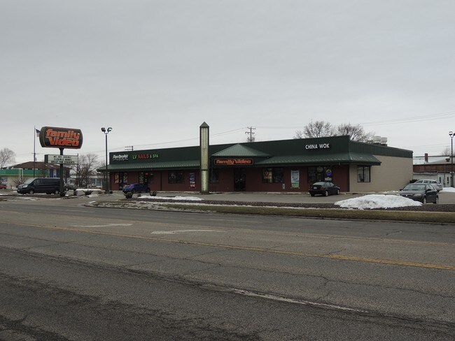
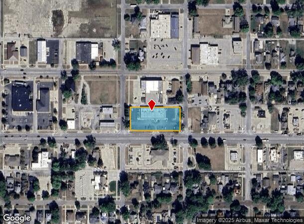
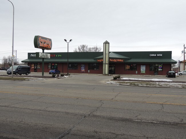
1100 Charleston Ave
Charleston-Mattoon, IL
Original Town Of Mattoon
07-1-04121-000
ORIGINAL TOWN OF MATTOON BLK 135 LOTS 7, 8, 9, 10, 11 & 12 SE 1/4 SEC 13 T12N R07E 2021 DOLLAR GENERAL & CHINA WOK
Commercialnec
Coles
AE
Illinois
17029C0280D
7-12
2024
0.96 AC
2024
Effingham/Central Illinois Area
001100
Other Market Areas
8,400 SF
DEMOGRAPHICS near 1100 Charleston Ave
1 Mile
3 Mile
5 Mile
2024 Total Population
8,642
17,104
19,323
2029 Population
8,504
16,764
18,933
Pop Growth 2024-2029
(1.60%)
(1.99%)
(2.02%)
Average Age
42
42
42
2024 Total Households
3,959
7,634
8,561
HH Growth 2024-2029
(1.77%)
(2.17%)
(2.20%)
Median Household Inc
$41,083
$44,565
$46,100
Avg Household Size
2.10
2.10
2.20
2024 Avg HH Vehicles
2.00
2.00
2.00
Median Home Value
$72,646
$85,574
$91,187
Median Year Built
1954
1957
1959
Nearby Places
Map Layers
Map Styles
 Street
 Aerial
- Restaurants
- Banks
- Shops
- Fitness
- Groceries
SALE & LEASE HISTORY
LISTING DATE
SALE/LEASE

Sep 25, 2016
For Lease
Apr 10, 2018
For Lease
Apr 10, 2018
For Lease
Nearby Properties
Address
Land Use
TOTAL SIZE
Lot Size
Zoning
Address
Land Use
TOTAL SIZE
Lot Size
Zoning
199,970 SF
24.47 AC
Address
Land Use
TOTAL SIZE
Lot Size
Zoning
75,332 SF
6.48 AC
Address
Land Use
TOTAL SIZE
Lot Size
Zoning
290,500 SF
30.27 AC
Address
Land Use
TOTAL SIZE
Lot Size
Zoning
24,943 SF
91.27 AC
Address
Land Use
TOTAL SIZE
Lot Size
Zoning
7,500 SF
26.72 AC
Address
Land Use
TOTAL SIZE
Lot Size
Zoning
0.92 AC
Address
Land Use
TOTAL SIZE
Lot Size
Zoning
4,500 SF
13.35 AC
Address
Land Use
TOTAL SIZE
Lot Size
Zoning
208,184 SF
30.37 AC
Address
Land Use
TOTAL SIZE
Lot Size
Zoning
39,960 SF
1.95 AC
Address
Land Use
TOTAL SIZE
Lot Size
Zoning
Address
Land Use
TOTAL SIZE
Lot Size
Zoning
59,782 SF
6.79 AC
Address
Land Use
TOTAL SIZE
Lot Size
Zoning
95,068 SF
10.13 AC
Address
Land Use
TOTAL SIZE
Lot Size
Zoning
3,360 SF
5.96 AC
Address
Land Use
TOTAL SIZE
Lot Size
Zoning
9,888 SF
1.17 AC
Address
Land Use
TOTAL SIZE
Lot Size
Zoning
31,026 SF
34.80 AC
Address
Land Use
TOTAL SIZE
Lot Size
Zoning
149,715 SF
56.72 AC
Address
Land Use
TOTAL SIZE
Lot Size
Zoning
41,673 SF
5.40 AC
Address
Land Use
TOTAL SIZE
Lot Size
Zoning
Address
Land Use
TOTAL SIZE
Lot Size
Zoning
2,580 SF
13.07 AC
Address
Land Use
TOTAL SIZE
Lot Size
Zoning
15,263 SF
2.80 AC
Address
Land Use
TOTAL SIZE
Lot Size
Zoning
2.61 AC
Address
Land Use
TOTAL SIZE
Lot Size
Zoning
230,400 SF
31.34 AC
Address
Land Use
TOTAL SIZE
Lot Size
Zoning
19,320 SF
1.44 AC
Address
Land Use
TOTAL SIZE
Lot Size
Zoning
38,486 SF
4.99 AC
Address
Land Use
TOTAL SIZE
Lot Size
Zoning
68,424 SF
5 AC
Address
Land Use
TOTAL SIZE
Lot Size
Zoning
171,500 SF
11.90 AC
Address
Land Use
TOTAL SIZE
Lot Size
Zoning
25,576 SF
6.60 AC
Address
Land Use
TOTAL SIZE
Lot Size
Zoning
38,414 SF
5.21 AC
Address
Land Use
TOTAL SIZE
Lot Size
Zoning
62,944 SF
0.80 AC
Address
Land Use
TOTAL SIZE
Lot Size
Zoning
27,534 SF
0.32 AC
The World's #1 Commercial Real Estate Marketplace
Connect with us
© 2026 CoStar Group
The information above has been obtained from sources believed reliable. While we do not doubt its accuracy we have not verified it and make no guarantee, warranty or representation about it. It is your responsibility to independently confirm its accuracy and completeness. Any projections, opinions, assumptions, or estimates used are for example only and do not represent the current or future performance of the property. The value of this transaction to you depends on tax and other factors which should be evaluated by your tax, financial, and legal advisors. You and your advisors should conduct a careful, independent investigation of the property to determine to your satisfaction the suitability of the property for your needs.