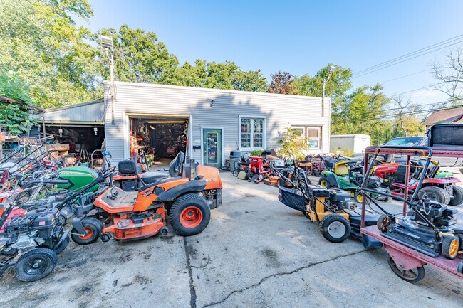
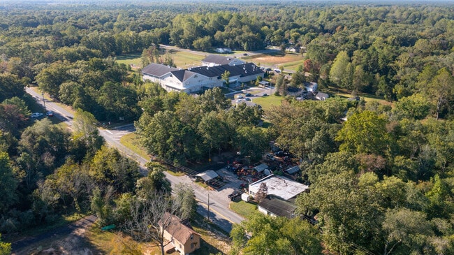
Property Record
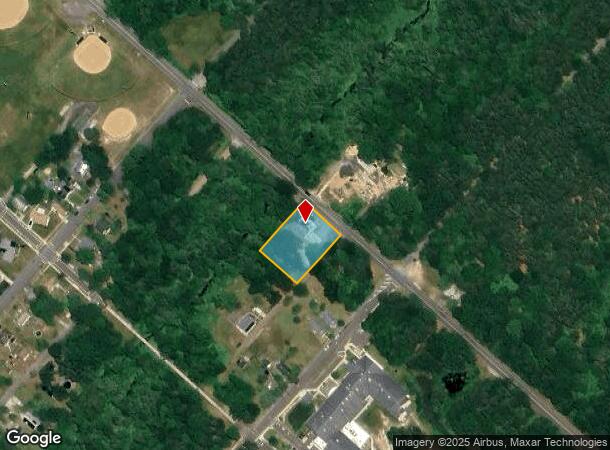
1100 Duerer St, Egg Harbor City, NJ 08215
NEARBY LISTINGS FOR SALE OR LEASE
Property Detail
1100 Duerer St
Atlantic City-Hammonton, NJ
Incl
07-00534-0000-00011
L12-15
Governmentalpublicusegeneral
Atlantic
ARE
New Jersey
34001C0142F
11
0
0.69 AC
2025
Atlantic City/Hammonton
010600
Philadelphia
4,865 SF
DEMOGRAPHICS near 1100 Duerer St
1 Mile
3 Mile
5 Mile
2024 Total Population
3,426
6,963
13,996
2029 Population
3,358
6,809
13,715
Pop Growth 2024-2029
(1.98%)
(2.21%)
(2.01%)
Average Age
39
41
42
2024 Total Households
1,293
2,706
5,233
HH Growth 2024-2029
(2.55%)
(2.81%)
(2.64%)
Median Household Inc
$53,276
$65,664
$74,510
Avg Household Size
2.50
2.50
2.50
2024 Avg HH Vehicles
1.00
2.00
2.00
Median Home Value
$172,804
$216,440
$240,513
Median Year Built
1957
1963
1974
Nearby Places
Map Layers
Map Styles
 Street
 Aerial
- Restaurants
- Banks
- Shops
- Fitness
- Groceries
PUBLIC TRANSPORTATION
COMMUTER RAIL
Egg Harbor City (Atlantic City Line - NJ Transit Commuter Rail (NJ Transit))
DRIVE
WALK
Distance
Egg Harbor City (Atlantic City Line - NJ Transit Commuter Rail (NJ Transit))
2 min
1.5 mi
AIRPORT
Atlantic City International
DRIVE
WALK
Distance
Atlantic City International
33 min
10.0 mi
Freight Ports
Broadway Terminal - Pier 5
DRIVE
WALK
Distance
Broadway Terminal - Pier 5
53 min
41.0 mi
SALE & LEASE HISTORY
LISTING DATE
SALE/LEASE

Oct 04, 2022
For Sale
Nearby Properties
Address
Land Use
TOTAL SIZE
Lot Size
Zoning
Address
Land Use
TOTAL SIZE
Lot Size
Zoning
5.81 AC
CC
Address
Land Use
TOTAL SIZE
Lot Size
Zoning
66.23 AC
3.2C
Address
Land Use
TOTAL SIZE
Lot Size
Zoning
68,744 SF
5.03 AC
R-11
Address
Land Use
TOTAL SIZE
Lot Size
Zoning
94,984 SF
2.07 AC
R-9
Address
Land Use
TOTAL SIZE
Lot Size
Zoning
Address
Land Use
TOTAL SIZE
Lot Size
Zoning
2.27 AC
R-9
Address
Land Use
TOTAL SIZE
Lot Size
Zoning
21,056 SF
5.23 AC
IND
Address
Land Use
TOTAL SIZE
Lot Size
Zoning
4,652 SF
14.80 AC
HC-2
Address
Land Use
TOTAL SIZE
Lot Size
Zoning
12,673 SF
2.58 AC
R-9
Address
Land Use
TOTAL SIZE
Lot Size
Zoning
14,546 SF
0.48 AC
R-C
Address
Land Use
TOTAL SIZE
Lot Size
Zoning
15,974 SF
2.87 AC
H-C
Address
Land Use
TOTAL SIZE
Lot Size
Zoning
31.90 AC
TI
Address
Land Use
TOTAL SIZE
Lot Size
Zoning
6,256 SF
4.55 AC
R-22
Address
Land Use
TOTAL SIZE
Lot Size
Zoning
4.13 AC
CRR
Address
Land Use
TOTAL SIZE
Lot Size
Zoning
9,984 SF
0.52 AC
R-6
Address
Land Use
TOTAL SIZE
Lot Size
Zoning
23,500 SF
2.27 AC
H-C
Address
Land Use
TOTAL SIZE
Lot Size
Zoning
2.15 AC
H-C
Address
Land Use
TOTAL SIZE
Lot Size
Zoning
9,972 SF
0.69 AC
R-6
Address
Land Use
TOTAL SIZE
Lot Size
Zoning
8,720 SF
2.76 AC
R-9
Address
Land Use
TOTAL SIZE
Lot Size
Zoning
10,674 SF
0.55 AC
R-9
Address
Land Use
TOTAL SIZE
Lot Size
Zoning
8,056 SF
1.12 AC
R-9
Address
Land Use
TOTAL SIZE
Lot Size
Zoning
10,044 SF
0.28 AC
R-6
Address
Land Use
TOTAL SIZE
Lot Size
Zoning
1,232 SF
40 AC
AG
Address
Land Use
TOTAL SIZE
Lot Size
Zoning
8,550 SF
0.34 AC
R-C
Address
Land Use
TOTAL SIZE
Lot Size
Zoning
17 AC
AG
Address
Land Use
TOTAL SIZE
Lot Size
Zoning
23.70 AC
PVPT
Address
Land Use
TOTAL SIZE
Lot Size
Zoning
4,935 SF
1.38 AC
R-9
Address
Land Use
TOTAL SIZE
Lot Size
Zoning
20 AC
RD
Address
Land Use
TOTAL SIZE
Lot Size
Zoning
1,000,000 SF
4 AC
HC-2
Address
Land Use
TOTAL SIZE
Lot Size
Zoning
47,696 SF
4.87 AC
IND
The World's #1 Commercial Real Estate Marketplace
Connect with us
© 2025 CoStar Group
The information above has been obtained from sources believed reliable. While we do not doubt its accuracy we have not verified it and make no guarantee, warranty or representation about it. It is your responsibility to independently confirm its accuracy and completeness. Any projections, opinions, assumptions, or estimates used are for example only and do not represent the current or future performance of the property. The value of this transaction to you depends on tax and other factors which should be evaluated by your tax, financial, and legal advisors. You and your advisors should conduct a careful, independent investigation of the property to determine to your satisfaction the suitability of the property for your needs.