Property Record
1100 E 36Th St, Texarkana, AR 71854
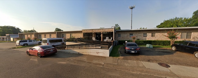


This Property Is For Sale
Property Detail
1100 E 36Th St
Texarkana, TX-AR
ALL LOTS 1-2-3-10-11-12 & 50X150 ABANDONED LINDEN ST ROW (JOINS WEST SIDE OF LOTS 1-3), AND 16X150 ALLEY BETWEEN LOTS 1-3 AND
2171040
MILLER
Retirementnursinghomecombined
Arkansas
B and X Area of moderate flood hazard, usually the area between the limits of the 100-year and 500-year floods.
1-12
2025
1.14 AC
2025
Arkansas South Area
020100
Other Market Areas
26,759 SF
NEARBY LISTINGS FOR SALE OR LEASE
-
-
View all Texarkana listings for sale on LoopNet.com
DEMOGRAPHICS near 1100 E 36Th St
1 mile
3 mile
5 mile
2025 Total Population
7,783
38,122
62,063
2030 Population
7,536
37,767
61,629
Pop Growth 2025-2030
(3.17%)
(0.93%)
(0.70%)
Average Age
39
39
39
2025 Total Households
3,381
15,327
24,894
HH Growth 2025-2030
(3.11%)
(0.99%)
(0.71%)
Median Household Inc
$43,911
$43,329
$45,869
Avg Household Size
2.20
2.30
2.30
2025 Avg HH Vehicles
2.00
2.00
2.00
Median Home Value
$143,947
$137,936
$147,626
Median Year Built
1975
1975
1978
Nearby Places
Map Layers
Map Styles
 Street
 Aerial
Transit
 Traffic
 Biking
Places
Listings with unknown addresses are not visible on the map
- Restaurants
- Banks
- Shops
- Fitness
- Groceries
PUBLIC TRANSPORTATION
COMMUTER RAIL
Texarkana Amtrak Station (Texas Eagle - Amtrak)
Drive
Walk
Distance
Texarkana Amtrak Station (Texas Eagle - Amtrak)
6 min
3.3 mi
AIRPORT
Texarkana Regional-Webb Field
Drive
Walk
Distance
Texarkana Regional-Webb Field
11 min
4.6 mi
Freight Ports
Port of Shreveport
Drive
Walk
Distance
Port of Shreveport
109 min
95.9 mi
Nearby Properties
Address
Land Use
TOTAL SIZE
Lot Size
Zoning
Address
Land Use
TOTAL SIZE
Lot Size
Zoning
37.76 AC
Address
Land Use
TOTAL SIZE
Lot Size
Zoning
594,669 SF
26.19 AC
Address
Land Use
TOTAL SIZE
Lot Size
Zoning
22.35 AC
Address
Land Use
TOTAL SIZE
Lot Size
Zoning
Address
Land Use
TOTAL SIZE
Lot Size
Zoning
162,169 SF
19.18 AC
Address
Land Use
TOTAL SIZE
Lot Size
Zoning
133,136 SF
5.80 AC
Address
Land Use
TOTAL SIZE
Lot Size
Zoning
3,642 SF
24.74 AC
Address
Land Use
TOTAL SIZE
Lot Size
Zoning
11,320 SF
142 AC
Address
Land Use
TOTAL SIZE
Lot Size
Zoning
97,914 SF
3.01 AC
Address
Land Use
TOTAL SIZE
Lot Size
Zoning
2.07 AC
Address
Land Use
TOTAL SIZE
Lot Size
Zoning
73,675 SF
4.44 AC
Address
Land Use
TOTAL SIZE
Lot Size
Zoning
Address
Land Use
TOTAL SIZE
Lot Size
Zoning
8.19 AC
Address
Land Use
TOTAL SIZE
Lot Size
Zoning
533,299 SF
50.60 AC
Address
Land Use
TOTAL SIZE
Lot Size
Zoning
51,587 SF
6.44 AC
Address
Land Use
TOTAL SIZE
Lot Size
Zoning
133,067 SF
11.20 AC
Address
Land Use
TOTAL SIZE
Lot Size
Zoning
51,049 SF
1.78 AC
Address
Land Use
TOTAL SIZE
Lot Size
Zoning
109,855 SF
6.24 AC
Address
Land Use
TOTAL SIZE
Lot Size
Zoning
18,105 SF
2.50 AC
Address
Land Use
TOTAL SIZE
Lot Size
Zoning
25,006 SF
3.93 AC
Address
Land Use
TOTAL SIZE
Lot Size
Zoning
49,330 SF
2.26 AC
Address
Land Use
TOTAL SIZE
Lot Size
Zoning
160,484 SF
10.01 AC
Address
Land Use
TOTAL SIZE
Lot Size
Zoning
102,614 SF
0.89 AC
Address
Land Use
TOTAL SIZE
Lot Size
Zoning
42,117 SF
0.86 AC
Address
Land Use
TOTAL SIZE
Lot Size
Zoning
22,103 SF
3.43 AC
Address
Land Use
TOTAL SIZE
Lot Size
Zoning
100,000 SF
5.92 AC
Address
Land Use
TOTAL SIZE
Lot Size
Zoning
74,246 SF
1.34 AC
Address
Land Use
TOTAL SIZE
Lot Size
Zoning
108,928 SF
6.26 AC
Address
Land Use
TOTAL SIZE
Lot Size
Zoning
94,536 SF
3.84 AC
Address
Land Use
TOTAL SIZE
Lot Size
Zoning
64,449 SF
6.23 AC
The World's #1 Commercial Real Estate Marketplace
Connect with us
© 2026 CoStar Group
The information above has been obtained from sources believed reliable. While we do not doubt its accuracy we have not verified it and make no guarantee, warranty or representation about it. It is your responsibility to independently confirm its accuracy and completeness. Any projections, opinions, assumptions, or estimates used are for example only and do not represent the current or future performance of the property. The value of this transaction to you depends on tax and other factors which should be evaluated by your tax, financial, and legal advisors. You and your advisors should conduct a careful, independent investigation of the property to determine to your satisfaction the suitability of the property for your needs.