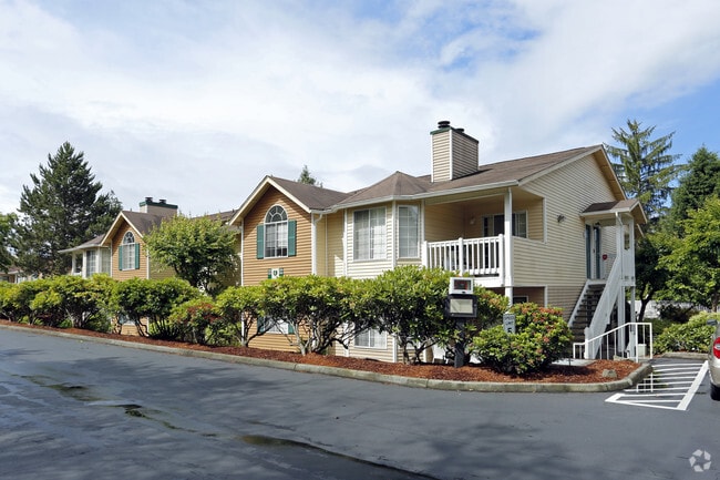
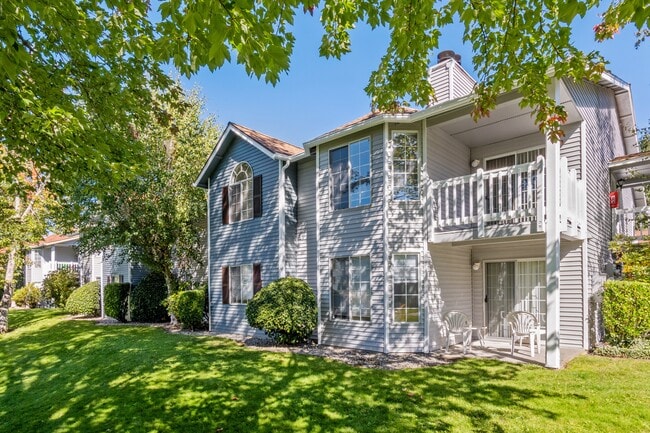
Property Record
1100 Fern St Sw, Olympia, WA 98502
NEARBY LISTINGS FOR SALE OR LEASE
Property Detail
1100 Fern St Sw
Olympia-Tumwater, WA
Bla Bla04-1972Ol
12822221100
SECTION 22 TOWNSHIP 18 RANGE 2W QUARTER SW NW NW EXCEPT THE S 330 FT OF THE W 130 FT.
Multifamilydwelling
Thurston
X
Washington
53067C0166G
1-8
2024
8.93 AC
2024
South Westside
010520
Olympia
93,899 SF
DEMOGRAPHICS near 1100 Fern St Sw
1 Mile
3 Mile
5 Mile
2024 Total Population
13,975
57,534
110,591
2029 Population
14,734
60,765
116,793
Pop Growth 2024-2029
+ 5.43%
+ 5.62%
+ 5.61%
Average Age
39
41
42
2024 Total Households
6,388
25,638
47,200
HH Growth 2024-2029
+ 5.48%
+ 5.81%
+ 5.76%
Median Household Inc
$47,979
$71,210
$74,057
Avg Household Size
2.00
2.10
2.30
2024 Avg HH Vehicles
1.00
2.00
2.00
Median Home Value
$365,131
$416,072
$419,709
Median Year Built
1986
1983
1985
Nearby Places
Map Layers
Map Styles
 Street
 Aerial
- Restaurants
- Banks
- Shops
- Fitness
- Groceries
Nearby Properties
Address
Land Use
TOTAL SIZE
Lot Size
Zoning
Address
Land Use
TOTAL SIZE
Lot Size
Zoning
1,446,648 SF
8.29 AC
CAP
Address
Land Use
TOTAL SIZE
Lot Size
Zoning
830,626 SF
21.53 AC
CAP
Address
Land Use
TOTAL SIZE
Lot Size
Zoning
523,407 SF
86.49 AC
R-4-8
Address
Land Use
TOTAL SIZE
Lot Size
Zoning
485,918 SF
6.64 AC
CAP
Address
Land Use
TOTAL SIZE
Lot Size
Zoning
6,928 SF
1.33 AC
UW
Address
Land Use
TOTAL SIZE
Lot Size
Zoning
784,559 SF
13.09 AC
CAP
Address
Land Use
TOTAL SIZE
Lot Size
Zoning
98,652 SF
95.43 AC
UW
Address
Land Use
TOTAL SIZE
Lot Size
Zoning
288,270 SF
11.88 AC
CAP
Address
Land Use
TOTAL SIZE
Lot Size
Zoning
179,860 SF
1.28 AC
CAP
Address
Land Use
TOTAL SIZE
Lot Size
Zoning
353,503 SF
36.94 AC
MFM
Address
Land Use
TOTAL SIZE
Lot Size
Zoning
213,177 SF
1.28 AC
CAP
Address
Land Use
TOTAL SIZE
Lot Size
Zoning
602,509 SF
49.48 AC
HDC-4
Address
Land Use
TOTAL SIZE
Lot Size
Zoning
151,657 SF
2.62 AC
MS
Address
Land Use
TOTAL SIZE
Lot Size
Zoning
235,042 SF
17.16 AC
MFM
Address
Land Use
TOTAL SIZE
Lot Size
Zoning
175,178 SF
36.69 AC
R-4-8
Address
Land Use
TOTAL SIZE
Lot Size
Zoning
114,331 SF
1.43 AC
CAP
Address
Land Use
TOTAL SIZE
Lot Size
Zoning
243,845 SF
12.58 AC
RM-24
Address
Land Use
TOTAL SIZE
Lot Size
Zoning
273,091 SF
17.87 AC
PO/RM
Address
Land Use
TOTAL SIZE
Lot Size
Zoning
94,349 SF
6.02 AC
CAP
Address
Land Use
TOTAL SIZE
Lot Size
Zoning
217,366 SF
10.88 AC
RM-24
Address
Land Use
TOTAL SIZE
Lot Size
Zoning
155,495 SF
1.06 AC
UWH
Address
Land Use
TOTAL SIZE
Lot Size
Zoning
102,698 SF
14.81 AC
LI
Address
Land Use
TOTAL SIZE
Lot Size
Zoning
197,571 SF
52.35 AC
R-4-8
Address
Land Use
TOTAL SIZE
Lot Size
Zoning
147,418 SF
11.74 AC
MFH
Address
Land Use
TOTAL SIZE
Lot Size
Zoning
266,887 SF
1.38 AC
UW
Address
Land Use
TOTAL SIZE
Lot Size
Zoning
241,689 SF
10.75 AC
RM-24
Address
Land Use
TOTAL SIZE
Lot Size
Zoning
175,938 SF
13 AC
MFM
Address
Land Use
TOTAL SIZE
Lot Size
Zoning
347,361 SF
1.38 AC
DB
Address
Land Use
TOTAL SIZE
Lot Size
Zoning
161,002 SF
8.66 AC
PO/RM
Address
Land Use
TOTAL SIZE
Lot Size
Zoning
133,336 SF
5.88 AC
RM-24
The World's #1 Commercial Real Estate Marketplace
Connect with us
© 2025 CoStar Group
The information above has been obtained from sources believed reliable. While we do not doubt its accuracy we have not verified it and make no guarantee, warranty or representation about it. It is your responsibility to independently confirm its accuracy and completeness. Any projections, opinions, assumptions, or estimates used are for example only and do not represent the current or future performance of the property. The value of this transaction to you depends on tax and other factors which should be evaluated by your tax, financial, and legal advisors. You and your advisors should conduct a careful, independent investigation of the property to determine to your satisfaction the suitability of the property for your needs.