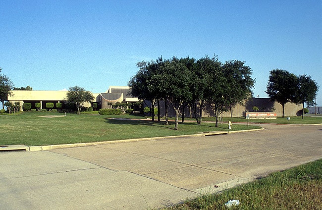
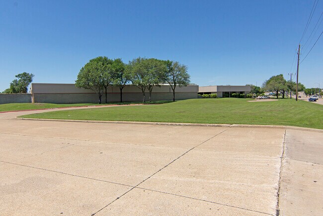
Property Record
1100 Geomap Ln, Plano, TX 75074

Property Detail
1100 Geomap Ln
R-0709-001-0010-1
GEOMAP ADDITION, BLK A, LOT 1
Commercialnec
Collin
RT
Texas
B and X Area of moderate flood hazard, usually the area between the limits of the 100-year and 500-year floods.
1
2025
5.48 AC
2025
Plano
032010
Dallas/Ft Worth
54,924 SF
Dallas-Fort Worth-Arlington, TX
NEARBY LISTINGS FOR SALE OR LEASE
DEMOGRAPHICS near 1100 Geomap Ln
1 mile
3 mile
5 mile
2024 Total Population
12,743
97,990
281,417
2029 Population
14,373
109,945
311,358
Pop Growth 2024-2029
+ 12.79%
+ 12.20%
+ 10.64%
Average Age
36
39
39
2024 Total Households
4,243
36,293
104,282
HH Growth 2024-2029
+ 13.08%
+ 12.43%
+ 10.85%
Median Household Inc
$85,706
$99,498
$102,506
Avg Household Size
2.90
2.60
2.60
2024 Avg HH Vehicles
2.00
2.00
2.00
Median Home Value
$358,023
$465,289
$430,712
Median Year Built
1987
1998
1994
Nearby Places
Map Layers
Map Styles
 Street
 Aerial
Transit
 Traffic
 Biking
Places
Listings with unknown addresses are not visible on the map
- Restaurants
- Banks
- Shops
- Fitness
- Groceries
PUBLIC TRANSPORTATION
AIRPORT
Dallas Love Field
Drive
Walk
Distance
Dallas Love Field
33 min
22.5 mi
Dallas-Fort Worth International
Drive
Walk
Distance
Dallas-Fort Worth International
38 min
30.6 mi
SALE & LEASE HISTORY
LISTING DATE
SALE/LEASE

May 18, 2021
For Lease
Feb 16, 2023
For Lease
Nearby Properties
Address
Land Use
TOTAL SIZE
Lot Size
Zoning
Address
Land Use
TOTAL SIZE
Lot Size
Zoning
1,283,376 SF
11.62 AC
Address
Land Use
TOTAL SIZE
Lot Size
Zoning
479,209 SF
19.97 AC
Address
Land Use
TOTAL SIZE
Lot Size
Zoning
453,635 SF
19.04 AC
RT
Address
Land Use
TOTAL SIZE
Lot Size
Zoning
630,247 SF
42 AC
Z239
Address
Land Use
TOTAL SIZE
Lot Size
Zoning
766,245 SF
49.94 AC
COMM
Address
Land Use
TOTAL SIZE
Lot Size
Zoning
567,715 SF
4.75 AC
LC/PD-A
Address
Land Use
TOTAL SIZE
Lot Size
Zoning
164,843 SF
24.94 AC
Address
Land Use
TOTAL SIZE
Lot Size
Zoning
418,520 SF
103.29 AC
Address
Land Use
TOTAL SIZE
Lot Size
Zoning
242,201 SF
14.54 AC
RT
Address
Land Use
TOTAL SIZE
Lot Size
Zoning
384,538 SF
2.63 AC
LI-1
Address
Land Use
TOTAL SIZE
Lot Size
Zoning
490,285 SF
29.66 AC
LC/PD-A
Address
Land Use
TOTAL SIZE
Lot Size
Zoning
341,492 SF
25.20 AC
SFR
Address
Land Use
TOTAL SIZE
Lot Size
Zoning
523,703 SF
67.08 AC
ED
Address
Land Use
TOTAL SIZE
Lot Size
Zoning
377,152 SF
3.91 AC
O-S
Address
Land Use
TOTAL SIZE
Lot Size
Zoning
279,693 SF
19.86 AC
Z239
Address
Land Use
TOTAL SIZE
Lot Size
Zoning
548,300 SF
17.29 AC
Z239
Address
Land Use
TOTAL SIZE
Lot Size
Zoning
324,000 SF
6.67 AC
O-S
Address
Land Use
TOTAL SIZE
Lot Size
Zoning
374,266 SF
19.42 AC
Z239
Address
Land Use
TOTAL SIZE
Lot Size
Zoning
617,776 SF
97.53 AC
A
Address
Land Use
TOTAL SIZE
Lot Size
Zoning
296,337 SF
3.28 AC
Address
Land Use
TOTAL SIZE
Lot Size
Zoning
360,673 SF
7.89 AC
PD-207 R
Address
Land Use
TOTAL SIZE
Lot Size
Zoning
502,554 SF
31.06 AC
MF-M
Address
Land Use
TOTAL SIZE
Lot Size
Zoning
355,408 SF
3.08 AC
LI-1
Address
Land Use
TOTAL SIZE
Lot Size
Zoning
353,347 SF
17 AC
Z02
Address
Land Use
TOTAL SIZE
Lot Size
Zoning
460,233 SF
10.31 AC
CC
Address
Land Use
TOTAL SIZE
Lot Size
Zoning
417,173 SF
4.48 AC
O-S
Address
Land Use
TOTAL SIZE
Lot Size
Zoning
450,481 SF
10.73 AC
PD-207 R
Address
Land Use
TOTAL SIZE
Lot Size
Zoning
137,772 SF
11.79 AC
LC/PD-A
Address
Land Use
TOTAL SIZE
Lot Size
Zoning
829,390 SF
66.56 AC
1-M-1
Address
Land Use
TOTAL SIZE
Lot Size
Zoning
284,231 SF
3.95 AC
MF-E
The World's #1 Commercial Real Estate Marketplace
Connect with us
© 2026 CoStar Group
The information above has been obtained from sources believed reliable. While we do not doubt its accuracy we have not verified it and make no guarantee, warranty or representation about it. It is your responsibility to independently confirm its accuracy and completeness. Any projections, opinions, assumptions, or estimates used are for example only and do not represent the current or future performance of the property. The value of this transaction to you depends on tax and other factors which should be evaluated by your tax, financial, and legal advisors. You and your advisors should conduct a careful, independent investigation of the property to determine to your satisfaction the suitability of the property for your needs.