Property Record
1100 Governor Lea Rd, Bear, DE 19701
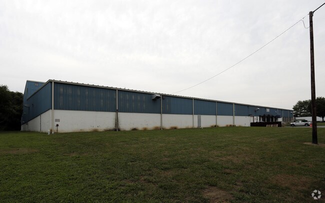

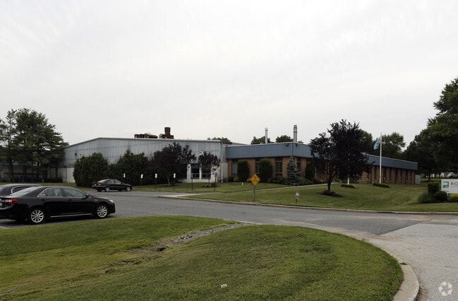
Property Detail
1100 Governor Lea Rd
Officebuilding
New Castle
I
Delaware
A Areas with a 1% annual chance of flooding and a 26% chance of flooding over the life of a 30-year mortgage.
31.78 AC
2025
New Castle County
2025
Philadelphia
016401
Philadelphia-Camden-Wilmington, PA-NJ-DE-MD
1,972 SF
12-002.00-029
NEARBY LISTINGS FOR SALE OR LEASE
DEMOGRAPHICS near 1100 Governor Lea Rd
1 mile
3 mile
5 mile
2025 Total Population
1,678
46,747
118,605
2030 Population
1,710
47,792
122,526
Pop Growth 2025-2030
+ 1.91%
+ 2.24%
+ 3.31%
Average Age
43
40
40
2025 Total Households
565
17,272
45,134
HH Growth 2025-2030
+ 2.12%
+ 2.39%
+ 3.58%
Median Household Inc
$126,232
$91,511
$87,844
Avg Household Size
2.90
2.60
2.60
2025 Avg HH Vehicles
2.00
2.00
2.00
Median Home Value
$432,487
$339,030
$342,717
Median Year Built
1998
1994
1990
Nearby Places
Map Layers
Map Styles
 Street
 Aerial
Layers
 Traffic
 Biking
Places
Listings with unknown addresses are not visible on the map
- Restaurants
- Banks
- Shops
- Fitness
- Groceries
PUBLIC TRANSPORTATION
COMMUTER RAIL
Churchmans Crossing (R2 - Southeastern Pennsylvania Transportation Authority Regional Rail (SEPTA Regional Rail))
Drive
Walk
Distance
Churchmans Crossing (R2 - Southeastern Pennsylvania Transportation Authority Regional Rail (SEPTA Regional Rail))
14 min
8.4 mi
Newark (R2 - Southeastern Pennsylvania Transportation Authority Regional Rail (SEPTA Regional Rail))
Drive
Walk
Distance
Newark (R2 - Southeastern Pennsylvania Transportation Authority Regional Rail (SEPTA Regional Rail))
18 min
9.8 mi
AIRPORT
Philadelphia International
Drive
Walk
Distance
Philadelphia International
48 min
32.4 mi
Freight Ports
Port of Wilmington, RI
Drive
Walk
Distance
Port of Wilmington, RI
23 min
12.3 mi
Nearby Properties
Address
Land Use
TOTAL SIZE
Lot Size
Zoning
Address
Land Use
TOTAL SIZE
Lot Size
Zoning
326,520 SF
125.02 AC
EX
Address
Land Use
TOTAL SIZE
Lot Size
Zoning
1,003,632 SF
70.39 AC
HI
Address
Land Use
TOTAL SIZE
Lot Size
Zoning
44,512 SF
370.29 AC
HI
Address
Land Use
TOTAL SIZE
Lot Size
Zoning
4,676 SF
42.81 AC
NCAP
Address
Land Use
TOTAL SIZE
Lot Size
Zoning
259,722 SF
20.72 AC
NCAP
Address
Land Use
TOTAL SIZE
Lot Size
Zoning
802.83 AC
HI
Address
Land Use
TOTAL SIZE
Lot Size
Zoning
343,216 SF
27.10 AC
ST
Address
Land Use
TOTAL SIZE
Lot Size
Zoning
594,720 SF
33.32 AC
HI
Address
Land Use
TOTAL SIZE
Lot Size
Zoning
293,376 SF
149.74 AC
I
Address
Land Use
TOTAL SIZE
Lot Size
Zoning
294.01 AC
HI
Address
Land Use
TOTAL SIZE
Lot Size
Zoning
18,476 SF
18 AC
NCAP
Address
Land Use
TOTAL SIZE
Lot Size
Zoning
152,860 SF
49.01 AC
CR
Address
Land Use
TOTAL SIZE
Lot Size
Zoning
305,422 SF
22.35 AC
NCPUD
Address
Land Use
TOTAL SIZE
Lot Size
Zoning
152,075 SF
35.66 AC
CR
Address
Land Use
TOTAL SIZE
Lot Size
Zoning
6,180 SF
214.27 AC
HI
Address
Land Use
TOTAL SIZE
Lot Size
Zoning
18,101 SF
8.91 AC
NCAP
Address
Land Use
TOTAL SIZE
Lot Size
Zoning
91,473 SF
59.44 AC
S
Address
Land Use
TOTAL SIZE
Lot Size
Zoning
11,362 SF
36.39 AC
I
Address
Land Use
TOTAL SIZE
Lot Size
Zoning
218,883 SF
42.56 AC
HI
Address
Land Use
TOTAL SIZE
Lot Size
Zoning
94,417 SF
28.89 AC
CR
Address
Land Use
TOTAL SIZE
Lot Size
Zoning
62,054 SF
37.38 AC
S
Address
Land Use
TOTAL SIZE
Lot Size
Zoning
252,888 SF
11.91 AC
NCPUD
Address
Land Use
TOTAL SIZE
Lot Size
Zoning
7,640 SF
60.67 AC
S
Address
Land Use
TOTAL SIZE
Lot Size
Zoning
119,610 SF
12.34 AC
CR
Address
Land Use
TOTAL SIZE
Lot Size
Zoning
206,062 SF
23.30 AC
HI
Address
Land Use
TOTAL SIZE
Lot Size
Zoning
5,166 SF
7.57 AC
NCAP
Address
Land Use
TOTAL SIZE
Lot Size
Zoning
59,957 SF
10.70 AC
OR
Address
Land Use
TOTAL SIZE
Lot Size
Zoning
857.48 AC
S
Address
Land Use
TOTAL SIZE
Lot Size
Zoning
136.77 AC
HI
Address
Land Use
TOTAL SIZE
Lot Size
Zoning
66.14 AC
S
The World's #1 Commercial Real Estate Marketplace
Connect with us
© 2026 CoStar Group
The information above has been obtained from sources believed reliable. While we do not doubt its accuracy we have not verified it and make no guarantee, warranty or representation about it. It is your responsibility to independently confirm its accuracy and completeness. Any projections, opinions, assumptions, or estimates used are for example only and do not represent the current or future performance of the property. The value of this transaction to you depends on tax and other factors which should be evaluated by your tax, financial, and legal advisors. You and your advisors should conduct a careful, independent investigation of the property to determine to your satisfaction the suitability of the property for your needs.