Property Record
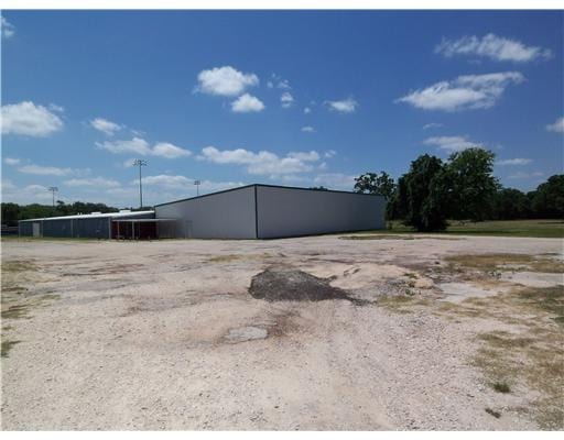
1100 Manley St, Navasota, TX 77868

NEARBY LISTINGS FOR SALE OR LEASE
Property Detail
1100 Manley St
R38436
D Tyler Surv A-55-5
Commercialnec
A0055-5 D TYLER, TRACT 5, PAR 32-1, ACRES 2.55
X
Grimes
48041C0425E
Texas
2024
2.55 AC
2025
Central Texas Area
180201
Other Market Areas
17,400 SF
DEMOGRAPHICS near 1100 Manley St
1 Mile
3 Mile
5 Mile
2024 Total Population
4,670
9,665
11,775
2029 Population
5,375
11,160
13,517
Pop Growth 2024-2029
+ 15.10%
+ 15.47%
+ 14.79%
Average Age
40
40
40
2024 Total Households
1,749
3,557
4,000
HH Growth 2024-2029
+ 15.49%
+ 15.86%
+ 15.93%
Median Household Inc
$46,437
$45,908
$47,226
Avg Household Size
2.60
2.60
2.60
2024 Avg HH Vehicles
2.00
2.00
2.00
Median Home Value
$134,409
$152,503
$161,087
Median Year Built
1982
1985
1986
Nearby Places
Map Layers
Map Styles
 Street
 Aerial
- Restaurants
- Banks
- Shops
- Fitness
- Groceries
PUBLIC TRANSPORTATION
AIRPORT
Easterwood Field
DRIVE
WALK
Distance
Easterwood Field
39 min
26.4 mi
Freight Ports
Port of Houston
DRIVE
WALK
Distance
Port of Houston
98 min
76.2 mi
SALE & LEASE HISTORY
LISTING DATE
SALE/LEASE

Sep 24, 2016
For Sale
Nearby Properties
Address
Land Use
TOTAL SIZE
Lot Size
Zoning
Address
Land Use
TOTAL SIZE
Lot Size
Zoning
70.65 AC
1C
Address
Land Use
TOTAL SIZE
Lot Size
Zoning
42.38 AC
1C
Address
Land Use
TOTAL SIZE
Lot Size
Zoning
267,353 SF
20 AC
1C
Address
Land Use
TOTAL SIZE
Lot Size
Zoning
47,579 SF
20.26 AC
Address
Land Use
TOTAL SIZE
Lot Size
Zoning
12.67 AC
1
Address
Land Use
TOTAL SIZE
Lot Size
Zoning
81,239 SF
3.77 AC
1C
Address
Land Use
TOTAL SIZE
Lot Size
Zoning
Address
Land Use
TOTAL SIZE
Lot Size
Zoning
27.71 AC
1C
Address
Land Use
TOTAL SIZE
Lot Size
Zoning
Address
Land Use
TOTAL SIZE
Lot Size
Zoning
65,913 SF
2.62 AC
Address
Land Use
TOTAL SIZE
Lot Size
Zoning
101,643 SF
4.14 AC
1
Address
Land Use
TOTAL SIZE
Lot Size
Zoning
13.87 AC
2
Address
Land Use
TOTAL SIZE
Lot Size
Zoning
548 SF
3.46 AC
1
Address
Land Use
TOTAL SIZE
Lot Size
Zoning
Address
Land Use
TOTAL SIZE
Lot Size
Zoning
81,358 SF
11.62 AC
Address
Land Use
TOTAL SIZE
Lot Size
Zoning
1,216 SF
28.77 AC
5
Address
Land Use
TOTAL SIZE
Lot Size
Zoning
1,287,420 SF
82.07 AC
1
Address
Land Use
TOTAL SIZE
Lot Size
Zoning
39,200 SF
7.58 AC
2
Address
Land Use
TOTAL SIZE
Lot Size
Zoning
Address
Land Use
TOTAL SIZE
Lot Size
Zoning
96.62 AC
Address
Land Use
TOTAL SIZE
Lot Size
Zoning
78,538 SF
7.91 AC
1C
Address
Land Use
TOTAL SIZE
Lot Size
Zoning
10.35 AC
Address
Land Use
TOTAL SIZE
Lot Size
Zoning
39,523 SF
2.87 AC
Address
Land Use
TOTAL SIZE
Lot Size
Zoning
70,326 SF
4.67 AC
Address
Land Use
TOTAL SIZE
Lot Size
Zoning
47,415 SF
4.60 AC
1C
Address
Land Use
TOTAL SIZE
Lot Size
Zoning
33,745 SF
5 AC
Address
Land Use
TOTAL SIZE
Lot Size
Zoning
23,750 SF
17.98 AC
1C
Address
Land Use
TOTAL SIZE
Lot Size
Zoning
1,126 SF
80.70 AC
1
Address
Land Use
TOTAL SIZE
Lot Size
Zoning
31,227 SF
54.69 AC
1
Address
Land Use
TOTAL SIZE
Lot Size
Zoning
13,257 SF
5.95 AC
The World's #1 Commercial Real Estate Marketplace
Connect with us
© 2026 CoStar Group
The information above has been obtained from sources believed reliable. While we do not doubt its accuracy we have not verified it and make no guarantee, warranty or representation about it. It is your responsibility to independently confirm its accuracy and completeness. Any projections, opinions, assumptions, or estimates used are for example only and do not represent the current or future performance of the property. The value of this transaction to you depends on tax and other factors which should be evaluated by your tax, financial, and legal advisors. You and your advisors should conduct a careful, independent investigation of the property to determine to your satisfaction the suitability of the property for your needs.