Property Record
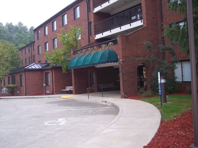
1100 Maple Ct, Cambridge, OH 43725

Property Detail
1100 Maple Ct
06-0008757.000
R3 T2 SS13-01 PT NE 1/4
Commercialnec
GUERNSEY
B and X Area of moderate flood hazard, usually the area between the limits of the 100-year and 500-year floods.
Ohio
2024
1.95 AC
2025
Ohio South Area
977400
Other Market Areas
17,115 SF
Cambridge, OH
NEARBY LISTINGS FOR SALE OR LEASE
-
-
View all Cambridge listings for sale on LoopNet.com
DEMOGRAPHICS near 1100 Maple Ct
1 mile
3 mile
5 mile
2025 Total Population
5,410
13,252
18,027
2030 Population
5,362
13,223
17,987
Pop Growth 2025-2030
(0.89%)
(0.22%)
(0.22%)
Average Age
41
42
42
2025 Total Households
2,361
5,870
7,867
HH Growth 2025-2030
(0.93%)
(0.20%)
(0.20%)
Median Household Inc
$48,282
$44,764
$47,390
Avg Household Size
2.20
2.20
2.20
2025 Avg HH Vehicles
2.00
2.00
2.00
Median Home Value
$144,400
$148,252
$158,379
Median Year Built
1952
1955
1960
Nearby Places
Map Layers
Map Styles
 Street
 Aerial
Layers
 Traffic
 Biking
Places
Listings with unknown addresses are not visible on the map
- Restaurants
- Banks
- Shops
- Fitness
- Groceries
Nearby Properties
Address
Land Use
TOTAL SIZE
Lot Size
Zoning
Address
Land Use
TOTAL SIZE
Lot Size
Zoning
137.95 AC
Address
Land Use
TOTAL SIZE
Lot Size
Zoning
11,950 SF
12.14 AC
Address
Land Use
TOTAL SIZE
Lot Size
Zoning
16,228 SF
2.72 AC
Address
Land Use
TOTAL SIZE
Lot Size
Zoning
25,142 SF
2.17 AC
Address
Land Use
TOTAL SIZE
Lot Size
Zoning
2.82 AC
Address
Land Use
TOTAL SIZE
Lot Size
Zoning
34,294 SF
5.15 AC
Address
Land Use
TOTAL SIZE
Lot Size
Zoning
67.95 AC
Address
Land Use
TOTAL SIZE
Lot Size
Zoning
30,860 SF
10 AC
Address
Land Use
TOTAL SIZE
Lot Size
Zoning
22,450 SF
13.08 AC
Address
Land Use
TOTAL SIZE
Lot Size
Zoning
30,520 SF
8.73 AC
Address
Land Use
TOTAL SIZE
Lot Size
Zoning
17,577 SF
2.31 AC
Address
Land Use
TOTAL SIZE
Lot Size
Zoning
9,760 SF
7.40 AC
Address
Land Use
TOTAL SIZE
Lot Size
Zoning
117,568 SF
8.59 AC
Address
Land Use
TOTAL SIZE
Lot Size
Zoning
1,605 SF
23.91 AC
Address
Land Use
TOTAL SIZE
Lot Size
Zoning
Address
Land Use
TOTAL SIZE
Lot Size
Zoning
12,985 SF
2.60 AC
Address
Land Use
TOTAL SIZE
Lot Size
Zoning
18,252 SF
43.67 AC
Address
Land Use
TOTAL SIZE
Lot Size
Zoning
15,635 SF
2.02 AC
Address
Land Use
TOTAL SIZE
Lot Size
Zoning
13,822 SF
2.82 AC
Address
Land Use
TOTAL SIZE
Lot Size
Zoning
9.99 AC
Address
Land Use
TOTAL SIZE
Lot Size
Zoning
9,240 SF
Address
Land Use
TOTAL SIZE
Lot Size
Zoning
70,642 SF
12.92 AC
Address
Land Use
TOTAL SIZE
Lot Size
Zoning
31,909 SF
9 AC
Address
Land Use
TOTAL SIZE
Lot Size
Zoning
11.41 AC
Address
Land Use
TOTAL SIZE
Lot Size
Zoning
31,267 SF
0.21 AC
Address
Land Use
TOTAL SIZE
Lot Size
Zoning
4,980 SF
4.62 AC
Address
Land Use
TOTAL SIZE
Lot Size
Zoning
10,200 SF
10.22 AC
Address
Land Use
TOTAL SIZE
Lot Size
Zoning
197,394 SF
39.09 AC
The World's #1 Commercial Real Estate Marketplace
Connect with us
© 2026 CoStar Group
The information above has been obtained from sources believed reliable. While we do not doubt its accuracy we have not verified it and make no guarantee, warranty or representation about it. It is your responsibility to independently confirm its accuracy and completeness. Any projections, opinions, assumptions, or estimates used are for example only and do not represent the current or future performance of the property. The value of this transaction to you depends on tax and other factors which should be evaluated by your tax, financial, and legal advisors. You and your advisors should conduct a careful, independent investigation of the property to determine to your satisfaction the suitability of the property for your needs.