Property Record
1100 N 19Th St, Palatka, FL 32177

NEARBY LISTINGS FOR SALE OR LEASE
-
-
View all Palatka listings for sale on LoopNet.com
Property Detail
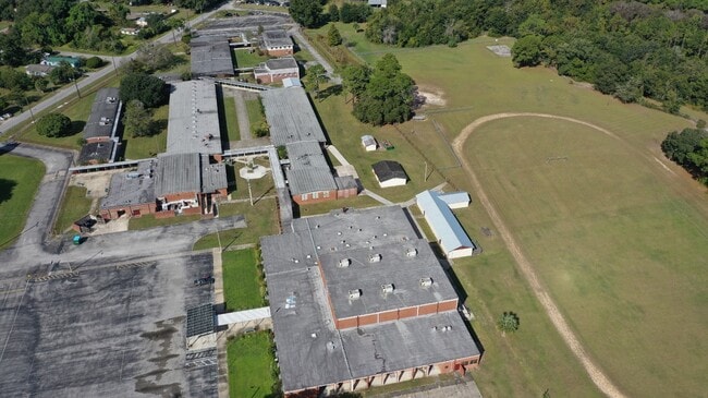
1100 N 19Th St
01-10-26-0000-0430-0000
PT OF LOT 1 BK90 P518 (EX OR17, P549) + S482 FT OF LOT 1 SEC 1, + LOT 4 SEC 6-10-27 THAT LIES, BETWEEN ACL RR + BRICK RD, (EX OR204 P673), (JENKINS MIDDLE SCHOOL)
Publicschool
Putnam
AE
Florida
12107C0192C
1
0
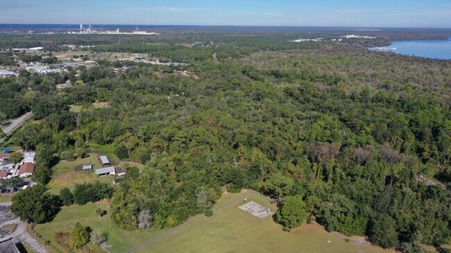
37.09 AC
2025
Florida Central North Area
950700
Other Market Areas
57,141 SF
Palatka, FL
DEMOGRAPHICS near 1100 N 19Th St
1 Mile
3 Mile
5 Mile
2024 Total Population
3,700
16,455
23,114
2029 Population
3,837
16,944
23,781
Pop Growth 2024-2029
+ 3.70%
+ 2.97%
+ 2.89%
Average Age
38
41
41
2024 Total Households
1,381
6,487
9,111
HH Growth 2024-2029
+ 3.69%
+ 2.84%
+ 2.77%
Median Household Inc
$29,117
$28,808
$31,925
Avg Household Size
2.60
2.40
2.40
2024 Avg HH Vehicles
1.00
2.00
2.00
Median Home Value
$85,251
$127,936
$141,605
Median Year Built
1965
1972
1975
Nearby Places
Map Layers
Map Styles
 Street
 Aerial
- Restaurants
- Banks
- Shops
- Fitness
- Groceries
PUBLIC TRANSPORTATION
COMMUTER RAIL
Palatka Amtrak (Silver Meteor - Amtrak, Silver Star - Amtrak)
DRIVE
WALK
Distance
Palatka Amtrak (Silver Meteor - Amtrak, Silver Star - Amtrak)
3 min
1.2 mi
Freight Ports
Jacksonville Port
DRIVE
WALK
Distance
Jacksonville Port
85 min
55.9 mi
SALE & LEASE HISTORY
LISTING DATE
SALE/LEASE

Nov 08, 2021
For Sale
Nearby Properties
Address
Land Use
TOTAL SIZE
Lot Size
Zoning
Address
Land Use
TOTAL SIZE
Lot Size
Zoning
211,250 SF
586.70 AC
Address
Land Use
TOTAL SIZE
Lot Size
Zoning
1,242 SF
693.76 AC
Address
Land Use
TOTAL SIZE
Lot Size
Zoning
174,699 SF
41.50 AC
Address
Land Use
TOTAL SIZE
Lot Size
Zoning
152,364 SF
27.76 AC
Address
Land Use
TOTAL SIZE
Lot Size
Zoning
7,139 SF
87.49 AC
Address
Land Use
TOTAL SIZE
Lot Size
Zoning
54,720 SF
29.19 AC
Address
Land Use
TOTAL SIZE
Lot Size
Zoning
59,233 SF
29.34 AC
Address
Land Use
TOTAL SIZE
Lot Size
Zoning
44,160 SF
8.99 AC
Address
Land Use
TOTAL SIZE
Lot Size
Zoning
106,319 SF
28.86 AC
Address
Land Use
TOTAL SIZE
Lot Size
Zoning
97,240 SF
12.72 AC
Address
Land Use
TOTAL SIZE
Lot Size
Zoning
33,616 SF
38.79 AC
Address
Land Use
TOTAL SIZE
Lot Size
Zoning
43,844 SF
31.63 AC
Address
Land Use
TOTAL SIZE
Lot Size
Zoning
75,330 SF
6.63 AC
Address
Land Use
TOTAL SIZE
Lot Size
Zoning
1,120 SF
12.44 AC
Address
Land Use
TOTAL SIZE
Lot Size
Zoning
38,392 SF
21.60 AC
Address
Land Use
TOTAL SIZE
Lot Size
Zoning
45,991 SF
1.69 AC
Address
Land Use
TOTAL SIZE
Lot Size
Zoning
1,107 SF
21.57 AC
Address
Land Use
TOTAL SIZE
Lot Size
Zoning
47,010 SF
9.43 AC
Address
Land Use
TOTAL SIZE
Lot Size
Zoning
39,660 SF
12.04 AC
Address
Land Use
TOTAL SIZE
Lot Size
Zoning
15.93 AC
Address
Land Use
TOTAL SIZE
Lot Size
Zoning
14,040 SF
14.25 AC
Address
Land Use
TOTAL SIZE
Lot Size
Zoning
10,503 SF
1.98 AC
Address
Land Use
TOTAL SIZE
Lot Size
Zoning
13,825 SF
4.13 AC
Address
Land Use
TOTAL SIZE
Lot Size
Zoning
2,444 SF
29.51 AC
Address
Land Use
TOTAL SIZE
Lot Size
Zoning
3,002 SF
14.82 AC
Address
Land Use
TOTAL SIZE
Lot Size
Zoning
64,863 SF
18.29 AC
Address
Land Use
TOTAL SIZE
Lot Size
Zoning
75,592 SF
7.87 AC
Address
Land Use
TOTAL SIZE
Lot Size
Zoning
18,895 SF
11.20 AC
Address
Land Use
TOTAL SIZE
Lot Size
Zoning
2,450 SF
26.46 AC
Address
Land Use
TOTAL SIZE
Lot Size
Zoning
6,120 SF
6.32 AC
The World's #1 Commercial Real Estate Marketplace
Connect with us
© 2026 CoStar Group
The information above has been obtained from sources believed reliable. While we do not doubt its accuracy we have not verified it and make no guarantee, warranty or representation about it. It is your responsibility to independently confirm its accuracy and completeness. Any projections, opinions, assumptions, or estimates used are for example only and do not represent the current or future performance of the property. The value of this transaction to you depends on tax and other factors which should be evaluated by your tax, financial, and legal advisors. You and your advisors should conduct a careful, independent investigation of the property to determine to your satisfaction the suitability of the property for your needs.