Property Record
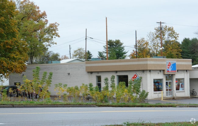
1100 N Atherton St, State College, PA 16803


NEARBY LISTINGS FOR SALE OR LEASE
Property Detail
1100 N Atherton St
24-014-011-0000
Centre
Restaurantbuilding
Pennsylvania
X
0.58 AC
42027C0617F
Pennsylvania Central Area
2025
Other Market Areas
2025
State College, PA
011504
DEMOGRAPHICS near 1100 N Atherton St
1 Mile
3 Mile
5 Mile
2024 Total Population
8,863
74,227
88,727
2029 Population
8,685
74,253
88,687
Pop Growth 2024-2029
(2.01%)
+ 0.04%
(0.05%)
Average Age
34
33
34
2024 Total Households
4,149
26,609
32,326
HH Growth 2024-2029
(2.34%)
(0.04%)
(0.12%)
Median Household Inc
$36,329
$53,772
$62,161
Avg Household Size
2.10
2.20
2.20
2024 Avg HH Vehicles
1.00
1.00
2.00
Median Home Value
$487,499
$363,217
$361,377
Median Year Built
1988
1983
1984
Nearby Places
Map Layers
Map Styles
 Street
 Aerial
- Restaurants
- Banks
- Shops
- Fitness
- Groceries
PUBLIC TRANSPORTATION
AIRPORT
State College Regional
DRIVE
WALK
Distance
State College Regional
14 min
6.2 mi
Freight Ports
Port of Baltimore
DRIVE
WALK
Distance
Port of Baltimore
230 min
168.8 mi
Nearby Properties
Address
Land Use
TOTAL SIZE
Lot Size
Zoning
Address
Land Use
TOTAL SIZE
Lot Size
Zoning
1,607.06 AC
Address
Land Use
TOTAL SIZE
Lot Size
Zoning
27.86 AC
Address
Land Use
TOTAL SIZE
Lot Size
Zoning
59.65 AC
Address
Land Use
TOTAL SIZE
Lot Size
Zoning
60.26 AC
Address
Land Use
TOTAL SIZE
Lot Size
Zoning
Address
Land Use
TOTAL SIZE
Lot Size
Zoning
Address
Land Use
TOTAL SIZE
Lot Size
Zoning
Address
Land Use
TOTAL SIZE
Lot Size
Zoning
Address
Land Use
TOTAL SIZE
Lot Size
Zoning
Address
Land Use
TOTAL SIZE
Lot Size
Zoning
Address
Land Use
TOTAL SIZE
Lot Size
Zoning
56.73 AC
Address
Land Use
TOTAL SIZE
Lot Size
Zoning
44.46 AC
Address
Land Use
TOTAL SIZE
Lot Size
Zoning
The World's #1 Commercial Real Estate Marketplace
Connect with us
© 2026 CoStar Group
The information above has been obtained from sources believed reliable. While we do not doubt its accuracy we have not verified it and make no guarantee, warranty or representation about it. It is your responsibility to independently confirm its accuracy and completeness. Any projections, opinions, assumptions, or estimates used are for example only and do not represent the current or future performance of the property. The value of this transaction to you depends on tax and other factors which should be evaluated by your tax, financial, and legal advisors. You and your advisors should conduct a careful, independent investigation of the property to determine to your satisfaction the suitability of the property for your needs.