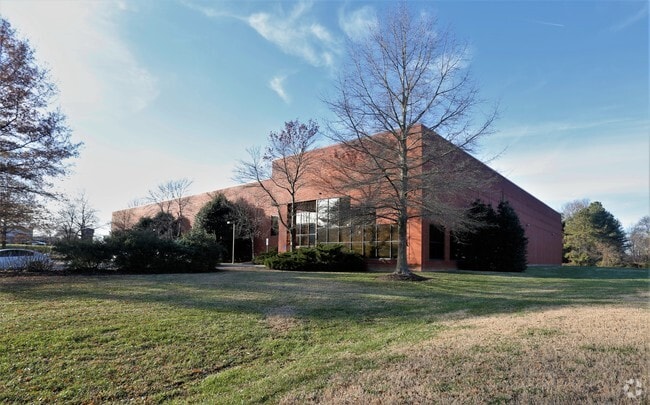
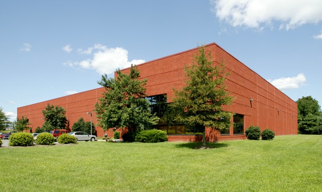
Property Record
1100 Technology Park Dr, Glen Allen, VA 23059


NEARBY LISTINGS FOR SALE OR LEASE
Property Detail
1100 Technology Park Dr
784-768-6281
Acreage
Publicstorage
00330A0000 0062A; ES U.S. RT# 1 AC 5.853 103 A1 102
X
Henrico
51085C0312C
Virginia
2025
5.85 AC
2025
I-95 North/Ashland
200907
Richmond VA
40,900 SF
Richmond, VA
DEMOGRAPHICS near 1100 Technology Park Dr
1 Mile
3 Mile
5 Mile
2024 Total Population
5,579
42,427
120,231
2029 Population
5,690
43,617
122,519
Pop Growth 2024-2029
+ 1.99%
+ 2.80%
+ 1.90%
Average Age
41
41
41
2024 Total Households
2,373
16,458
48,369
HH Growth 2024-2029
+ 1.73%
+ 2.70%
+ 1.80%
Median Household Inc
$76,703
$87,135
$80,549
Avg Household Size
2.30
2.50
2.40
2024 Avg HH Vehicles
2.00
2.00
2.00
Median Home Value
$273,968
$290,372
$293,816
Median Year Built
1999
1992
1985
Nearby Places
Map Layers
Map Styles
 Street
 Aerial
- Restaurants
- Banks
- Shops
- Fitness
- Groceries
PUBLIC TRANSPORTATION
COMMUTER RAIL
DRIVE
WALK
Distance
13 min
6.1 mi
DRIVE
WALK
Distance
14 min
7.1 mi
AIRPORT
Richmond International
DRIVE
WALK
Distance
Richmond International
28 min
19.0 mi
Freight Ports
Virginia Port Authority - Richmond
DRIVE
WALK
Distance
Virginia Port Authority - Richmond
29 min
17.3 mi
SALE & LEASE HISTORY
LISTING DATE
SALE/LEASE

May 09, 2025
For Sale
Nearby Properties
Address
Land Use
TOTAL SIZE
Lot Size
Zoning
Address
Land Use
TOTAL SIZE
Lot Size
Zoning
136.01 AC
A-1
Address
Land Use
TOTAL SIZE
Lot Size
Zoning
43,929 SF
46.83 AC
O-S
Address
Land Use
TOTAL SIZE
Lot Size
Zoning
104,972 SF
108.49 AC
MIXE
Address
Land Use
TOTAL SIZE
Lot Size
Zoning
347,648 SF
24.75 AC
R-5
Address
Land Use
TOTAL SIZE
Lot Size
Zoning
186,034 SF
13.86 AC
B-3C
Address
Land Use
TOTAL SIZE
Lot Size
Zoning
43.49 AC
M-2
Address
Land Use
TOTAL SIZE
Lot Size
Zoning
59.30 AC
M-2
Address
Land Use
TOTAL SIZE
Lot Size
Zoning
135,874 SF
31.99 AC
MIXE
Address
Land Use
TOTAL SIZE
Lot Size
Zoning
180,070 SF
17.13 AC
R-5
Address
Land Use
TOTAL SIZE
Lot Size
Zoning
102,942 SF
71.86 AC
MIXE
Address
Land Use
TOTAL SIZE
Lot Size
Zoning
104,023 SF
98.16 AC
MIXE
Address
Land Use
TOTAL SIZE
Lot Size
Zoning
50.20 AC
M-2
Address
Land Use
TOTAL SIZE
Lot Size
Zoning
10,818 SF
161.99 AC
MIXE
Address
Land Use
TOTAL SIZE
Lot Size
Zoning
251,400 SF
16.18 AC
R-6C
Address
Land Use
TOTAL SIZE
Lot Size
Zoning
2,952 SF
20.87 AC
RM
Address
Land Use
TOTAL SIZE
Lot Size
Zoning
216,900 SF
13.41 AC
R-6
Address
Land Use
TOTAL SIZE
Lot Size
Zoning
159,432 SF
14 AC
R-5
Address
Land Use
TOTAL SIZE
Lot Size
Zoning
138,140 SF
7.66 AC
R-6
Address
Land Use
TOTAL SIZE
Lot Size
Zoning
142,140 SF
10.01 AC
R-5
Address
Land Use
TOTAL SIZE
Lot Size
Zoning
21 AC
M-2
Address
Land Use
TOTAL SIZE
Lot Size
Zoning
182,096 SF
16.70 AC
R-5
Address
Land Use
TOTAL SIZE
Lot Size
Zoning
204,358 SF
25.99 AC
B-3
Address
Land Use
TOTAL SIZE
Lot Size
Zoning
33,931 SF
30.81 AC
R-3
Address
Land Use
TOTAL SIZE
Lot Size
Zoning
304,119 SF
93.21 AC
UMUC
Address
Land Use
TOTAL SIZE
Lot Size
Zoning
76,749 SF
22.25 AC
A-1
Address
Land Use
TOTAL SIZE
Lot Size
Zoning
31.70 AC
M-2
Address
Land Use
TOTAL SIZE
Lot Size
Zoning
145,380 SF
18.32 AC
B-3
Address
Land Use
TOTAL SIZE
Lot Size
Zoning
128,005 SF
16.91 AC
M-1
Address
Land Use
TOTAL SIZE
Lot Size
Zoning
129,663 SF
14 AC
MIXE
Address
Land Use
TOTAL SIZE
Lot Size
Zoning
89,982 SF
10.20 AC
MIXE
The World's #1 Commercial Real Estate Marketplace
Connect with us
© 2026 CoStar Group
The information above has been obtained from sources believed reliable. While we do not doubt its accuracy we have not verified it and make no guarantee, warranty or representation about it. It is your responsibility to independently confirm its accuracy and completeness. Any projections, opinions, assumptions, or estimates used are for example only and do not represent the current or future performance of the property. The value of this transaction to you depends on tax and other factors which should be evaluated by your tax, financial, and legal advisors. You and your advisors should conduct a careful, independent investigation of the property to determine to your satisfaction the suitability of the property for your needs.