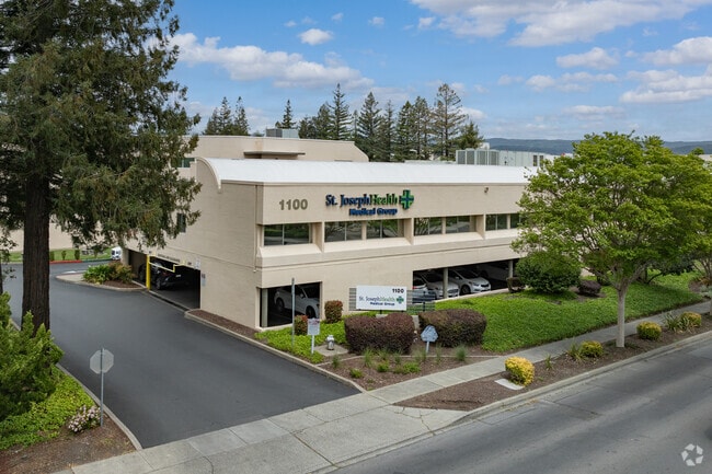
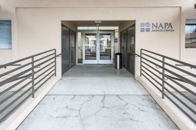
Property Record
1100 Trancas St, Napa, CA 94558

Current Lease Availabilities
NEARBY LISTINGS FOR SALE OR LEASE
Property Detail
1100 Trancas St
Napa, CA
Final Map Montecito Heights
038-430-009
PCLS 1,2,3 MAP NO 2583 6P/M64 W/L R/W 1166/813, PG&E R/W 1165/727
Medicalbuilding
Napa
X
California
06055C0508F
3 AC
2024
Napa County
2025
North Bay/Santa Rosa
200602
DEMOGRAPHICS near 1100 Trancas St
1 Mile
3 Mile
5 Mile
2024 Total Population
17,640
75,353
87,522
2029 Population
17,058
72,977
84,784
Pop Growth 2024-2029
(3.30%)
(3.15%)
(3.13%)
Average Age
41
42
42
2024 Total Households
6,423
27,990
32,505
HH Growth 2024-2029
(3.32%)
(3.26%)
(3.22%)
Median Household Inc
$92,911
$97,620
$98,297
Avg Household Size
2.60
2.50
2.60
2024 Avg HH Vehicles
2.00
2.00
2.00
Median Home Value
$702,869
$789,907
$803,316
Median Year Built
1975
1973
1973
Nearby Places
Map Layers
Map Styles
 Street
 Aerial
- Restaurants
- Banks
- Shops
- Fitness
- Groceries
Nearby Properties
Address
Land Use
TOTAL SIZE
Lot Size
Zoning
Address
Land Use
TOTAL SIZE
Lot Size
Zoning
12.32 AC
PQ
Address
Land Use
TOTAL SIZE
Lot Size
Zoning
195,343 SF
9.31 AC
CT
Address
Land Use
TOTAL SIZE
Lot Size
Zoning
160,241 SF
12.54 AC
Address
Land Use
TOTAL SIZE
Lot Size
Zoning
149,714 SF
0.40 AC
Address
Land Use
TOTAL SIZE
Lot Size
Zoning
83,251 SF
8.05 AC
CT
Address
Land Use
TOTAL SIZE
Lot Size
Zoning
283,311 SF
8.27 AC
Address
Land Use
TOTAL SIZE
Lot Size
Zoning
97,515 SF
0.30 AC
03
Address
Land Use
TOTAL SIZE
Lot Size
Zoning
10.05 AC
Address
Land Use
TOTAL SIZE
Lot Size
Zoning
72,468 SF
278.73 AC
PD
Address
Land Use
TOTAL SIZE
Lot Size
Zoning
177,350 SF
7.85 AC
RM
Address
Land Use
TOTAL SIZE
Lot Size
Zoning
201,042 SF
11.38 AC
Address
Land Use
TOTAL SIZE
Lot Size
Zoning
2.95 AC
Address
Land Use
TOTAL SIZE
Lot Size
Zoning
202,098 SF
6.67 AC
RM
Address
Land Use
TOTAL SIZE
Lot Size
Zoning
158.96 AC
AW
Address
Land Use
TOTAL SIZE
Lot Size
Zoning
2,268 SF
2.10 AC
Address
Land Use
TOTAL SIZE
Lot Size
Zoning
53,871 SF
2.49 AC
CT
Address
Land Use
TOTAL SIZE
Lot Size
Zoning
4.70 AC
RM
Address
Land Use
TOTAL SIZE
Lot Size
Zoning
4.99 AC
RM
Address
Land Use
TOTAL SIZE
Lot Size
Zoning
94,464 SF
6.48 AC
RM
Address
Land Use
TOTAL SIZE
Lot Size
Zoning
105,371 SF
0.83 AC
CD
Address
Land Use
TOTAL SIZE
Lot Size
Zoning
1,296 SF
57.97 AC
Address
Land Use
TOTAL SIZE
Lot Size
Zoning
63,612 SF
9.08 AC
RM
Address
Land Use
TOTAL SIZE
Lot Size
Zoning
157,093 SF
12.58 AC
CC
Address
Land Use
TOTAL SIZE
Lot Size
Zoning
5,142 SF
50 AC
AP
Address
Land Use
TOTAL SIZE
Lot Size
Zoning
134,629 SF
4.13 AC
Address
Land Use
TOTAL SIZE
Lot Size
Zoning
30,449 SF
1.23 AC
Address
Land Use
TOTAL SIZE
Lot Size
Zoning
63,781 SF
40.06 AC
AP
Address
Land Use
TOTAL SIZE
Lot Size
Zoning
68,360 SF
1.58 AC
CDP
Address
Land Use
TOTAL SIZE
Lot Size
Zoning
46,734 SF
11.28 AC
AP
Address
Land Use
TOTAL SIZE
Lot Size
Zoning
10.64 AC
The World's #1 Commercial Real Estate Marketplace
Connect with us
© 2025 CoStar Group
The information above has been obtained from sources believed reliable. While we do not doubt its accuracy we have not verified it and make no guarantee, warranty or representation about it. It is your responsibility to independently confirm its accuracy and completeness. Any projections, opinions, assumptions, or estimates used are for example only and do not represent the current or future performance of the property. The value of this transaction to you depends on tax and other factors which should be evaluated by your tax, financial, and legal advisors. You and your advisors should conduct a careful, independent investigation of the property to determine to your satisfaction the suitability of the property for your needs.