Property Record
1100 W High St, Orrville, OH 44667

NEARBY LISTINGS FOR SALE OR LEASE
-
-
View all Orrville listings for lease on LoopNet.com
Property Detail
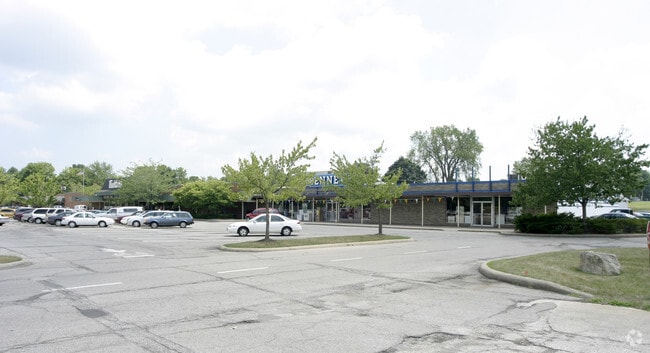
1100 W High St
59-00827-000
Buehler Food Market
Supermarket
12-17-25 NMPT NW 1.38A MP 9
X
Wayne
39169C0250E
Ohio
2024
6.30 AC
2024
Ohio North Area
001300
Other Market Areas
73,444 SF
Wooster, OH
DEMOGRAPHICS near 1100 W High St
1 Mile
3 Mile
5 Mile
2024 Total Population
7,671
11,412
20,587
2029 Population
7,767
11,517
20,592
Pop Growth 2024-2029
+ 1.25%
+ 0.92%
+ 0.02%
Average Age
40
41
40
2024 Total Households
3,091
4,581
7,913
HH Growth 2024-2029
+ 1.07%
+ 0.74%
(0.13%)
Median Household Inc
$60,230
$59,513
$59,769
Avg Household Size
2.40
2.40
2.50
2024 Avg HH Vehicles
2.00
2.00
2.00
Median Home Value
$159,125
$166,020
$180,552
Median Year Built
1969
1972
1973
Nearby Places
Map Layers
Map Styles
 Street
 Aerial
- Restaurants
- Banks
- Shops
- Fitness
- Groceries
PUBLIC TRANSPORTATION
AIRPORT
Akron-Canton Regional
DRIVE
WALK
Distance
Akron-Canton Regional
47 min
26.1 mi
SALE & LEASE HISTORY
LISTING DATE
SALE/LEASE

Aug 27, 2021
For Lease
Nearby Properties
Address
Land Use
TOTAL SIZE
Lot Size
Zoning
Address
Land Use
TOTAL SIZE
Lot Size
Zoning
42.13 AC
I2
Address
Land Use
TOTAL SIZE
Lot Size
Zoning
58,309 SF
25.78 AC
R1
Address
Land Use
TOTAL SIZE
Lot Size
Zoning
116,400 SF
27.23 AC
Address
Land Use
TOTAL SIZE
Lot Size
Zoning
146,173 SF
93.20 AC
R1
Address
Land Use
TOTAL SIZE
Lot Size
Zoning
303,000 SF
35.16 AC
I2
Address
Land Use
TOTAL SIZE
Lot Size
Zoning
1.27 AC
I2
Address
Land Use
TOTAL SIZE
Lot Size
Zoning
15,294 SF
28.13 AC
C1
Address
Land Use
TOTAL SIZE
Lot Size
Zoning
37.44 AC
Address
Land Use
TOTAL SIZE
Lot Size
Zoning
1.77 AC
I2
Address
Land Use
TOTAL SIZE
Lot Size
Zoning
74,002 SF
22.98 AC
I1
Address
Land Use
TOTAL SIZE
Lot Size
Zoning
75,859 SF
2.94 AC
R1
Address
Land Use
TOTAL SIZE
Lot Size
Zoning
20,000 SF
14.99 AC
I2
Address
Land Use
TOTAL SIZE
Lot Size
Zoning
5.07 AC
I2
Address
Land Use
TOTAL SIZE
Lot Size
Zoning
40.76 AC
C3
Address
Land Use
TOTAL SIZE
Lot Size
Zoning
3.73 AC
I2
Address
Land Use
TOTAL SIZE
Lot Size
Zoning
210,542 SF
25.72 AC
Address
Land Use
TOTAL SIZE
Lot Size
Zoning
30,000 SF
8.29 AC
I2
Address
Land Use
TOTAL SIZE
Lot Size
Zoning
105,000 SF
9.44 AC
Address
Land Use
TOTAL SIZE
Lot Size
Zoning
3,588 SF
8.08 AC
I2
Address
Land Use
TOTAL SIZE
Lot Size
Zoning
17,151 SF
2.72 AC
I1
Address
Land Use
TOTAL SIZE
Lot Size
Zoning
29.38 AC
I2
Address
Land Use
TOTAL SIZE
Lot Size
Zoning
30,006 SF
19.83 AC
R1
Address
Land Use
TOTAL SIZE
Lot Size
Zoning
19,926 SF
2.65 AC
CBDD
Address
Land Use
TOTAL SIZE
Lot Size
Zoning
33.06 AC
I1
Address
Land Use
TOTAL SIZE
Lot Size
Zoning
38,496 SF
2.46 AC
R2
Address
Land Use
TOTAL SIZE
Lot Size
Zoning
2,492 SF
308.59 AC
Address
Land Use
TOTAL SIZE
Lot Size
Zoning
2.22 AC
I2
Address
Land Use
TOTAL SIZE
Lot Size
Zoning
15,000 SF
11.87 AC
I2
Address
Land Use
TOTAL SIZE
Lot Size
Zoning
25,392 SF
14.04 AC
Address
Land Use
TOTAL SIZE
Lot Size
Zoning
31,497 SF
2.62 AC
I2
The World's #1 Commercial Real Estate Marketplace
Connect with us
© 2025 CoStar Group
The information above has been obtained from sources believed reliable. While we do not doubt its accuracy we have not verified it and make no guarantee, warranty or representation about it. It is your responsibility to independently confirm its accuracy and completeness. Any projections, opinions, assumptions, or estimates used are for example only and do not represent the current or future performance of the property. The value of this transaction to you depends on tax and other factors which should be evaluated by your tax, financial, and legal advisors. You and your advisors should conduct a careful, independent investigation of the property to determine to your satisfaction the suitability of the property for your needs.