Property Record
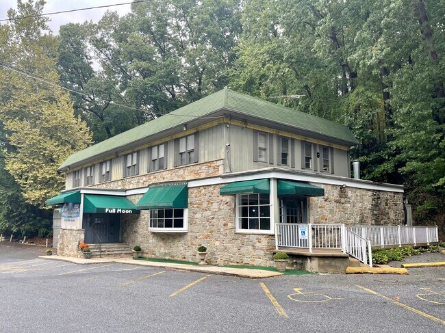
1100 Westminster Pike, Reisterstown, MD 21136


NEARBY LISTINGS FOR SALE OR LEASE
Property Detail
1100 Westminster Pike
04-0403049880
Westminster Pike
Restaurantbuilding
1.955 AC NS WESTMINSTER PIKE
X
Baltimore
2400100205G
Maryland
2024
1.95 AC
2025
Reisterstown Rd Corridor
404600
Baltimore
8,860 SF
Baltimore-Columbia-Towson, MD
DEMOGRAPHICS near 1100 Westminster Pike
1 Mile
3 Mile
5 Mile
2024 Total Population
611
13,890
53,455
2029 Population
605
13,861
53,179
Pop Growth 2024-2029
(0.98%)
(0.21%)
(0.52%)
Average Age
45
43
41
2024 Total Households
222
5,197
19,951
HH Growth 2024-2029
(0.90%)
(0.25%)
(0.58%)
Median Household Inc
$119,317
$99,580
$96,605
Avg Household Size
2.60
2.60
2.60
2024 Avg HH Vehicles
2.00
2.00
2.00
Median Home Value
$496,153
$374,865
$381,257
Median Year Built
1972
1981
1982
Nearby Places
Map Layers
Map Styles
 Street
 Aerial
- Restaurants
- Banks
- Shops
- Fitness
- Groceries
PUBLIC TRANSPORTATION
AIRPORT
Baltimore/Washington International Thurgood Marshall
DRIVE
WALK
Distance
Baltimore/Washington International Thurgood Marshall
38 min
25.8 mi
Freight Ports
Port of Baltimore
DRIVE
WALK
Distance
Port of Baltimore
39 min
26.3 mi
SALE & LEASE HISTORY
LISTING DATE
SALE/LEASE

Sep 21, 2022
For Sale
Jan 29, 2021
For Sale
Feb 06, 2024
For Sale
Nearby Properties
Address
Land Use
TOTAL SIZE
Lot Size
Zoning
Address
Land Use
TOTAL SIZE
Lot Size
Zoning
31,185 SF
486.08 AC
RC2
Address
Land Use
TOTAL SIZE
Lot Size
Zoning
18.87 AC
DR16
Address
Land Use
TOTAL SIZE
Lot Size
Zoning
47,370 SF
90.74 AC
R-400
Address
Land Use
TOTAL SIZE
Lot Size
Zoning
125,171 SF
8.80 AC
Address
Land Use
TOTAL SIZE
Lot Size
Zoning
107,713 SF
3.85 AC
Address
Land Use
TOTAL SIZE
Lot Size
Zoning
157,975 SF
5.49 AC
BL
Address
Land Use
TOTAL SIZE
Lot Size
Zoning
86,496 SF
52.58 AC
RC-2
Address
Land Use
TOTAL SIZE
Lot Size
Zoning
6.88 AC
DR3.5
Address
Land Use
TOTAL SIZE
Lot Size
Zoning
91,776 SF
1.33 AC
Address
Land Use
TOTAL SIZE
Lot Size
Zoning
15 AC
BMCCC
Address
Land Use
TOTAL SIZE
Lot Size
Zoning
69,077 SF
8.64 AC
DR3,3
Address
Land Use
TOTAL SIZE
Lot Size
Zoning
106,900 SF
15.42 AC
BL
Address
Land Use
TOTAL SIZE
Lot Size
Zoning
58,300 SF
80.97 AC
Address
Land Use
TOTAL SIZE
Lot Size
Zoning
58,688 SF
23.36 AC
RC4
Address
Land Use
TOTAL SIZE
Lot Size
Zoning
62,200 SF
17.30 AC
Address
Land Use
TOTAL SIZE
Lot Size
Zoning
31,570 SF
11.46 AC
C-2
Address
Land Use
TOTAL SIZE
Lot Size
Zoning
7,068 SF
18.66 AC
I-2
Address
Land Use
TOTAL SIZE
Lot Size
Zoning
29,664 SF
7.79 AC
RC5
Address
Land Use
TOTAL SIZE
Lot Size
Zoning
82,970 SF
2.72 AC
Address
Land Use
TOTAL SIZE
Lot Size
Zoning
77,320 SF
2.04 AC
Address
Land Use
TOTAL SIZE
Lot Size
Zoning
5,483 SF
14.80 AC
I-2
Address
Land Use
TOTAL SIZE
Lot Size
Zoning
13,054 SF
5.06 AC
R-400
Address
Land Use
TOTAL SIZE
Lot Size
Zoning
24,674 SF
2.94 AC
Address
Land Use
TOTAL SIZE
Lot Size
Zoning
19,913 SF
7.70 AC
RC4
Address
Land Use
TOTAL SIZE
Lot Size
Zoning
40,972 SF
5.10 AC
Address
Land Use
TOTAL SIZE
Lot Size
Zoning
40,000 SF
2.84 AC
I-1
Address
Land Use
TOTAL SIZE
Lot Size
Zoning
2,144 SF
4.53 AC
C-2
Address
Land Use
TOTAL SIZE
Lot Size
Zoning
32,730 SF
2.60 AC
BM
Address
Land Use
TOTAL SIZE
Lot Size
Zoning
53,478 SF
10.22 AC
I-1
Address
Land Use
TOTAL SIZE
Lot Size
Zoning
21,200 SF
5.73 AC
C-2
The World's #1 Commercial Real Estate Marketplace
Connect with us
© 2025 CoStar Group
The information above has been obtained from sources believed reliable. While we do not doubt its accuracy we have not verified it and make no guarantee, warranty or representation about it. It is your responsibility to independently confirm its accuracy and completeness. Any projections, opinions, assumptions, or estimates used are for example only and do not represent the current or future performance of the property. The value of this transaction to you depends on tax and other factors which should be evaluated by your tax, financial, and legal advisors. You and your advisors should conduct a careful, independent investigation of the property to determine to your satisfaction the suitability of the property for your needs.