Property Record
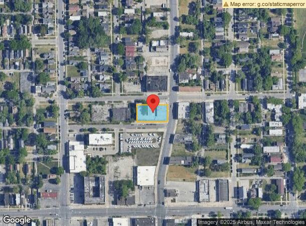
11000 S Michigan Ave, Chicago, IL 60628


NEARBY LISTINGS FOR SALE OR LEASE
Property Detail
11000 S Michigan Ave
Chicago-Naperville-Elgin, IL-IN-WI
Vandersyde & Tons
25-15-320-014-0000
(VANDERSYDE) & (TONS) SUB OF PT OF LAND LY W OF CHICA GO RD 5 CHNS N OF SW COR,THEN CE E 20 CHNS N 5 CHNS W 20 CHNS SO 5 CHAI
Storebuilding
Cook
X
Illinois
17031C0655J
16,13
2023
0.41 AC
2025
Roseland
490901
Chicago
12,592 SF
DEMOGRAPHICS near 11000 S Michigan Ave
1 Mile
3 Mile
5 Mile
2024 Total Population
26,233
143,805
434,310
2029 Population
25,589
139,672
420,314
Pop Growth 2024-2029
(2.45%)
(2.87%)
(3.22%)
Average Age
41
41
41
2024 Total Households
10,147
54,758
167,633
HH Growth 2024-2029
(2.89%)
(3.25%)
(3.61%)
Median Household Inc
$37,931
$50,122
$49,879
Avg Household Size
2.40
2.50
2.50
2024 Avg HH Vehicles
1.00
1.00
1.00
Median Home Value
$129,950
$153,678
$171,368
Median Year Built
1948
1950
1949
Nearby Places
Map Layers
Map Styles
 Street
 Aerial
- Restaurants
- Banks
- Shops
- Fitness
- Groceries
PUBLIC TRANSPORTATION
TRANSIT/SUBWAY
Pullman/111th Street Station (Metra Electric Line - Northeast Illinois Regional Commuter Railroad (Metra))
DRIVE
WALK
Distance
Pullman/111th Street Station (Metra Electric Line - Northeast Illinois Regional Commuter Railroad (Metra))
3 min
17 min
0.9 mi
Kensington Street Station (South Shore Line - Northern Indiana Commuter Transportation District (South Shore Line))
DRIVE
WALK
Distance
Kensington Street Station (South Shore Line - Northern Indiana Commuter Transportation District (South Shore Line))
3 min
19 min
1.0 mi
115th Street (Kensington) Station (Metra Electric Line - Northeast Illinois Regional Commuter Railroad (Metra))
DRIVE
WALK
Distance
115th Street (Kensington) Station (Metra Electric Line - Northeast Illinois Regional Commuter Railroad (Metra))
3 min
19 min
1.0 mi
COMMUTER RAIL
Washington Heights Station (Rock Island District Line - Northeast Illinois Regional Commuter Railroad (Metra))
DRIVE
WALK
Distance
Washington Heights Station (Rock Island District Line - Northeast Illinois Regional Commuter Railroad (Metra))
9 min
2.8 mi
AIRPORT
Chicago Midway International
DRIVE
WALK
Distance
Chicago Midway International
28 min
19.0 mi
Chicago O'Hare International
DRIVE
WALK
Distance
Chicago O'Hare International
33 min
29.1 mi
SALE & LEASE HISTORY
LISTING DATE
SALE/LEASE

Sep 26, 2016
For Lease
Sep 24, 2016
For Sale
Sep 06, 2024
For Sale
May 30, 2019
For Sale
Feb 29, 2020
For Sale
Feb 06, 2018
For Sale
Aug 29, 2019
For Sale
Nearby Properties
Address
Land Use
TOTAL SIZE
Lot Size
Zoning
Address
Land Use
TOTAL SIZE
Lot Size
Zoning
8 AC
PD 1168
Address
Land Use
TOTAL SIZE
Lot Size
Zoning
0.51 AC
PD 1168
Address
Land Use
TOTAL SIZE
Lot Size
Zoning
1.08 AC
PD 1168
Address
Land Use
TOTAL SIZE
Lot Size
Zoning
41,400 SF
13.35 AC
PD 1254
Address
Land Use
TOTAL SIZE
Lot Size
Zoning
11 AC
PD 1168
Address
Land Use
TOTAL SIZE
Lot Size
Zoning
307,335 SF
24.17 AC
PD 770
Address
Land Use
TOTAL SIZE
Lot Size
Zoning
67,348 SF
6.33 AC
PD 131
Address
Land Use
TOTAL SIZE
Lot Size
Zoning
88,008 SF
3.96 AC
Address
Land Use
TOTAL SIZE
Lot Size
Zoning
63,930 SF
3.49 AC
PD 181
Address
Land Use
TOTAL SIZE
Lot Size
Zoning
162,000 SF
20.94 AC
PD 1167
Address
Land Use
TOTAL SIZE
Lot Size
Zoning
148,700 SF
Address
Land Use
TOTAL SIZE
Lot Size
Zoning
400,737 SF
PD 1167
Address
Land Use
TOTAL SIZE
Lot Size
Zoning
129,837 SF
10.44 AC
PD 770
Address
Land Use
TOTAL SIZE
Lot Size
Zoning
622,934 SF
34.41 AC
M2-3
Address
Land Use
TOTAL SIZE
Lot Size
Zoning
63,700 SF
0.74 AC
C1-1
Address
Land Use
TOTAL SIZE
Lot Size
Zoning
1 AC
RS-3
Address
Land Use
TOTAL SIZE
Lot Size
Zoning
73,947 SF
17.40 AC
PD 1167
Address
Land Use
TOTAL SIZE
Lot Size
Zoning
136,075 SF
13.65 AC
PD 1167
Address
Land Use
TOTAL SIZE
Lot Size
Zoning
101,294 SF
8.10 AC
B3-1
Address
Land Use
TOTAL SIZE
Lot Size
Zoning
542,852 SF
PMD 6,M2-1
Address
Land Use
TOTAL SIZE
Lot Size
Zoning
155,765 SF
8.75 AC
PD 1167
Address
Land Use
TOTAL SIZE
Lot Size
Zoning
76,867 SF
3.44 AC
M1-1
Address
Land Use
TOTAL SIZE
Lot Size
Zoning
207,100 SF
9.84 AC
M2-2
Address
Land Use
TOTAL SIZE
Lot Size
Zoning
451,400 SF
26.59 AC
M3-3
Address
Land Use
TOTAL SIZE
Lot Size
Zoning
9.55 AC
M2-2
Address
Land Use
TOTAL SIZE
Lot Size
Zoning
72,219 SF
4.30 AC
M1-2
Address
Land Use
TOTAL SIZE
Lot Size
Zoning
84,400 SF
15.18 AC
M2-2,M1-1
Address
Land Use
TOTAL SIZE
Lot Size
Zoning
12.42 AC
PD 485
Address
Land Use
TOTAL SIZE
Lot Size
Zoning
71,700 SF
6.24 AC
PD 485
Address
Land Use
TOTAL SIZE
Lot Size
Zoning
1.71 AC
PD 1168
The World's #1 Commercial Real Estate Marketplace
Connect with us
© 2026 CoStar Group
The information above has been obtained from sources believed reliable. While we do not doubt its accuracy we have not verified it and make no guarantee, warranty or representation about it. It is your responsibility to independently confirm its accuracy and completeness. Any projections, opinions, assumptions, or estimates used are for example only and do not represent the current or future performance of the property. The value of this transaction to you depends on tax and other factors which should be evaluated by your tax, financial, and legal advisors. You and your advisors should conduct a careful, independent investigation of the property to determine to your satisfaction the suitability of the property for your needs.