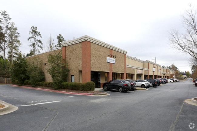
Property Record
11005 Jones Bridge Rd, Alpharetta, GA 30022


NEARBY LISTINGS FOR SALE OR LEASE
Property Detail
11005 Jones Bridge Rd
11-0470-0167-241-0
Fulton
Storebuilding
Georgia
X
167
13121C0086F
2 AC
2024
Roswell/Alpharetta
2025
Atlanta
011658
Atlanta-Sandy Springs-Roswell, GA
19,650 SF
DEMOGRAPHICS near 11005 Jones Bridge Rd
1 Mile
3 Mile
5 Mile
2024 Total Population
12,368
78,227
195,139
2029 Population
12,516
79,057
203,699
Pop Growth 2024-2029
+ 1.20%
+ 1.06%
+ 4.39%
Average Age
39
39
39
2024 Total Households
4,359
26,202
70,478
HH Growth 2024-2029
+ 1.31%
+ 1.16%
+ 4.43%
Median Household Inc
$117,664
$145,431
$129,558
Avg Household Size
2.80
2.90
2.70
2024 Avg HH Vehicles
2.00
2.00
2.00
Median Home Value
$372,109
$512,831
$483,865
Median Year Built
1992
1993
1995
Nearby Places
Map Layers
Map Styles
 Street
 Aerial
- Restaurants
- Banks
- Shops
- Fitness
- Groceries
PUBLIC TRANSPORTATION
AIRPORT
Hartsfield - Jackson Atlanta International
DRIVE
WALK
Distance
Hartsfield - Jackson Atlanta International
54 min
38.4 mi
SALE & LEASE HISTORY
LISTING DATE
SALE/LEASE

Sep 25, 2016
For Lease
May 29, 2018
For Lease
Jan 19, 2017
For Lease
Jan 09, 2017
For Lease
Dec 16, 2022
For Lease
Aug 07, 2020
For Lease
Nearby Properties
Address
Land Use
TOTAL SIZE
Lot Size
Zoning
Address
Land Use
TOTAL SIZE
Lot Size
Zoning
321,541 SF
63.16 AC
OI
Address
Land Use
TOTAL SIZE
Lot Size
Zoning
2,044,910 SF
30.61 AC
CUP
Address
Land Use
TOTAL SIZE
Lot Size
Zoning
330,549 SF
68.46 AC
CUP
Address
Land Use
TOTAL SIZE
Lot Size
Zoning
3,617,271 SF
29 AC
CUP
Address
Land Use
TOTAL SIZE
Lot Size
Zoning
489,097 SF
34 AC
R3
Address
Land Use
TOTAL SIZE
Lot Size
Zoning
559,910 SF
74.65 AC
Address
Land Use
TOTAL SIZE
Lot Size
Zoning
1,297,776 SF
34.75 AC
CUP
Address
Land Use
TOTAL SIZE
Lot Size
Zoning
311,452 SF
29.19 AC
CUP
Address
Land Use
TOTAL SIZE
Lot Size
Zoning
237,995 SF
23 AC
TRC
Address
Land Use
TOTAL SIZE
Lot Size
Zoning
329,029 SF
21.16 AC
C1
Address
Land Use
TOTAL SIZE
Lot Size
Zoning
2,045,850 SF
21.23 AC
CUP
Address
Land Use
TOTAL SIZE
Lot Size
Zoning
1,854,951 SF
33.30 AC
CUP
Address
Land Use
TOTAL SIZE
Lot Size
Zoning
2,101,414 SF
11 AC
CUP
Address
Land Use
TOTAL SIZE
Lot Size
Zoning
2,480,205 SF
37.86 AC
C1
Address
Land Use
TOTAL SIZE
Lot Size
Zoning
1,351,350 SF
19.20 AC
OICON
Address
Land Use
TOTAL SIZE
Lot Size
Zoning
88.90 AC
AG1
Address
Land Use
TOTAL SIZE
Lot Size
Zoning
244,177 SF
8.96 AC
MIXU
Address
Land Use
TOTAL SIZE
Lot Size
Zoning
37.26 AC
TRC
Address
Land Use
TOTAL SIZE
Lot Size
Zoning
1,747,896 SF
36.51 AC
C1C
Address
Land Use
TOTAL SIZE
Lot Size
Zoning
257,871 SF
46.98 AC
OI
Address
Land Use
TOTAL SIZE
Lot Size
Zoning
842,228 SF
17.66 AC
OI
Address
Land Use
TOTAL SIZE
Lot Size
Zoning
214,626 SF
6.29 AC
Address
Land Use
TOTAL SIZE
Lot Size
Zoning
629,088 SF
19.23 AC
CUP
Address
Land Use
TOTAL SIZE
Lot Size
Zoning
1,650 SF
74.37 AC
AG1
Address
Land Use
TOTAL SIZE
Lot Size
Zoning
289,676 SF
4.03 AC
C1
Address
Land Use
TOTAL SIZE
Lot Size
Zoning
180,572 SF
14.77 AC
C1
Address
Land Use
TOTAL SIZE
Lot Size
Zoning
174,304 SF
24.84 AC
OI
Address
Land Use
TOTAL SIZE
Lot Size
Zoning
43.34 AC
R4A
Address
Land Use
TOTAL SIZE
Lot Size
Zoning
208,218 SF
1.98 AC
OI
Address
Land Use
TOTAL SIZE
Lot Size
Zoning
320,516 SF
21.24 AC
CUP
The World's #1 Commercial Real Estate Marketplace
Connect with us
© 2025 CoStar Group
The information above has been obtained from sources believed reliable. While we do not doubt its accuracy we have not verified it and make no guarantee, warranty or representation about it. It is your responsibility to independently confirm its accuracy and completeness. Any projections, opinions, assumptions, or estimates used are for example only and do not represent the current or future performance of the property. The value of this transaction to you depends on tax and other factors which should be evaluated by your tax, financial, and legal advisors. You and your advisors should conduct a careful, independent investigation of the property to determine to your satisfaction the suitability of the property for your needs.