Property Record
1111 63Rd Ave N, Nashville, TN 37209


NEARBY LISTINGS FOR SALE OR LEASE
Property Detail
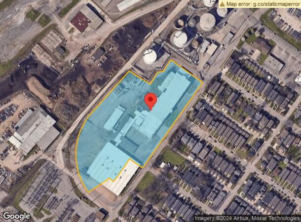
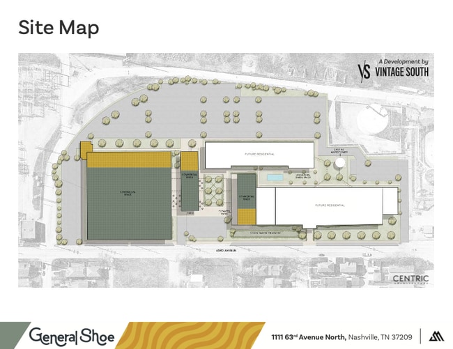
1111 63Rd Ave N
091-00-0-007
Plan 1 West Nashville
Publicstorage
W SIDE 63RD AVE N & S OF CENTENNIAL BLVD
X
Davidson
47037C0236H
Tennessee
2025
8.73 AC
2025
West
018101
Nashville
110,849 SF
Nashville-Davidson--Murfreesboro--Franklin, TN
DEMOGRAPHICS near 1111 63Rd Ave N
1 Mile
3 Mile
5 Mile
2024 Total Population
6,225
51,847
164,265
2029 Population
6,271
52,245
166,694
Pop Growth 2024-2029
+ 0.74%
+ 0.77%
+ 1.48%
Average Age
34
36
37
2024 Total Households
2,822
22,063
75,746
HH Growth 2024-2029
+ 0.35%
+ 0.62%
+ 1.86%
Median Household Inc
$80,246
$60,317
$68,607
Avg Household Size
2.10
2.10
1.90
2024 Avg HH Vehicles
2.00
2.00
1.00
Median Home Value
$413,668
$434,023
$485,715
Median Year Built
2010
1981
1998
Nearby Places
Map Layers
Map Styles
 Street
 Aerial
- Restaurants
- Banks
- Shops
- Fitness
- Groceries
PUBLIC TRANSPORTATION
COMMUTER RAIL
Riverfront (East Corridor Line - Tennessee Regional Transportation Authority Music City Star (Music City Star))
DRIVE
WALK
Distance
Riverfront (East Corridor Line - Tennessee Regional Transportation Authority Music City Star (Music City Star))
11 min
6.3 mi
AIRPORT
Nashville International
DRIVE
WALK
Distance
Nashville International
23 min
16.0 mi
Freight Ports
Port of Mobile
DRIVE
WALK
Distance
Port of Mobile
490 min
449.7 mi
Nearby Properties
Address
Land Use
TOTAL SIZE
Lot Size
Zoning
Address
Land Use
TOTAL SIZE
Lot Size
Zoning
184,700 SF
14.20 AC
RM40
Address
Land Use
TOTAL SIZE
Lot Size
Zoning
301.19 AC
MULTI-ZONE
Address
Land Use
TOTAL SIZE
Lot Size
Zoning
80,280 SF
2.20 AC
OVUDO
Address
Land Use
TOTAL SIZE
Lot Size
Zoning
121,769 SF
4.64 AC
MULTI-ZONE
Address
Land Use
TOTAL SIZE
Lot Size
Zoning
226,728 SF
10.15 AC
MUG-A
Address
Land Use
TOTAL SIZE
Lot Size
Zoning
91.99 AC
R8
Address
Land Use
TOTAL SIZE
Lot Size
Zoning
352,170 SF
3.11 AC
ORIA
Address
Land Use
TOTAL SIZE
Lot Size
Zoning
213,556 SF
123.31 AC
IR
Address
Land Use
TOTAL SIZE
Lot Size
Zoning
180,982 SF
14.71 AC
MUIA
Address
Land Use
TOTAL SIZE
Lot Size
Zoning
154,530 SF
6.18 AC
SP
Address
Land Use
TOTAL SIZE
Lot Size
Zoning
80.71 AC
R6
Address
Land Use
TOTAL SIZE
Lot Size
Zoning
75,265 SF
4.31 AC
MULTIZONE
Address
Land Use
TOTAL SIZE
Lot Size
Zoning
33,664 SF
18.98 AC
IWD
Address
Land Use
TOTAL SIZE
Lot Size
Zoning
289,766 SF
3.51 AC
SP
Address
Land Use
TOTAL SIZE
Lot Size
Zoning
89,821 SF
3.90 AC
IR
Address
Land Use
TOTAL SIZE
Lot Size
Zoning
146.13 AC
IR
Address
Land Use
TOTAL SIZE
Lot Size
Zoning
234,840 SF
3.25 AC
MULTIZONE
Address
Land Use
TOTAL SIZE
Lot Size
Zoning
4.35 AC
MUI-A
Address
Land Use
TOTAL SIZE
Lot Size
Zoning
99,471 SF
3.06 AC
MULTI-ZONE
Address
Land Use
TOTAL SIZE
Lot Size
Zoning
258,857 SF
1.63 AC
SP
Address
Land Use
TOTAL SIZE
Lot Size
Zoning
2,768 SF
16.64 AC
RM9
Address
Land Use
TOTAL SIZE
Lot Size
Zoning
15,045 SF
7.10 AC
IR
Address
Land Use
TOTAL SIZE
Lot Size
Zoning
116,459 SF
1.96 AC
SP
Address
Land Use
TOTAL SIZE
Lot Size
Zoning
11,960 SF
5.03 AC
MULTI-ZONE
Address
Land Use
TOTAL SIZE
Lot Size
Zoning
146,453 SF
3.42 AC
IR
Address
Land Use
TOTAL SIZE
Lot Size
Zoning
218,402 SF
6.23 AC
MUG-A
Address
Land Use
TOTAL SIZE
Lot Size
Zoning
94,354 SF
10.01 AC
CS
Address
Land Use
TOTAL SIZE
Lot Size
Zoning
6,160 SF
12.53 AC
MULTI-ZONE
Address
Land Use
TOTAL SIZE
Lot Size
Zoning
3.63 AC
SP
Address
Land Use
TOTAL SIZE
Lot Size
Zoning
76,395 SF
5.10 AC
MULA
The World's #1 Commercial Real Estate Marketplace
Connect with us
© 2026 CoStar Group
The information above has been obtained from sources believed reliable. While we do not doubt its accuracy we have not verified it and make no guarantee, warranty or representation about it. It is your responsibility to independently confirm its accuracy and completeness. Any projections, opinions, assumptions, or estimates used are for example only and do not represent the current or future performance of the property. The value of this transaction to you depends on tax and other factors which should be evaluated by your tax, financial, and legal advisors. You and your advisors should conduct a careful, independent investigation of the property to determine to your satisfaction the suitability of the property for your needs.