Property Record
1101 Beaumont Centre Ln, Lexington, KY 40513

Save to a Folder
{{folder.Name}}
{{folder.ListingIds.length}} Properties
{{folder.ListingIds.length}} Property
Create a New Folder
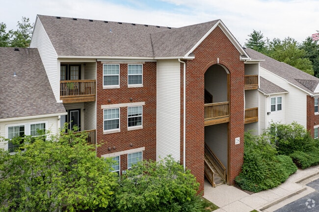
Property Detail
1101 Beaumont Centre Ln
19346310
K-661 LOT 2; BOOK: 1945 PAGE: 189
Clubslodgesprofessionalassociations
Fayette
R-3
Kentucky
B and X Area of moderate flood hazard, usually the area between the limits of the 100-year and 500-year floods.
2
2025
14.26 AC
2025
Beaumont Residential
004208
Lexington/Fayette
2,968 SF
Lexington-Fayette, KY
NEARBY LISTINGS FOR SALE OR LEASE
DEMOGRAPHICS near 1101 Beaumont Centre Ln
1 mile
3 mile
5 mile
2025 Total Population
11,507
75,770
184,978
2030 Population
11,902
78,119
191,149
Pop Growth 2025-2030
+ 3.43%
+ 3.10%
+ 3.34%
Average Age
41
39
38
2025 Total Households
4,748
32,204
78,825
HH Growth 2025-2030
+ 3.73%
+ 3.32%
+ 3.67%
Median Household Inc
$85,992
$67,036
$64,564
Avg Household Size
2.30
2.30
2.20
2025 Avg HH Vehicles
2.00
2.00
2.00
Median Home Value
$390,963
$316,577
$318,734
Median Year Built
1983
1976
1978
Nearby Places
Map Layers
Map Styles
 Street
 Aerial
Layers
 Traffic
 Biking
Places
Listings with unknown addresses are not visible on the map
- Restaurants
- Banks
- Shops
- Fitness
- Groceries
PUBLIC TRANSPORTATION
AIRPORT
Blue Grass
Drive
Walk
Distance
Blue Grass
12 min
5.7 mi
Freight Ports
Port of Toledo
Drive
Walk
Distance
Port of Toledo
342 min
291.8 mi
Nearby Properties
Address
Land Use
TOTAL SIZE
Lot Size
Zoning
Address
Land Use
TOTAL SIZE
Lot Size
Zoning
635,961 SF
23.52 AC
P-1
Address
Land Use
TOTAL SIZE
Lot Size
Zoning
510,633 SF
15.10 AC
P-1
Address
Land Use
TOTAL SIZE
Lot Size
Zoning
319,500 SF
0.25 AC
P-1
Address
Land Use
TOTAL SIZE
Lot Size
Zoning
292,730 SF
3.18 AC
R-1C
Address
Land Use
TOTAL SIZE
Lot Size
Zoning
648.54 AC
A-R
Address
Land Use
TOTAL SIZE
Lot Size
Zoning
263,090 SF
37.66 AC
A-U
Address
Land Use
TOTAL SIZE
Lot Size
Zoning
238,393 SF
9.83 AC
B-6P
Address
Land Use
TOTAL SIZE
Lot Size
Zoning
8,078 SF
10.61 AC
R-5
Address
Land Use
TOTAL SIZE
Lot Size
Zoning
384,037 SF
9.52 AC
P-1
Address
Land Use
TOTAL SIZE
Lot Size
Zoning
2,545 SF
14 AC
R-4
Address
Land Use
TOTAL SIZE
Lot Size
Zoning
9,774 SF
798.32 AC
A-R
Address
Land Use
TOTAL SIZE
Lot Size
Zoning
8,880 SF
7.39 AC
R-4
Address
Land Use
TOTAL SIZE
Lot Size
Zoning
63,509 SF
2.24 AC
B-1
Address
Land Use
TOTAL SIZE
Lot Size
Zoning
97,729 SF
4.22 AC
P-1
Address
Land Use
TOTAL SIZE
Lot Size
Zoning
10.41 AC
R-3
Address
Land Use
TOTAL SIZE
Lot Size
Zoning
14,292 SF
11.32 AC
R-4
Address
Land Use
TOTAL SIZE
Lot Size
Zoning
2,480 SF
9.12 AC
R-3
Address
Land Use
TOTAL SIZE
Lot Size
Zoning
23,042 SF
8.90 AC
R-4
Address
Land Use
TOTAL SIZE
Lot Size
Zoning
123,221 SF
17.32 AC
R-1B
Address
Land Use
TOTAL SIZE
Lot Size
Zoning
4,214 SF
741.62 AC
A-R
Address
Land Use
TOTAL SIZE
Lot Size
Zoning
78,675 SF
2.12 AC
P-1
Address
Land Use
TOTAL SIZE
Lot Size
Zoning
277,375 SF
8.77 AC
B-4
Address
Land Use
TOTAL SIZE
Lot Size
Zoning
25,880 SF
0.78 AC
P-1
Address
Land Use
TOTAL SIZE
Lot Size
Zoning
160,800 SF
74.22 AC
R-1C
Address
Land Use
TOTAL SIZE
Lot Size
Zoning
156,350 SF
18.83 AC
B-6P
Address
Land Use
TOTAL SIZE
Lot Size
Zoning
94,930 SF
15.03 AC
R-1D
Address
Land Use
TOTAL SIZE
Lot Size
Zoning
88,216 SF
15 AC
R-1C
Address
Land Use
TOTAL SIZE
Lot Size
Zoning
85,491 SF
8 AC
R-1D
Address
Land Use
TOTAL SIZE
Lot Size
Zoning
236,150 SF
17.83 AC
R-1D
The World's #1 Commercial Real Estate Marketplace
Connect with us
© 2026 CoStar Group
The information above has been obtained from sources believed reliable. While we do not doubt its accuracy we have not verified it and make no guarantee, warranty or representation about it. It is your responsibility to independently confirm its accuracy and completeness. Any projections, opinions, assumptions, or estimates used are for example only and do not represent the current or future performance of the property. The value of this transaction to you depends on tax and other factors which should be evaluated by your tax, financial, and legal advisors. You and your advisors should conduct a careful, independent investigation of the property to determine to your satisfaction the suitability of the property for your needs.