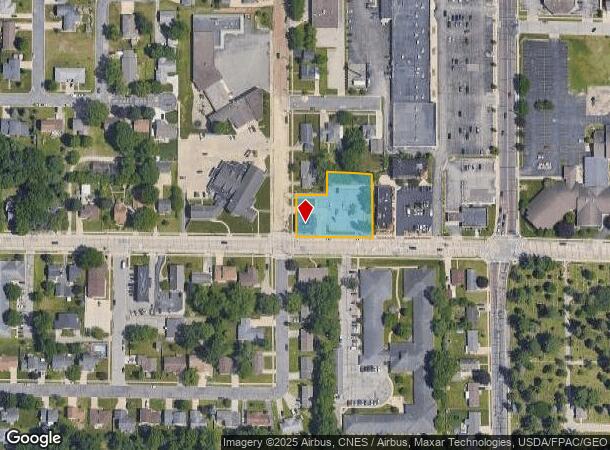
Property Record
1101 Main St, Onalaska, WI 54650


NEARBY LISTINGS FOR SALE OR LEASE
Property Detail
1101 Main St
La Crosse-Onalaska, WI-MN
Assessors Plat Of Onalaska Prt
018-000789-000
ASSESSORS PLAT OF ONALASKA PRT OUTLOT 11 COM SE COR W 388.7FT TO POB W 150FT N 208.7FT E 150FT S 208.7FT TO POB EX COM SE COR N 33FT W 604.71FT N 227.65FT TOPOB S89D7ME 86.71FT S 110.65FT N89D7MW 86.71FT N 110.65FT TO POB & PRT OUTLOT 11 COM SE COR
Commercialnec
La Crosse
X
Wisconsin
55063C0163D
0.87 AC
2024
La Crosse/Onalaska
2024
Other Market Areas
010403
DEMOGRAPHICS near 1101 Main St
1 Mile
3 Mile
5 Mile
2024 Total Population
9,926
31,234
52,449
2029 Population
10,030
31,510
52,898
Pop Growth 2024-2029
+ 1.05%
+ 0.88%
+ 0.86%
Average Age
41
42
39
2024 Total Households
4,292
13,131
21,201
HH Growth 2024-2029
+ 0.86%
+ 0.65%
+ 0.79%
Median Household Inc
$60,420
$69,219
$58,863
Avg Household Size
2.30
2.30
2.30
2024 Avg HH Vehicles
2.00
2.00
2.00
Median Home Value
$207,435
$234,455
$227,869
Median Year Built
1978
1980
1980
Nearby Places
Map Layers
Map Styles
 Street
 Aerial
- Restaurants
- Banks
- Shops
- Fitness
- Groceries
PUBLIC TRANSPORTATION
COMMUTER RAIL
La Crosse (Empire Builder - Amtrak)
DRIVE
WALK
Distance
La Crosse (Empire Builder - Amtrak)
11 min
5.4 mi
AIRPORT
La Crosse Regional
DRIVE
WALK
Distance
La Crosse Regional
10 min
5.3 mi
Freight Ports
Port Milwaukee
DRIVE
WALK
Distance
Port Milwaukee
230 min
208.0 mi
Nearby Properties
Address
Land Use
TOTAL SIZE
Lot Size
Zoning
Address
Land Use
TOTAL SIZE
Lot Size
Zoning
45.53 AC
MZA
Address
Land Use
TOTAL SIZE
Lot Size
Zoning
42.20 AC
MZA
Address
Land Use
TOTAL SIZE
Lot Size
Zoning
12.60 AC
MZA
Address
Land Use
TOTAL SIZE
Lot Size
Zoning
6.91 AC
Address
Land Use
TOTAL SIZE
Lot Size
Zoning
7.68 AC
MZA
Address
Land Use
TOTAL SIZE
Lot Size
Zoning
14.59 AC
MZA
Address
Land Use
TOTAL SIZE
Lot Size
Zoning
11.40 AC
MZA
Address
Land Use
TOTAL SIZE
Lot Size
Zoning
29.80 AC
MZA
Address
Land Use
TOTAL SIZE
Lot Size
Zoning
12,500 SF
5.12 AC
MZA
Address
Land Use
TOTAL SIZE
Lot Size
Zoning
14.61 AC
MZA
Address
Land Use
TOTAL SIZE
Lot Size
Zoning
4.81 AC
Address
Land Use
TOTAL SIZE
Lot Size
Zoning
2.52 AC
Address
Land Use
TOTAL SIZE
Lot Size
Zoning
19.67 AC
MZA
Address
Land Use
TOTAL SIZE
Lot Size
Zoning
15.41 AC
MZA
Address
Land Use
TOTAL SIZE
Lot Size
Zoning
5.29 AC
MZA
Address
Land Use
TOTAL SIZE
Lot Size
Zoning
2.63 AC
MZA
Address
Land Use
TOTAL SIZE
Lot Size
Zoning
19.98 AC
Address
Land Use
TOTAL SIZE
Lot Size
Zoning
5.98 AC
MZA
Address
Land Use
TOTAL SIZE
Lot Size
Zoning
4.40 AC
Address
Land Use
TOTAL SIZE
Lot Size
Zoning
33.17 AC
MZA
Address
Land Use
TOTAL SIZE
Lot Size
Zoning
5.90 AC
Address
Land Use
TOTAL SIZE
Lot Size
Zoning
10.64 AC
MZA
Address
Land Use
TOTAL SIZE
Lot Size
Zoning
5.03 AC
Address
Land Use
TOTAL SIZE
Lot Size
Zoning
11.04 AC
MZA
Address
Land Use
TOTAL SIZE
Lot Size
Zoning
10.92 AC
MZA
Address
Land Use
TOTAL SIZE
Lot Size
Zoning
8.40 AC
MZA
Address
Land Use
TOTAL SIZE
Lot Size
Zoning
3.75 AC
Address
Land Use
TOTAL SIZE
Lot Size
Zoning
11.55 AC
Address
Land Use
TOTAL SIZE
Lot Size
Zoning
7.59 AC
MZA
Address
Land Use
TOTAL SIZE
Lot Size
Zoning
8.39 AC
MZA
The World's #1 Commercial Real Estate Marketplace
Connect with us
© 2025 CoStar Group
The information above has been obtained from sources believed reliable. While we do not doubt its accuracy we have not verified it and make no guarantee, warranty or representation about it. It is your responsibility to independently confirm its accuracy and completeness. Any projections, opinions, assumptions, or estimates used are for example only and do not represent the current or future performance of the property. The value of this transaction to you depends on tax and other factors which should be evaluated by your tax, financial, and legal advisors. You and your advisors should conduct a careful, independent investigation of the property to determine to your satisfaction the suitability of the property for your needs.