Property Record
1101 Nw 33Rd St, Pompano Beach, FL 33064


NEARBY LISTINGS FOR SALE OR LEASE
Property Detail
1101 Nw 33Rd St
48-42-22-19-0070
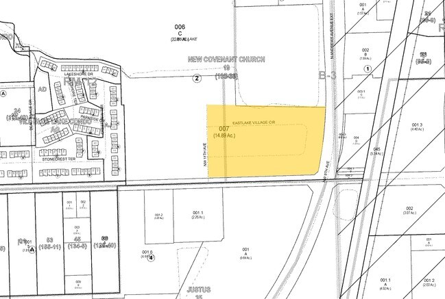
New Covenant Church Plat
Religious
NEW COVENANT CHURCH PLAT 105-38 B,TR D,LESS,BEG NE COR OF TR D,SLY 395,SW 30.93,W 644.26,N 443.39,E 41.72,N 183.57 E 137,S 190,E 548.01 TO POB
AE
Broward
12099C1175F
Florida
0
7.47 AC
2025
Pompano Beach
030500
South Florida
39,721 SF
Fort Lauderdale-Pompano Beach-Deerfield Beach, FL
DEMOGRAPHICS near 1101 Nw 33Rd St
1 Mile
3 Mile
5 Mile
2024 Total Population
16,579
126,311
347,184
2029 Population
16,511
126,517
350,301
Pop Growth 2024-2029
(0.41%)
+ 0.16%
+ 0.90%
Average Age
37
43
44
2024 Total Households
6,181
50,639
150,515
HH Growth 2024-2029
(0.81%)
+ 0.46%
+ 1.04%
Median Household Inc
$47,548
$48,652
$60,112
Avg Household Size
2.50
2.30
2.20
2024 Avg HH Vehicles
1.00
1.00
2.00
Median Home Value
$214,316
$203,097
$319,120
Median Year Built
1975
1977
1979
Nearby Places
Map Layers
Map Styles
 Street
 Aerial
- Restaurants
- Banks
- Shops
- Fitness
- Groceries
PUBLIC TRANSPORTATION
COMMUTER RAIL
Pompano Beach (Tri-County Commuter - South Florida Regional Transportation Authority (Tri-Rail))
DRIVE
WALK
Distance
Pompano Beach (Tri-County Commuter - South Florida Regional Transportation Authority (Tri-Rail))
2 min
6 min
0.3 mi
Deerfield Beach (Tri-County Commuter - South Florida Regional Transportation Authority (Tri-Rail))
DRIVE
WALK
Distance
Deerfield Beach (Tri-County Commuter - South Florida Regional Transportation Authority (Tri-Rail))
11 min
5.7 mi
AIRPORT
Fort Lauderdale/Hollywood International
DRIVE
WALK
Distance
Fort Lauderdale/Hollywood International
26 min
17.2 mi
Palm Beach International
DRIVE
WALK
Distance
Palm Beach International
44 min
33.2 mi
Freight Ports
Port Everglades
DRIVE
WALK
Distance
Port Everglades
25 min
15.8 mi
Nearby Properties
Address
Land Use
TOTAL SIZE
Lot Size
Zoning
Address
Land Use
TOTAL SIZE
Lot Size
Zoning
605,126 SF
39.63 AC
I
Address
Land Use
TOTAL SIZE
Lot Size
Zoning
696,020 SF
31.74 AC
OPC
Address
Land Use
TOTAL SIZE
Lot Size
Zoning
1,166,083 SF
74.07 AC
I
Address
Land Use
TOTAL SIZE
Lot Size
Zoning
32,538 SF
331.51 AC
P
Address
Land Use
TOTAL SIZE
Lot Size
Zoning
484,380 SF
137.82 AC
T
Address
Land Use
TOTAL SIZE
Lot Size
Zoning
467,722 SF
36.71 AC
I-1
Address
Land Use
TOTAL SIZE
Lot Size
Zoning
285,335 SF
8.56 AC
RM-45
Address
Land Use
TOTAL SIZE
Lot Size
Zoning
392,222 SF
5.33 AC
RPUD
Address
Land Use
TOTAL SIZE
Lot Size
Zoning
307,641 SF
20 AC
PUD
Address
Land Use
TOTAL SIZE
Lot Size
Zoning
434,859 SF
38.72 AC
CF
Address
Land Use
TOTAL SIZE
Lot Size
Zoning
548,682 SF
21.63 AC
CF
Address
Land Use
TOTAL SIZE
Lot Size
Zoning
380,866 SF
26.23 AC
O-IP/PCD
Address
Land Use
TOTAL SIZE
Lot Size
Zoning
374,776 SF
23.52 AC
I-1
Address
Land Use
TOTAL SIZE
Lot Size
Zoning
440,709 SF
22.39 AC
I
Address
Land Use
TOTAL SIZE
Lot Size
Zoning
435,201 SF
23.78 AC
I-1
Address
Land Use
TOTAL SIZE
Lot Size
Zoning
313,030 SF
37.22 AC
CF
Address
Land Use
TOTAL SIZE
Lot Size
Zoning
192,214 SF
10.84 AC
B-3/PCD
Address
Land Use
TOTAL SIZE
Lot Size
Zoning
283,330 SF
27.02 AC
I-1/PCI
Address
Land Use
TOTAL SIZE
Lot Size
Zoning
247,079 SF
14.66 AC
I
Address
Land Use
TOTAL SIZE
Lot Size
Zoning
159,618 SF
77.09 AC
PU
Address
Land Use
TOTAL SIZE
Lot Size
Zoning
244,452 SF
13.10 AC
RM-20
Address
Land Use
TOTAL SIZE
Lot Size
Zoning
224,769 SF
15.48 AC
I-1
Address
Land Use
TOTAL SIZE
Lot Size
Zoning
249,657 SF
17.49 AC
I-1/PCD
Address
Land Use
TOTAL SIZE
Lot Size
Zoning
389,735 SF
28.12 AC
CF
Address
Land Use
TOTAL SIZE
Lot Size
Zoning
222,660 SF
18.22 AC
CF
Address
Land Use
TOTAL SIZE
Lot Size
Zoning
99.83 AC
P
Address
Land Use
TOTAL SIZE
Lot Size
Zoning
152,273 SF
20.03 AC
B-3
Address
Land Use
TOTAL SIZE
Lot Size
Zoning
144,205 SF
5 AC
RM-25
Address
Land Use
TOTAL SIZE
Lot Size
Zoning
153,579 SF
31 AC
I-1
Address
Land Use
TOTAL SIZE
Lot Size
Zoning
197,145 SF
13.71 AC
PUD
The World's #1 Commercial Real Estate Marketplace
Connect with us
© 2025 CoStar Group
The information above has been obtained from sources believed reliable. While we do not doubt its accuracy we have not verified it and make no guarantee, warranty or representation about it. It is your responsibility to independently confirm its accuracy and completeness. Any projections, opinions, assumptions, or estimates used are for example only and do not represent the current or future performance of the property. The value of this transaction to you depends on tax and other factors which should be evaluated by your tax, financial, and legal advisors. You and your advisors should conduct a careful, independent investigation of the property to determine to your satisfaction the suitability of the property for your needs.