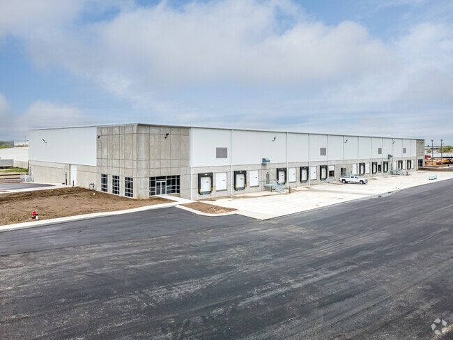
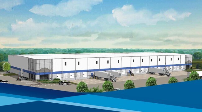
Property Record
1101 S 5Th St, Kansas City, KS 66105

NEARBY LISTINGS FOR SALE OR LEASE
Property Detail
1101 S 5Th St
Kansas City
Prime Industrial Dev Ii Rep
Kansas City, MO-KS
PRIME INDUSTRIAL DEV II REP L1, S22, T11, R25, ACRES 11.12, L1
421000
Wyandotte
Shipyard
Kansas
2025
1
2025
11.05 AC
980900
Armourdale
77,004 SF
DEMOGRAPHICS near 1101 S 5Th St
1 Mile
3 Mile
5 Mile
2024 Total Population
2,280
105,446
259,179
2029 Population
2,262
105,993
261,775
Pop Growth 2024-2029
(0.79%)
+ 0.52%
+ 1.00%
Average Age
36
36
37
2024 Total Households
754
50,710
113,086
HH Growth 2024-2029
(0.80%)
+ 0.98%
+ 1.29%
Median Household Inc
$37,798
$57,421
$56,093
Avg Household Size
2.80
1.90
2.20
2024 Avg HH Vehicles
2.00
1.00
2.00
Median Home Value
$66,882
$189,832
$190,605
Median Year Built
1952
1954
1953
Nearby Places
Map Layers
Map Styles
 Street
 Aerial
- Restaurants
- Banks
- Shops
- Fitness
- Groceries
PUBLIC TRANSPORTATION
COMMUTER RAIL
Kansas City (Lincoln Service Missouri River Runner - Amtrak, Missouri River Runner - Amtrak, Southwest Chief - Amtrak)
DRIVE
WALK
Distance
Kansas City (Lincoln Service Missouri River Runner - Amtrak, Missouri River Runner - Amtrak, Southwest Chief - Amtrak)
8 min
3.0 mi
AIRPORT
Kansas City International
DRIVE
WALK
Distance
Kansas City International
29 min
19.9 mi
Freight Ports
Tulsa Port Of Catoosa
DRIVE
WALK
Distance
Tulsa Port Of Catoosa
263 min
236.2 mi
SALE & LEASE HISTORY
LISTING DATE
SALE/LEASE

Feb 14, 2018
For Lease
Nearby Properties
Address
Land Use
TOTAL SIZE
Lot Size
Zoning
Address
Land Use
TOTAL SIZE
Lot Size
Zoning
761,113 SF
18.37 AC
KC3
Address
Land Use
TOTAL SIZE
Lot Size
Zoning
91,485 SF
10.11 AC
Address
Land Use
TOTAL SIZE
Lot Size
Zoning
208,800 SF
5.57 AC
KRP5
Address
Land Use
TOTAL SIZE
Lot Size
Zoning
172,810 SF
Address
Land Use
TOTAL SIZE
Lot Size
Zoning
191,956 SF
10.45 AC
KR1B
Address
Land Use
TOTAL SIZE
Lot Size
Zoning
568,235 SF
9.59 AC
Address
Land Use
TOTAL SIZE
Lot Size
Zoning
126,962 SF
4.50 AC
KC0
Address
Land Use
TOTAL SIZE
Lot Size
Zoning
488,351 SF
8.34 AC
Address
Land Use
TOTAL SIZE
Lot Size
Zoning
132,304 SF
3.72 AC
KCD
Address
Land Use
TOTAL SIZE
Lot Size
Zoning
1,825,083 SF
25.77 AC
Address
Land Use
TOTAL SIZE
Lot Size
Zoning
404,524 SF
5.51 AC
Address
Land Use
TOTAL SIZE
Lot Size
Zoning
711,196 SF
15.58 AC
Address
Land Use
TOTAL SIZE
Lot Size
Zoning
105,247 SF
0.72 AC
Address
Land Use
TOTAL SIZE
Lot Size
Zoning
277,042 SF
0.40 AC
Address
Land Use
TOTAL SIZE
Lot Size
Zoning
257,647 SF
3.63 AC
Address
Land Use
TOTAL SIZE
Lot Size
Zoning
277,267 SF
4.18 AC
KCD
Address
Land Use
TOTAL SIZE
Lot Size
Zoning
626,244 SF
16.41 AC
Address
Land Use
TOTAL SIZE
Lot Size
Zoning
44,491 SF
1.96 AC
C3A2
Address
Land Use
TOTAL SIZE
Lot Size
Zoning
81,578 SF
1.63 AC
Address
Land Use
TOTAL SIZE
Lot Size
Zoning
124,492 SF
4.24 AC
Address
Land Use
TOTAL SIZE
Lot Size
Zoning
162,989 SF
3.92 AC
KC0
Address
Land Use
TOTAL SIZE
Lot Size
Zoning
115,627 SF
1.56 AC
Address
Land Use
TOTAL SIZE
Lot Size
Zoning
261,570 SF
1.82 AC
Address
Land Use
TOTAL SIZE
Lot Size
Zoning
157,488 SF
1.60 AC
Address
Land Use
TOTAL SIZE
Lot Size
Zoning
87,294 SF
0.70 AC
Address
Land Use
TOTAL SIZE
Lot Size
Zoning
803,812 SF
5.85 AC
Address
Land Use
TOTAL SIZE
Lot Size
Zoning
69,130 SF
6.49 AC
R-1
Address
Land Use
TOTAL SIZE
Lot Size
Zoning
129,265 SF
1.17 AC
Address
Land Use
TOTAL SIZE
Lot Size
Zoning
274,622 SF
1.35 AC
Address
Land Use
TOTAL SIZE
Lot Size
Zoning
109,563 SF
0.98 AC
The World's #1 Commercial Real Estate Marketplace
Connect with us
© 2025 CoStar Group
The information above has been obtained from sources believed reliable. While we do not doubt its accuracy we have not verified it and make no guarantee, warranty or representation about it. It is your responsibility to independently confirm its accuracy and completeness. Any projections, opinions, assumptions, or estimates used are for example only and do not represent the current or future performance of the property. The value of this transaction to you depends on tax and other factors which should be evaluated by your tax, financial, and legal advisors. You and your advisors should conduct a careful, independent investigation of the property to determine to your satisfaction the suitability of the property for your needs.