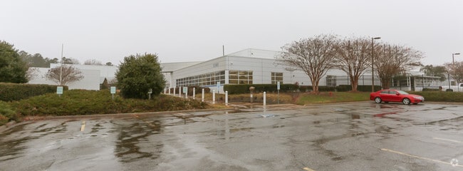
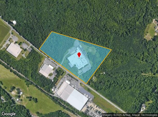
Property Record
1101 S Highway 27, Stanley, NC 28164
NEARBY LISTINGS FOR SALE OR LEASE
Property Detail
1101 S Highway 27
175770
14 056 033 00 000
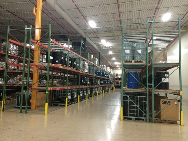
Industrialgeneral
Gaston
X
North Carolina
3710358800J
26.16 AC
2025
Gaston County
2025
Charlotte
030207
Charlotte-Concord-Gastonia, NC-SC
138,105 SF
DEMOGRAPHICS near 1101 S Highway 27
1 mile
3 mile
5 mile
2024 Total Population
1,741
14,447
47,094
2029 Population
1,884
15,442
50,332
Pop Growth 2024-2029
+ 8.21%
+ 6.89%
+ 6.88%
Average Age
45
42
40
2024 Total Households
658
5,680
18,514
HH Growth 2024-2029
+ 8.81%
+ 7.18%
+ 7.10%
Median Household Inc
$70,241
$61,658
$57,784
Avg Household Size
2.50
2.50
2.50
2024 Avg HH Vehicles
2.00
2.00
2.00
Median Home Value
$257,883
$220,083
$204,735
Median Year Built
1996
1982
1984
Nearby Places
Map Layers
Map Styles
 Street
 Aerial
Transit
 Traffic
 Biking
Places
Listings with unknown addresses are not visible on the map
- Restaurants
- Banks
- Shops
- Fitness
- Groceries
PUBLIC TRANSPORTATION
COMMUTER RAIL
Drive
Walk
Distance
20 min
9.7 mi
AIRPORT
Charlotte/Douglas International
Drive
Walk
Distance
Charlotte/Douglas International
31 min
15.3 mi
Concord-Padgett Regional
Drive
Walk
Distance
Concord-Padgett Regional
36 min
24.9 mi
SALE & LEASE HISTORY
LISTING DATE
SALE/LEASE

Oct 17, 2016
For Sale
Mar 22, 2017
For Sale
Jul 19, 2018
For Sale
Apr 18, 2018
For Sale
Nearby Properties
Address
Land Use
TOTAL SIZE
Lot Size
Zoning
Address
Land Use
TOTAL SIZE
Lot Size
Zoning
6,720 SF
60.15 AC
PUB01
Address
Land Use
TOTAL SIZE
Lot Size
Zoning
135,468 SF
35.34 AC
PUB01
Address
Land Use
TOTAL SIZE
Lot Size
Zoning
426,374 SF
17.13 AC
INDS2
Address
Land Use
TOTAL SIZE
Lot Size
Zoning
76,455 SF
36.80 AC
Address
Land Use
TOTAL SIZE
Lot Size
Zoning
278,424 SF
25.32 AC
INDS2
Address
Land Use
TOTAL SIZE
Lot Size
Zoning
Address
Land Use
TOTAL SIZE
Lot Size
Zoning
7,490 SF
10.10 AC
HCAR4
Address
Land Use
TOTAL SIZE
Lot Size
Zoning
12,000 SF
5.90 AC
SHOP5
Address
Land Use
TOTAL SIZE
Lot Size
Zoning
30,272 SF
9.13 AC
R20
Address
Land Use
TOTAL SIZE
Lot Size
Zoning
76,602 SF
11.48 AC
PUB01
Address
Land Use
TOTAL SIZE
Lot Size
Zoning
604.71 AC
DW
Address
Land Use
TOTAL SIZE
Lot Size
Zoning
59,315 SF
10.31 AC
CHUR2
Address
Land Use
TOTAL SIZE
Lot Size
Zoning
61,359 SF
12.30 AC
PUB01
Address
Land Use
TOTAL SIZE
Lot Size
Zoning
40,937 SF
4.44 AC
MRKT4
Address
Land Use
TOTAL SIZE
Lot Size
Zoning
80,590 SF
9.89 AC
INDS2
Address
Land Use
TOTAL SIZE
Lot Size
Zoning
30,636 SF
8.01 AC
CHUR2
Address
Land Use
TOTAL SIZE
Lot Size
Zoning
1,260 SF
3.80 AC
OFF01
Address
Land Use
TOTAL SIZE
Lot Size
Zoning
5,400 SF
11.91 AC
CHUR3
Address
Land Use
TOTAL SIZE
Lot Size
Zoning
30,592 SF
4.03 AC
CHUR2
Address
Land Use
TOTAL SIZE
Lot Size
Zoning
7,267 SF
63.40 AC
Address
Land Use
TOTAL SIZE
Lot Size
Zoning
8,980 SF
8.02 AC
CHUR2
Address
Land Use
TOTAL SIZE
Lot Size
Zoning
73,956 SF
8.27 AC
INDS1
Address
Land Use
TOTAL SIZE
Lot Size
Zoning
27,609 SF
3.89 AC
HCAR3
Address
Land Use
TOTAL SIZE
Lot Size
Zoning
1,935 SF
2.16 AC
APT02
Address
Land Use
TOTAL SIZE
Lot Size
Zoning
10,125 SF
1.18 AC
RET05
Address
Land Use
TOTAL SIZE
Lot Size
Zoning
8,222 SF
2.08 AC
CHUR5
Address
Land Use
TOTAL SIZE
Lot Size
Zoning
18,377 SF
5.22 AC
CHUR2
Address
Land Use
TOTAL SIZE
Lot Size
Zoning
7,621 SF
1.68 AC
R2
Address
Land Use
TOTAL SIZE
Lot Size
Zoning
5,400 SF
6.19 AC
STOR4
The World's #1 Commercial Real Estate Marketplace
Connect with us
© 2026 CoStar Group
The information above has been obtained from sources believed reliable. While we do not doubt its accuracy we have not verified it and make no guarantee, warranty or representation about it. It is your responsibility to independently confirm its accuracy and completeness. Any projections, opinions, assumptions, or estimates used are for example only and do not represent the current or future performance of the property. The value of this transaction to you depends on tax and other factors which should be evaluated by your tax, financial, and legal advisors. You and your advisors should conduct a careful, independent investigation of the property to determine to your satisfaction the suitability of the property for your needs.