Property Record
1101 S Thornton Ave, Dalton, GA 30720
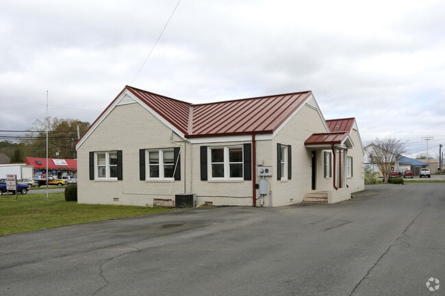
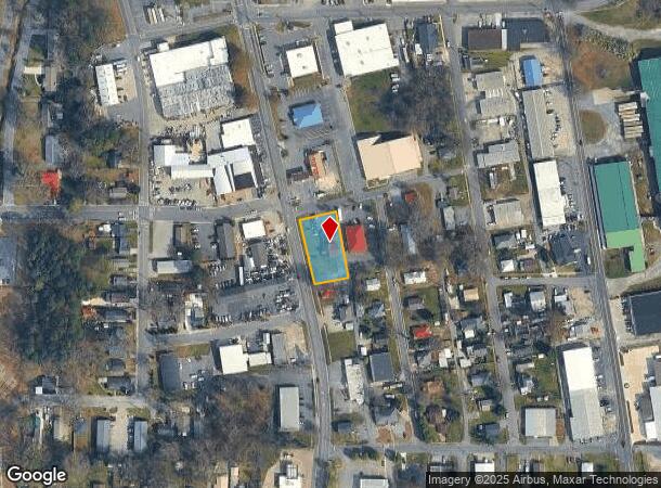
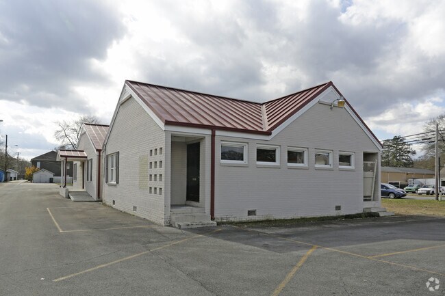
This Property Is For Sale
NEARBY LISTINGS FOR SALE OR LEASE
Property Detail
1101 S Thornton Ave
12-257-06-003
Comm Small Tract
Commercialnec
PT L600T602 CROWN MILL
X
Whitfield
13213C0100D
Georgia
2024
0.42 AC
2024
Georgia Northwest
001200
Other Market Areas
2,627 SF
Dalton, GA
DEMOGRAPHICS near 1101 S Thornton Ave
1 Mile
3 Mile
5 Mile
2024 Total Population
4,588
41,421
63,255
2029 Population
4,595
41,558
63,382
Pop Growth 2024-2029
+ 0.15%
+ 0.33%
+ 0.20%
Average Age
37
36
37
2024 Total Households
1,600
14,055
21,888
HH Growth 2024-2029
+ 0.06%
+ 0.38%
+ 0.21%
Median Household Inc
$81,880
$49,079
$51,809
Avg Household Size
2.80
2.80
2.80
2024 Avg HH Vehicles
2.00
2.00
2.00
Median Home Value
$213,223
$167,467
$171,049
Median Year Built
1972
1981
1984
Nearby Places
- Restaurants
- Banks
- Shops
- Fitness
- Groceries
PUBLIC TRANSPORTATION
AIRPORT
Lovell Field
DRIVE
WALK
Distance
Lovell Field
39 min
29.5 mi
Freight Ports
Georgia Ports - Savannah
DRIVE
WALK
Distance
Georgia Ports - Savannah
376 min
335.1 mi
Nearby Properties
Address
Land Use
TOTAL SIZE
Lot Size
Zoning
Address
Land Use
TOTAL SIZE
Lot Size
Zoning
34,320 SF
13.50 AC
Address
Land Use
TOTAL SIZE
Lot Size
Zoning
54,546 SF
128.30 AC
Address
Land Use
TOTAL SIZE
Lot Size
Zoning
500,075 SF
11.48 AC
Address
Land Use
TOTAL SIZE
Lot Size
Zoning
39,664 SF
27.50 AC
Address
Land Use
TOTAL SIZE
Lot Size
Zoning
784,920 SF
56.60 AC
Address
Land Use
TOTAL SIZE
Lot Size
Zoning
123,430 SF
51.17 AC
Address
Land Use
TOTAL SIZE
Lot Size
Zoning
1,183,067 SF
48.97 AC
Address
Land Use
TOTAL SIZE
Lot Size
Zoning
133,712 SF
14.93 AC
R7
Address
Land Use
TOTAL SIZE
Lot Size
Zoning
193,716 SF
29.23 AC
Address
Land Use
TOTAL SIZE
Lot Size
Zoning
664,020 SF
28.75 AC
Address
Land Use
TOTAL SIZE
Lot Size
Zoning
662,926 SF
67.28 AC
Address
Land Use
TOTAL SIZE
Lot Size
Zoning
68,465 SF
0.71 AC
Address
Land Use
TOTAL SIZE
Lot Size
Zoning
100,084 SF
1.47 AC
Address
Land Use
TOTAL SIZE
Lot Size
Zoning
115,979 SF
10.60 AC
C2
Address
Land Use
TOTAL SIZE
Lot Size
Zoning
747,587 SF
24.63 AC
Address
Land Use
TOTAL SIZE
Lot Size
Zoning
125,756 SF
7 AC
Address
Land Use
TOTAL SIZE
Lot Size
Zoning
250,000 SF
12.50 AC
Address
Land Use
TOTAL SIZE
Lot Size
Zoning
150,771 SF
12.66 AC
Address
Land Use
TOTAL SIZE
Lot Size
Zoning
6,650 SF
22.70 AC
Address
Land Use
TOTAL SIZE
Lot Size
Zoning
8,208 SF
11.86 AC
Address
Land Use
TOTAL SIZE
Lot Size
Zoning
174,347 SF
87.57 AC
Address
Land Use
TOTAL SIZE
Lot Size
Zoning
18,016 SF
27.65 AC
Address
Land Use
TOTAL SIZE
Lot Size
Zoning
38,016 SF
18 AC
Address
Land Use
TOTAL SIZE
Lot Size
Zoning
55,020 SF
7.02 AC
Address
Land Use
TOTAL SIZE
Lot Size
Zoning
1,125,548 SF
24.22 AC
Address
Land Use
TOTAL SIZE
Lot Size
Zoning
184,000 SF
29.32 AC
Address
Land Use
TOTAL SIZE
Lot Size
Zoning
39,191 SF
1.93 AC
Address
Land Use
TOTAL SIZE
Lot Size
Zoning
31,376 SF
9.64 AC
Address
Land Use
TOTAL SIZE
Lot Size
Zoning
471,045 SF
45.93 AC
Address
Land Use
TOTAL SIZE
Lot Size
Zoning
185,916 SF
24.52 AC
The World's #1 Commercial Real Estate Marketplace
Connect with us
© 2025 CoStar Group
The information above has been obtained from sources believed reliable. While we do not doubt its accuracy we have not verified it and make no guarantee, warranty or representation about it. It is your responsibility to independently confirm its accuracy and completeness. Any projections, opinions, assumptions, or estimates used are for example only and do not represent the current or future performance of the property. The value of this transaction to you depends on tax and other factors which should be evaluated by your tax, financial, and legal advisors. You and your advisors should conduct a careful, independent investigation of the property to determine to your satisfaction the suitability of the property for your needs.