Property Record
1101 Highway 9 Byp W, Lancaster, SC 29720
NEARBY LISTINGS FOR SALE OR LEASE
Property Detail
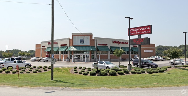
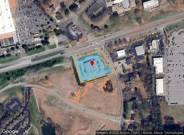
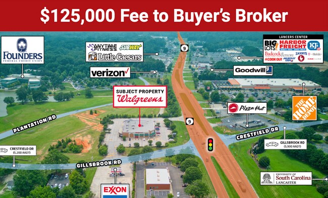
1101 Highway 9 Byp W
Drugstorepharmacycvswalgreens
Lancaster
X
South Carolina
45057C0231E
2.26 AC
2024
Lancaster County
2024
Charlotte
010900
Charlotte-Concord-Gastonia, NC-SC
14,820 SF
0067F-0D-001.01
DEMOGRAPHICS near 1101 Highway 9 Byp W
1 Mile
3 Mile
5 Mile
2024 Total Population
2,914
19,117
30,005
2029 Population
3,511
23,160
36,287
Pop Growth 2024-2029
+ 20.49%
+ 21.15%
+ 20.94%
Average Age
43
40
41
2024 Total Households
1,202
7,839
12,165
HH Growth 2024-2029
+ 20.47%
+ 21.13%
+ 20.95%
Median Household Inc
$63,574
$44,548
$49,278
Avg Household Size
2.40
2.40
2.40
2024 Avg HH Vehicles
2.00
2.00
2.00
Median Home Value
$232,768
$169,568
$163,091
Median Year Built
1979
1974
1978
Nearby Places
Map Layers
Map Styles
 Street
 Aerial
- Restaurants
- Banks
- Shops
- Fitness
- Groceries
PUBLIC TRANSPORTATION
AIRPORT
Charlotte/Douglas International
DRIVE
WALK
Distance
Charlotte/Douglas International
60 min
39.4 mi
SALE & LEASE HISTORY
LISTING DATE
SALE/LEASE

Oct 20, 2023
For Sale
Aug 01, 2023
For Sale
Apr 08, 2024
For Sale
Nearby Properties
Address
Land Use
TOTAL SIZE
Lot Size
Zoning
Address
Land Use
TOTAL SIZE
Lot Size
Zoning
214,483 SF
20.62 AC
CITY
Address
Land Use
TOTAL SIZE
Lot Size
Zoning
11,456 SF
395 AC
CITY
Address
Land Use
TOTAL SIZE
Lot Size
Zoning
38,652 SF
83.76 AC
CITY
Address
Land Use
TOTAL SIZE
Lot Size
Zoning
145,281 SF
19 AC
CITY
Address
Land Use
TOTAL SIZE
Lot Size
Zoning
53,564 SF
42.71 AC
INS
Address
Land Use
TOTAL SIZE
Lot Size
Zoning
55,998 SF
398 AC
CITY
Address
Land Use
TOTAL SIZE
Lot Size
Zoning
17,802 SF
5.24 AC
INS
Address
Land Use
TOTAL SIZE
Lot Size
Zoning
69,482 SF
63.14 AC
CITY
Address
Land Use
TOTAL SIZE
Lot Size
Zoning
17,000 SF
1.30 AC
INS
Address
Land Use
TOTAL SIZE
Lot Size
Zoning
49,240 SF
12.60 AC
CITY
Address
Land Use
TOTAL SIZE
Lot Size
Zoning
4,550 SF
34.40 AC
CITY
Address
Land Use
TOTAL SIZE
Lot Size
Zoning
19,198 SF
11.61 AC
INS
Address
Land Use
TOTAL SIZE
Lot Size
Zoning
45,440 SF
22 AC
INS
Address
Land Use
TOTAL SIZE
Lot Size
Zoning
50,637 SF
2.42 AC
CITY
Address
Land Use
TOTAL SIZE
Lot Size
Zoning
9,491 SF
412 AC
CITY
Address
Land Use
TOTAL SIZE
Lot Size
Zoning
20,023 SF
9.79 AC
INS
Address
Land Use
TOTAL SIZE
Lot Size
Zoning
90,765 SF
16.75 AC
CITY
Address
Land Use
TOTAL SIZE
Lot Size
Zoning
21,299 SF
390 AC
CITY
Address
Land Use
TOTAL SIZE
Lot Size
Zoning
61,875 SF
5.74 AC
CITY
Address
Land Use
TOTAL SIZE
Lot Size
Zoning
9,502 SF
393 AC
CITY
Address
Land Use
TOTAL SIZE
Lot Size
Zoning
16,877 SF
381 AC
CITY
Address
Land Use
TOTAL SIZE
Lot Size
Zoning
71.28 AC
CITY
Address
Land Use
TOTAL SIZE
Lot Size
Zoning
228.68 AC
OSP
Address
Land Use
TOTAL SIZE
Lot Size
Zoning
20,368 SF
18.68 AC
GB
Address
Land Use
TOTAL SIZE
Lot Size
Zoning
15,659 SF
8.69 AC
CITY
Address
Land Use
TOTAL SIZE
Lot Size
Zoning
16,558 SF
5.99 AC
CITY
Address
Land Use
TOTAL SIZE
Lot Size
Zoning
16,163 SF
4 AC
CITY
Address
Land Use
TOTAL SIZE
Lot Size
Zoning
53.69 AC
CITY
Address
Land Use
TOTAL SIZE
Lot Size
Zoning
7,072 SF
225 AC
CITY
Address
Land Use
TOTAL SIZE
Lot Size
Zoning
41.49 AC
HI
The World's #1 Commercial Real Estate Marketplace
Connect with us
© 2025 CoStar Group
The information above has been obtained from sources believed reliable. While we do not doubt its accuracy we have not verified it and make no guarantee, warranty or representation about it. It is your responsibility to independently confirm its accuracy and completeness. Any projections, opinions, assumptions, or estimates used are for example only and do not represent the current or future performance of the property. The value of this transaction to you depends on tax and other factors which should be evaluated by your tax, financial, and legal advisors. You and your advisors should conduct a careful, independent investigation of the property to determine to your satisfaction the suitability of the property for your needs.