Property Record
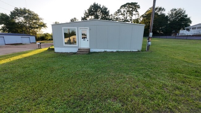
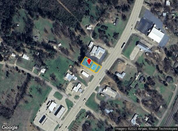
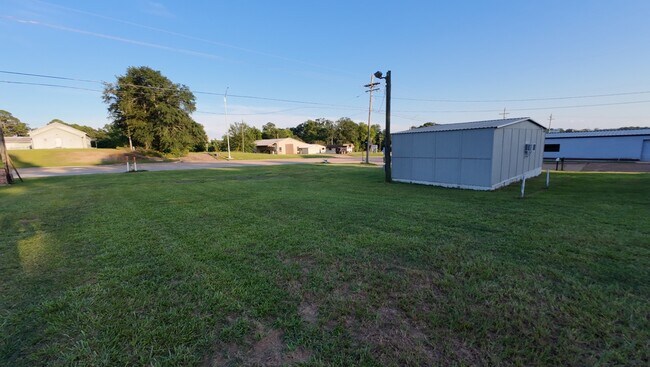
302 Walnut St, Atlanta, TX 75551
This Property Is For Sale
NEARBY LISTINGS FOR SALE OR LEASE
Property Detail
302 Walnut St
1982
Jane Richie Survey Abstract No 877
Sfr
J CLEMENTS ABST 198 TR 5 .437 AC
X
Cass
48067C0270C
Texas
2025
5
2025
0.44 AC
950400
Texas East Area
1,432 SF
Other Market Areas
DEMOGRAPHICS near 302 Walnut St
1 mile
3 mile
5 mile
2024 Total Population
1,531
6,134
9,838
2029 Population
1,596
6,366
10,184
Pop Growth 2024-2029
+ 4.25%
+ 3.78%
+ 3.52%
Average Age
41
41
42
2024 Total Households
646
2,535
4,010
HH Growth 2024-2029
+ 4.18%
+ 3.79%
+ 3.54%
Median Household Inc
$55,384
$57,843
$60,563
Avg Household Size
2.30
2.40
2.40
2024 Avg HH Vehicles
2.00
2.00
2.00
Median Home Value
$133,333
$153,628
$158,692
Median Year Built
1985
1977
1980
Nearby Places
Map Layers
Map Styles
 Street
 Aerial
Transit
 Traffic
 Biking
Places
Listings with unknown addresses are not visible on the map
- Restaurants
- Banks
- Shops
- Fitness
- Groceries
PUBLIC TRANSPORTATION
AIRPORT
Texarkana Regional-Webb Field
Drive
Walk
Distance
Texarkana Regional-Webb Field
37 min
28.1 mi
Freight Ports
Port of Shreveport
Drive
Walk
Distance
Port of Shreveport
105 min
81.6 mi
Nearby Properties
Address
Land Use
TOTAL SIZE
Lot Size
Zoning
Address
Land Use
TOTAL SIZE
Lot Size
Zoning
256,896 SF
127.95 AC
Address
Land Use
TOTAL SIZE
Lot Size
Zoning
131,391 SF
50.15 AC
Address
Land Use
TOTAL SIZE
Lot Size
Zoning
65,730 SF
7.55 AC
Address
Land Use
TOTAL SIZE
Lot Size
Zoning
62,914 SF
36.58 AC
Address
Land Use
TOTAL SIZE
Lot Size
Zoning
113,368 SF
0.57 AC
Address
Land Use
TOTAL SIZE
Lot Size
Zoning
39,887 SF
16.10 AC
Address
Land Use
TOTAL SIZE
Lot Size
Zoning
36,049 SF
20.28 AC
Address
Land Use
TOTAL SIZE
Lot Size
Zoning
41,570 SF
1 AC
Address
Land Use
TOTAL SIZE
Lot Size
Zoning
60,210 SF
4.28 AC
Address
Land Use
TOTAL SIZE
Lot Size
Zoning
88,077 SF
19.52 AC
Address
Land Use
TOTAL SIZE
Lot Size
Zoning
35,654 SF
1.08 AC
Address
Land Use
TOTAL SIZE
Lot Size
Zoning
23,737 SF
1.26 AC
Address
Land Use
TOTAL SIZE
Lot Size
Zoning
31,400 SF
2.30 AC
Address
Land Use
TOTAL SIZE
Lot Size
Zoning
487.51 AC
Address
Land Use
TOTAL SIZE
Lot Size
Zoning
33,471 SF
3.93 AC
Address
Land Use
TOTAL SIZE
Lot Size
Zoning
18,483 SF
1.47 AC
Address
Land Use
TOTAL SIZE
Lot Size
Zoning
39,572 SF
3.53 AC
Address
Land Use
TOTAL SIZE
Lot Size
Zoning
1,808 SF
248.76 AC
Address
Land Use
TOTAL SIZE
Lot Size
Zoning
12,848 SF
3 AC
Address
Land Use
TOTAL SIZE
Lot Size
Zoning
16,019 SF
1.34 AC
Address
Land Use
TOTAL SIZE
Lot Size
Zoning
2,176 SF
153 AC
Address
Land Use
TOTAL SIZE
Lot Size
Zoning
32,922 SF
88.19 AC
Address
Land Use
TOTAL SIZE
Lot Size
Zoning
17,336 SF
1.08 AC
Address
Land Use
TOTAL SIZE
Lot Size
Zoning
58,754 SF
7.49 AC
Address
Land Use
TOTAL SIZE
Lot Size
Zoning
13,069 SF
1.36 AC
Address
Land Use
TOTAL SIZE
Lot Size
Zoning
17,481 SF
1.41 AC
Address
Land Use
TOTAL SIZE
Lot Size
Zoning
26,432 SF
4.64 AC
Address
Land Use
TOTAL SIZE
Lot Size
Zoning
24,512 SF
2.36 AC
Address
Land Use
TOTAL SIZE
Lot Size
Zoning
10,476 SF
1.75 AC
Address
Land Use
TOTAL SIZE
Lot Size
Zoning
34,800 SF
1.20 AC
The World's #1 Commercial Real Estate Marketplace
Connect with us
© 2026 CoStar Group
The information above has been obtained from sources believed reliable. While we do not doubt its accuracy we have not verified it and make no guarantee, warranty or representation about it. It is your responsibility to independently confirm its accuracy and completeness. Any projections, opinions, assumptions, or estimates used are for example only and do not represent the current or future performance of the property. The value of this transaction to you depends on tax and other factors which should be evaluated by your tax, financial, and legal advisors. You and your advisors should conduct a careful, independent investigation of the property to determine to your satisfaction the suitability of the property for your needs.