Property Record
11010 Kentucky Springs Rd, Mineral, VA 23117
NEARBY LISTINGS FOR SALE OR LEASE
-
-
View all Mineral listings for sale on LoopNet.com
Property Detail
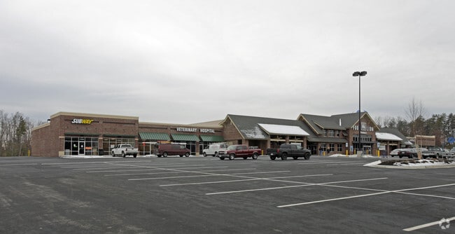
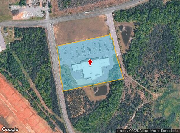
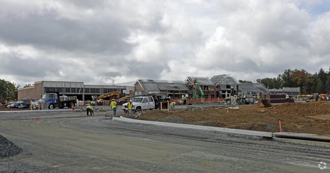
11010 Kentucky Springs Rd
29-35B
New Bridge Landing Lcc
Commercialnec
ALLAH COOPER & PITTS PLAT 8/2806 DB 1210/191 6.666 AC
X
Louisa
51177C0325D
Virginia
2024
6.67 AC
2025
Louisa County
950102
Richmond VA
DEMOGRAPHICS near 11010 Kentucky Springs Rd
1 Mile
3 Mile
5 Mile
2024 Total Population
502
4,384
8,920
2029 Population
607
5,221
10,542
Pop Growth 2024-2029
+ 20.92%
+ 19.09%
+ 18.18%
Average Age
52
49
48
2024 Total Households
228
1,897
3,739
HH Growth 2024-2029
+ 20.61%
+ 18.92%
+ 18.11%
Median Household Inc
$93,855
$94,122
$95,015
Avg Household Size
2.20
2.30
2.40
2024 Avg HH Vehicles
2.00
3.00
3.00
Median Home Value
$426,470
$394,892
$381,639
Median Year Built
1996
1996
1995
Nearby Places
Map Layers
Map Styles
 Street
 Aerial
- Restaurants
- Banks
- Shops
- Fitness
- Groceries
PUBLIC TRANSPORTATION
AIRPORT
Charlottesville-Albemarle
DRIVE
WALK
Distance
Charlottesville-Albemarle
77 min
47.6 mi
Freight Ports
Virginia Port Authority - Richmond
DRIVE
WALK
Distance
Virginia Port Authority - Richmond
88 min
64.9 mi
Nearby Properties
Address
Land Use
TOTAL SIZE
Lot Size
Zoning
Address
Land Use
TOTAL SIZE
Lot Size
Zoning
364.51 AC
RA - AGRIC
Address
Land Use
TOTAL SIZE
Lot Size
Zoning
699.74 AC
RD
Address
Land Use
TOTAL SIZE
Lot Size
Zoning
Address
Land Use
TOTAL SIZE
Lot Size
Zoning
38,000 SF
7.88 AC
RC - COMME
Address
Land Use
TOTAL SIZE
Lot Size
Zoning
6,000 SF
8.97 AC
RC - COMME
Address
Land Use
TOTAL SIZE
Lot Size
Zoning
4,752 SF
8.24 AC
RD
Address
Land Use
TOTAL SIZE
Lot Size
Zoning
1.75 AC
C2
Address
Land Use
TOTAL SIZE
Lot Size
Zoning
3,000 SF
4.44 AC
RC - COMME
Address
Land Use
TOTAL SIZE
Lot Size
Zoning
5,394 SF
93.78 AC
A2
Address
Land Use
TOTAL SIZE
Lot Size
Zoning
6 AC
C2
Address
Land Use
TOTAL SIZE
Lot Size
Zoning
20,827 SF
13.31 AC
A2
Address
Land Use
TOTAL SIZE
Lot Size
Zoning
34.03 AC
RC - COMME
Address
Land Use
TOTAL SIZE
Lot Size
Zoning
164.52 AC
R2
Address
Land Use
TOTAL SIZE
Lot Size
Zoning
24.97 AC
C2
Address
Land Use
TOTAL SIZE
Lot Size
Zoning
2.40 AC
C2
Address
Land Use
TOTAL SIZE
Lot Size
Zoning
5,092 SF
5.27 AC
R2
Address
Land Use
TOTAL SIZE
Lot Size
Zoning
112.64 AC
C2
Address
Land Use
TOTAL SIZE
Lot Size
Zoning
2.09 AC
Address
Land Use
TOTAL SIZE
Lot Size
Zoning
Address
Land Use
TOTAL SIZE
Lot Size
Zoning
21.94 AC
C2
Address
Land Use
TOTAL SIZE
Lot Size
Zoning
1.14 AC
PUD
Address
Land Use
TOTAL SIZE
Lot Size
Zoning
12.94 AC
RR - RESID
Address
Land Use
TOTAL SIZE
Lot Size
Zoning
2,614 SF
0.05 AC
RD
Address
Land Use
TOTAL SIZE
Lot Size
Zoning
2,614 SF
0.06 AC
RD
Address
Land Use
TOTAL SIZE
Lot Size
Zoning
0.05 AC
Address
Land Use
TOTAL SIZE
Lot Size
Zoning
0.04 AC
Address
Land Use
TOTAL SIZE
Lot Size
Zoning
2,614 SF
0.04 AC
RD
Address
Land Use
TOTAL SIZE
Lot Size
Zoning
0.06 AC
The World's #1 Commercial Real Estate Marketplace
Connect with us
© 2025 CoStar Group
The information above has been obtained from sources believed reliable. While we do not doubt its accuracy we have not verified it and make no guarantee, warranty or representation about it. It is your responsibility to independently confirm its accuracy and completeness. Any projections, opinions, assumptions, or estimates used are for example only and do not represent the current or future performance of the property. The value of this transaction to you depends on tax and other factors which should be evaluated by your tax, financial, and legal advisors. You and your advisors should conduct a careful, independent investigation of the property to determine to your satisfaction the suitability of the property for your needs.