Property Record
11010 White Rock Rd, Rancho Cordova, CA 95670
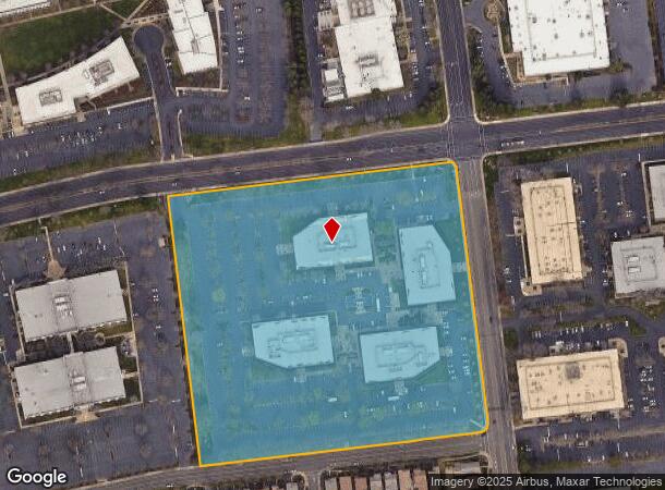

NEARBY LISTINGS FOR SALE OR LEASE
Property Detail
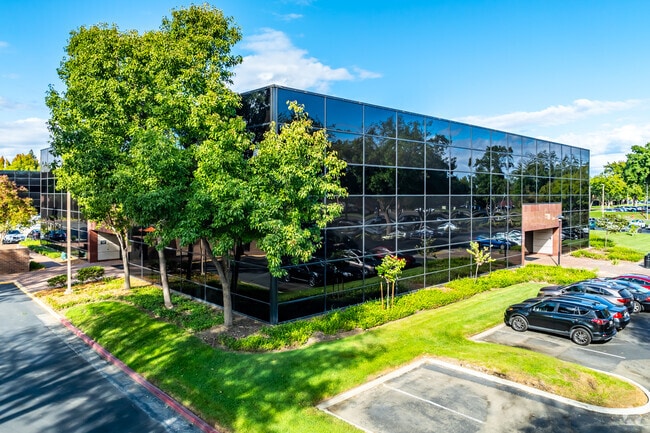
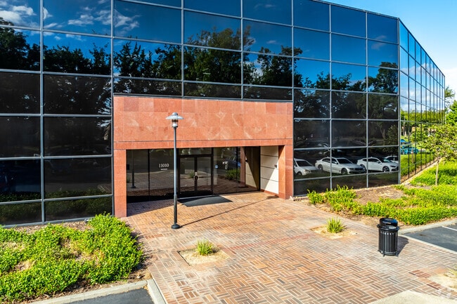
11010 White Rock Rd
072-0650-020
White Rock Bus
Officebuilding
POR PCL D OF BK 78 PARCEL MAPS PG 8 BEG AT NE COR SD PCL; TH FMP O B S.07%2404E 843.97 FT; TH S.82%4744W 850 FT TH
X
Sacramento
06067C0209H
California
2024
14.22 AC
2025
Highway 50 Corridor
009010
Sacramento
218,216 SF
Sacramento--Roseville--Arden-Arcade, CA
DEMOGRAPHICS near 11010 White Rock Rd
1 Mile
3 Mile
5 Mile
2024 Total Population
9,432
66,804
188,270
2029 Population
9,507
67,212
189,348
Pop Growth 2024-2029
+ 0.80%
+ 0.61%
+ 0.57%
Average Age
38
39
41
2024 Total Households
3,354
24,566
71,232
HH Growth 2024-2029
+ 0.69%
+ 0.61%
+ 0.53%
Median Household Inc
$100,176
$79,327
$91,100
Avg Household Size
2.80
2.70
2.60
2024 Avg HH Vehicles
2.00
2.00
2.00
Median Home Value
$463,146
$406,652
$493,918
Median Year Built
2003
1977
1976
Nearby Places
Map Layers
Map Styles
 Street
 Aerial
- Restaurants
- Banks
- Shops
- Fitness
- Groceries
PUBLIC TRANSPORTATION
AIRPORT
Sacramento International
DRIVE
WALK
Distance
Sacramento International
35 min
26.1 mi
Freight Ports
Port of Stockton
DRIVE
WALK
Distance
Port of Stockton
71 min
59.7 mi
SALE & LEASE HISTORY
LISTING DATE
SALE/LEASE

Sep 24, 2016
For Lease
Nearby Properties
Address
Land Use
TOTAL SIZE
Lot Size
Zoning
Address
Land Use
TOTAL SIZE
Lot Size
Zoning
251,024 SF
5.19 AC
SPA (CVSPA
Address
Land Use
TOTAL SIZE
Lot Size
Zoning
83.57 AC
MP (RDOSP)
Address
Land Use
TOTAL SIZE
Lot Size
Zoning
223,046 SF
10.99 AC
RD 20
Address
Land Use
TOTAL SIZE
Lot Size
Zoning
7.94 AC
RD-25
Address
Land Use
TOTAL SIZE
Lot Size
Zoning
109,805 SF
20.04 AC
OPMU
Address
Land Use
TOTAL SIZE
Lot Size
Zoning
181,573 SF
12.10 AC
SPA (MFSPA
Address
Land Use
TOTAL SIZE
Lot Size
Zoning
192,500 SF
11.78 AC
OPMU
Address
Land Use
TOTAL SIZE
Lot Size
Zoning
323,088 SF
19.69 AC
OPMU
Address
Land Use
TOTAL SIZE
Lot Size
Zoning
162,023 SF
8.96 AC
OIMU
Address
Land Use
TOTAL SIZE
Lot Size
Zoning
166,216 SF
10.77 AC
M-2
Address
Land Use
TOTAL SIZE
Lot Size
Zoning
6.31 AC
RC (ZSPA)
Address
Land Use
TOTAL SIZE
Lot Size
Zoning
221,337 SF
12.19 AC
RD 25
Address
Land Use
TOTAL SIZE
Lot Size
Zoning
132,149 SF
8.29 AC
OPMU
Address
Land Use
TOTAL SIZE
Lot Size
Zoning
95,174 SF
5.29 AC
SPA (MFSPA
Address
Land Use
TOTAL SIZE
Lot Size
Zoning
156,032 SF
9.31 AC
OPMU
Address
Land Use
TOTAL SIZE
Lot Size
Zoning
198,413 SF
9.24 AC
RD 30
Address
Land Use
TOTAL SIZE
Lot Size
Zoning
104,042 SF
7.40 AC
OIMU
Address
Land Use
TOTAL SIZE
Lot Size
Zoning
135,197 SF
11.38 AC
SPA (CVSPA
Address
Land Use
TOTAL SIZE
Lot Size
Zoning
137,306 SF
15.91 AC
GC
Address
Land Use
TOTAL SIZE
Lot Size
Zoning
12.47 AC
RD 30
Address
Land Use
TOTAL SIZE
Lot Size
Zoning
457,088 SF
12.50 AC
RD 30
Address
Land Use
TOTAL SIZE
Lot Size
Zoning
98,767 SF
6.43 AC
BP (ZSPA)
Address
Land Use
TOTAL SIZE
Lot Size
Zoning
89,098 SF
4.93 AC
RD-40
Address
Land Use
TOTAL SIZE
Lot Size
Zoning
302,966 SF
15.94 AC
RD 30
Address
Land Use
TOTAL SIZE
Lot Size
Zoning
258,819 SF
13.47 AC
RD 30
Address
Land Use
TOTAL SIZE
Lot Size
Zoning
164,149 SF
9.31 AC
LI (ZSPA)
Address
Land Use
TOTAL SIZE
Lot Size
Zoning
12,988 SF
3.98 AC
M-2
Address
Land Use
TOTAL SIZE
Lot Size
Zoning
112,244 SF
3.55 AC
GC
Address
Land Use
TOTAL SIZE
Lot Size
Zoning
110,960 SF
6.62 AC
SPA (MFSPA
The World's #1 Commercial Real Estate Marketplace
Connect with us
© 2025 CoStar Group
The information above has been obtained from sources believed reliable. While we do not doubt its accuracy we have not verified it and make no guarantee, warranty or representation about it. It is your responsibility to independently confirm its accuracy and completeness. Any projections, opinions, assumptions, or estimates used are for example only and do not represent the current or future performance of the property. The value of this transaction to you depends on tax and other factors which should be evaluated by your tax, financial, and legal advisors. You and your advisors should conduct a careful, independent investigation of the property to determine to your satisfaction the suitability of the property for your needs.