Property Record
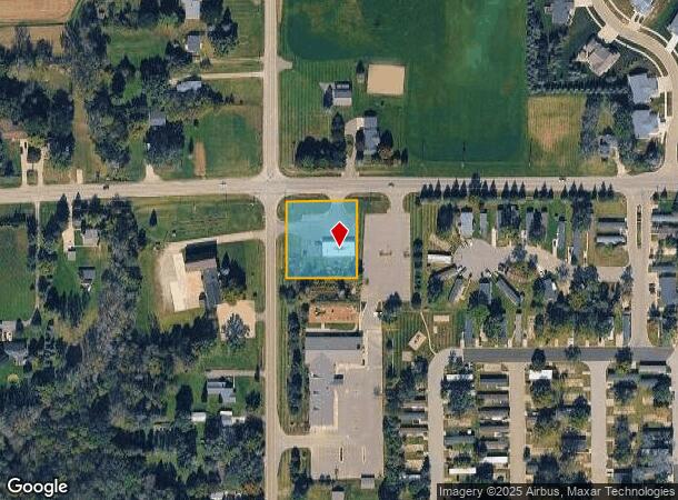
11018 Davison Rd, Davison, MI 48423


NEARBY LISTINGS FOR SALE OR LEASE
-
-
View all Davison listings for sale on LoopNet.com
Property Detail
11018 Davison Rd
05-11-100-001
A POL BEG AT NW COR OF SEC TH E 220 FT TH S 00 DEG 01 MIN W 237 FT TH W 220 FT TH N 00 DEG 01 MIN E 237 FT TO POB SEC 11 T7N
Commercialnec
Genesee
X
Michigan
26049C0250D
1.20 AC
2024
Flint
2025
Detroit
011712
Flint, MI
2,880 SF
DEMOGRAPHICS near 11018 Davison Rd
1 Mile
3 Mile
5 Mile
2024 Total Population
3,093
20,415
36,814
2029 Population
3,025
20,014
35,979
Pop Growth 2024-2029
(2.20%)
(1.96%)
(2.27%)
Average Age
42
42
42
2024 Total Households
1,405
9,251
15,592
HH Growth 2024-2029
(2.28%)
(2.00%)
(2.26%)
Median Household Inc
$50,815
$55,061
$63,244
Avg Household Size
2.20
2.20
2.30
2024 Avg HH Vehicles
1.00
2.00
2.00
Median Home Value
$174,566
$177,172
$185,400
Median Year Built
1981
1979
1977
Nearby Places
Map Layers
Map Styles
 Street
 Aerial
- Restaurants
- Banks
- Shops
- Fitness
- Groceries
PUBLIC TRANSPORTATION
COMMUTER RAIL
DRIVE
WALK
Distance
14 min
9.8 mi
AIRPORT
Bishop International
DRIVE
WALK
Distance
Bishop International
31 min
19.2 mi
Nearby Properties
Address
Land Use
TOTAL SIZE
Lot Size
Zoning
Address
Land Use
TOTAL SIZE
Lot Size
Zoning
51.59 AC
NOT AVAILA
Address
Land Use
TOTAL SIZE
Lot Size
Zoning
46.83 AC
NOT AVAILA
Address
Land Use
TOTAL SIZE
Lot Size
Zoning
156,996 SF
NOT AVAILA
Address
Land Use
TOTAL SIZE
Lot Size
Zoning
19.05 AC
NOT AVAILA
Address
Land Use
TOTAL SIZE
Lot Size
Zoning
159,560 SF
9.96 AC
NOT AVAILA
Address
Land Use
TOTAL SIZE
Lot Size
Zoning
6,449 SF
90.81 AC
MH
Address
Land Use
TOTAL SIZE
Lot Size
Zoning
42,397 SF
15.14 AC
NOT AVAILA
Address
Land Use
TOTAL SIZE
Lot Size
Zoning
56,966 SF
1.81 AC
NOT AVAILA
Address
Land Use
TOTAL SIZE
Lot Size
Zoning
59,276 SF
3.40 AC
NOT AVAILA
Address
Land Use
TOTAL SIZE
Lot Size
Zoning
72,603 SF
4 AC
NOT AVAILA
Address
Land Use
TOTAL SIZE
Lot Size
Zoning
34,096 SF
131.93 AC
Address
Land Use
TOTAL SIZE
Lot Size
Zoning
12.16 AC
NOT AVAILA
Address
Land Use
TOTAL SIZE
Lot Size
Zoning
44,280 SF
5.48 AC
C-3
Address
Land Use
TOTAL SIZE
Lot Size
Zoning
46,464 SF
9.69 AC
NOT AVAILA
Address
Land Use
TOTAL SIZE
Lot Size
Zoning
38,881 SF
3.70 AC
NOT AVAILA
Address
Land Use
TOTAL SIZE
Lot Size
Zoning
79,677 SF
13.79 AC
B-1
Address
Land Use
TOTAL SIZE
Lot Size
Zoning
101,648 SF
18.65 AC
I
Address
Land Use
TOTAL SIZE
Lot Size
Zoning
59,420 SF
5.25 AC
C-3
Address
Land Use
TOTAL SIZE
Lot Size
Zoning
98,410 SF
4.34 AC
C-3
Address
Land Use
TOTAL SIZE
Lot Size
Zoning
1,438 SF
40.80 AC
NOT AVAILA
Address
Land Use
TOTAL SIZE
Lot Size
Zoning
49,688 SF
8.79 AC
NOT AVAILA
Address
Land Use
TOTAL SIZE
Lot Size
Zoning
10.05 AC
NOT AVAILA
Address
Land Use
TOTAL SIZE
Lot Size
Zoning
127,708 SF
9.40 AC
B-1
Address
Land Use
TOTAL SIZE
Lot Size
Zoning
9.70 AC
NOT AVAILA
Address
Land Use
TOTAL SIZE
Lot Size
Zoning
28.20 AC
Address
Land Use
TOTAL SIZE
Lot Size
Zoning
2,328 SF
79 AC
RRA
Address
Land Use
TOTAL SIZE
Lot Size
Zoning
2,244 SF
24 AC
Address
Land Use
TOTAL SIZE
Lot Size
Zoning
17,604 SF
8.29 AC
NOT AVAILA
Address
Land Use
TOTAL SIZE
Lot Size
Zoning
17,217 SF
2.98 AC
NOT AVAILA
Address
Land Use
TOTAL SIZE
Lot Size
Zoning
56.58 AC
The World's #1 Commercial Real Estate Marketplace
Connect with us
© 2026 CoStar Group
The information above has been obtained from sources believed reliable. While we do not doubt its accuracy we have not verified it and make no guarantee, warranty or representation about it. It is your responsibility to independently confirm its accuracy and completeness. Any projections, opinions, assumptions, or estimates used are for example only and do not represent the current or future performance of the property. The value of this transaction to you depends on tax and other factors which should be evaluated by your tax, financial, and legal advisors. You and your advisors should conduct a careful, independent investigation of the property to determine to your satisfaction the suitability of the property for your needs.