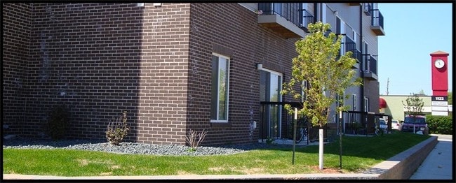
Property Record
1102 1St Ave N, Fargo, ND 58102


Property Detail
1102 1St Ave N
01-2382-04000-000
LOT: 7 BLOCK: 39 ADDITION: ROBERTS 2ND ADDITIONAL: ROBERTS 2ND LOTS 7 & 8 BLK 39
Apartment
Cass
DMU
North Dakota
C and X Area of minimal flood hazard, usually depicted on FIRMs as above the 500-year flood level.
7-8
2025
0.32 AC
2025
Downtown Fargo
000602
Other Market Areas
23,437 SF
Fargo, ND-MN
NEARBY LISTINGS FOR SALE OR LEASE
DEMOGRAPHICS near 1102 1St Ave N
1 mile
3 mile
5 mile
2025 Total Population
18,297
98,047
175,656
2030 Population
19,786
104,304
185,564
Pop Growth 2025-2030
+ 8.14%
+ 6.38%
+ 5.64%
Average Age
37
37
37
2025 Total Households
9,499
43,665
76,818
HH Growth 2025-2030
+ 8.14%
+ 6.79%
+ 6.11%
Median Household Inc
$50,293
$56,489
$61,602
Avg Household Size
1.80
2.00
2.10
2025 Avg HH Vehicles
2.00
2.00
2.00
Median Home Value
$226,143
$241,237
$264,598
Median Year Built
1961
1974
1986
Nearby Places
Map Layers
Map Styles
 Street
 Aerial
Layers
 Traffic
 Biking
Places
Listings with unknown addresses are not visible on the map
- Restaurants
- Banks
- Shops
- Fitness
- Groceries
PUBLIC TRANSPORTATION
COMMUTER RAIL
Drive
Walk
Distance
2 min
14 min
0.7 mi
AIRPORT
Hector International
Drive
Walk
Distance
Hector International
8 min
3.9 mi
Nearby Properties
Address
Land Use
TOTAL SIZE
Lot Size
Zoning
Address
Land Use
TOTAL SIZE
Lot Size
Zoning
40.49 AC
Address
Land Use
TOTAL SIZE
Lot Size
Zoning
30.61 AC
Address
Land Use
TOTAL SIZE
Lot Size
Zoning
Address
Land Use
TOTAL SIZE
Lot Size
Zoning
17.38 AC
Address
Land Use
TOTAL SIZE
Lot Size
Zoning
21.81 AC
Address
Land Use
TOTAL SIZE
Lot Size
Zoning
53.42 AC
Address
Land Use
TOTAL SIZE
Lot Size
Zoning
39.01 AC
Address
Land Use
TOTAL SIZE
Lot Size
Zoning
32.98 AC
Address
Land Use
TOTAL SIZE
Lot Size
Zoning
408,617 SF
9.33 AC
GC
Address
Land Use
TOTAL SIZE
Lot Size
Zoning
41.38 AC
Address
Land Use
TOTAL SIZE
Lot Size
Zoning
14.53 AC
Address
Land Use
TOTAL SIZE
Lot Size
Zoning
621,097 SF
49.49 AC
LI
Address
Land Use
TOTAL SIZE
Lot Size
Zoning
121,584 SF
5.64 AC
MR3
Address
Land Use
TOTAL SIZE
Lot Size
Zoning
3.39 AC
Address
Land Use
TOTAL SIZE
Lot Size
Zoning
162,875 SF
12.32 AC
MR3
Address
Land Use
TOTAL SIZE
Lot Size
Zoning
Address
Land Use
TOTAL SIZE
Lot Size
Zoning
107,995 SF
1 AC
DMU
Address
Land Use
TOTAL SIZE
Lot Size
Zoning
12.07 AC
Address
Land Use
TOTAL SIZE
Lot Size
Zoning
5.23 AC
Address
Land Use
TOTAL SIZE
Lot Size
Zoning
2.77 AC
Address
Land Use
TOTAL SIZE
Lot Size
Zoning
0.22 AC
Address
Land Use
TOTAL SIZE
Lot Size
Zoning
999.99 AC
Address
Land Use
TOTAL SIZE
Lot Size
Zoning
3.31 AC
Address
Land Use
TOTAL SIZE
Lot Size
Zoning
0.17 AC
Address
Land Use
TOTAL SIZE
Lot Size
Zoning
303,970 SF
49.72 AC
GI
Address
Land Use
TOTAL SIZE
Lot Size
Zoning
4.90 AC
Address
Land Use
TOTAL SIZE
Lot Size
Zoning
2.91 AC
Address
Land Use
TOTAL SIZE
Lot Size
Zoning
163,398 SF
1.92 AC
LC
Address
Land Use
TOTAL SIZE
Lot Size
Zoning
73.98 AC
Address
Land Use
TOTAL SIZE
Lot Size
Zoning
109,174 SF
1.25 AC
UMU
The World's #1 Commercial Real Estate Marketplace
Connect with us
© 2026 CoStar Group
The information above has been obtained from sources believed reliable. While we do not doubt its accuracy we have not verified it and make no guarantee, warranty or representation about it. It is your responsibility to independently confirm its accuracy and completeness. Any projections, opinions, assumptions, or estimates used are for example only and do not represent the current or future performance of the property. The value of this transaction to you depends on tax and other factors which should be evaluated by your tax, financial, and legal advisors. You and your advisors should conduct a careful, independent investigation of the property to determine to your satisfaction the suitability of the property for your needs.