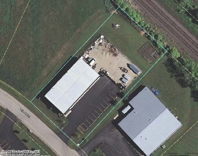
Property Record
1102 Rail Dr, Woodstock, IL 60098

NEARBY LISTINGS FOR SALE OR LEASE
Property Detail
1102 Rail Dr
Chicago-Naperville-Elgin, IL-IN-WI
Trakk Industrial Park
07-25-376-008
DOC 2012R0033038 LT 7 TRAKK INDUSTRIAL PARK /EX PT OUT FOR LEASEHOLD/ LEASEHOLD PIN IS 07-25-376-009 MEMO: N IL CEMENT MASONS/ PLASTERERS JNT APPRENTICESHIP & TRAINING FUND
Taxexempt
McHenry
X
Illinois
17111C0178J
7
2022
1.03 AC
2024
McHenry County
870200
Chicago
7,200 SF
DEMOGRAPHICS near 1102 Rail Dr
1 Mile
3 Mile
5 Mile
2024 Total Population
271
17,765
28,350
2029 Population
268
17,724
28,334
Pop Growth 2024-2029
(1.11%)
(0.23%)
(0.06%)
Average Age
50
41
41
2024 Total Households
100
6,644
10,777
HH Growth 2024-2029
(2.00%)
(0.27%)
(0.08%)
Median Household Inc
$84,722
$75,050
$76,429
Avg Household Size
2.50
2.50
2.50
2024 Avg HH Vehicles
2.00
2.00
2.00
Median Home Value
$341,860
$188,432
$213,772
Median Year Built
1971
1974
1981
Nearby Places
Map Layers
Map Styles
 Street
 Aerial
- Restaurants
- Banks
- Shops
- Fitness
- Groceries
PUBLIC TRANSPORTATION
COMMUTER RAIL
Woodstock Station (Union Pacific Northwest Line - Northeast Illinois Regional Commuter Railroad (Metra))
DRIVE
WALK
Distance
Woodstock Station (Union Pacific Northwest Line - Northeast Illinois Regional Commuter Railroad (Metra))
6 min
2.7 mi
AIRPORT
Chicago/Rockford International
DRIVE
WALK
Distance
Chicago/Rockford International
73 min
46.4 mi
Freight Ports
Port Milwaukee
DRIVE
WALK
Distance
Port Milwaukee
97 min
73.8 mi
Nearby Properties
Address
Land Use
TOTAL SIZE
Lot Size
Zoning
Address
Land Use
TOTAL SIZE
Lot Size
Zoning
96,633 SF
3.97 AC
Address
Land Use
TOTAL SIZE
Lot Size
Zoning
164,167 SF
16.11 AC
Address
Land Use
TOTAL SIZE
Lot Size
Zoning
45,876 SF
5.02 AC
Address
Land Use
TOTAL SIZE
Lot Size
Zoning
12,699 SF
8 AC
Address
Land Use
TOTAL SIZE
Lot Size
Zoning
2.78 AC
Address
Land Use
TOTAL SIZE
Lot Size
Zoning
24,968 SF
0.50 AC
Address
Land Use
TOTAL SIZE
Lot Size
Zoning
32,754 SF
0.11 AC
Address
Land Use
TOTAL SIZE
Lot Size
Zoning
Address
Land Use
TOTAL SIZE
Lot Size
Zoning
Address
Land Use
TOTAL SIZE
Lot Size
Zoning
22,724 SF
3.63 AC
Address
Land Use
TOTAL SIZE
Lot Size
Zoning
24,164 SF
4.99 AC
Address
Land Use
TOTAL SIZE
Lot Size
Zoning
25,650 SF
0.19 AC
Address
Land Use
TOTAL SIZE
Lot Size
Zoning
139,352 SF
29.32 AC
Address
Land Use
TOTAL SIZE
Lot Size
Zoning
Address
Land Use
TOTAL SIZE
Lot Size
Zoning
35,389 SF
4.44 AC
Address
Land Use
TOTAL SIZE
Lot Size
Zoning
Address
Land Use
TOTAL SIZE
Lot Size
Zoning
7,740 SF
1.12 AC
Address
Land Use
TOTAL SIZE
Lot Size
Zoning
39,860 SF
2.10 AC
Address
Land Use
TOTAL SIZE
Lot Size
Zoning
Address
Land Use
TOTAL SIZE
Lot Size
Zoning
9,785 SF
2.58 AC
Address
Land Use
TOTAL SIZE
Lot Size
Zoning
78,482 SF
3.63 AC
Address
Land Use
TOTAL SIZE
Lot Size
Zoning
Address
Land Use
TOTAL SIZE
Lot Size
Zoning
27,360 SF
3.62 AC
Address
Land Use
TOTAL SIZE
Lot Size
Zoning
24,255 SF
0.25 AC
Address
Land Use
TOTAL SIZE
Lot Size
Zoning
Address
Land Use
TOTAL SIZE
Lot Size
Zoning
4,950 SF
0.52 AC
Address
Land Use
TOTAL SIZE
Lot Size
Zoning
23,864 SF
1.40 AC
Address
Land Use
TOTAL SIZE
Lot Size
Zoning
Address
Land Use
TOTAL SIZE
Lot Size
Zoning
12.41 AC
The World's #1 Commercial Real Estate Marketplace
Connect with us
© 2025 CoStar Group
The information above has been obtained from sources believed reliable. While we do not doubt its accuracy we have not verified it and make no guarantee, warranty or representation about it. It is your responsibility to independently confirm its accuracy and completeness. Any projections, opinions, assumptions, or estimates used are for example only and do not represent the current or future performance of the property. The value of this transaction to you depends on tax and other factors which should be evaluated by your tax, financial, and legal advisors. You and your advisors should conduct a careful, independent investigation of the property to determine to your satisfaction the suitability of the property for your needs.