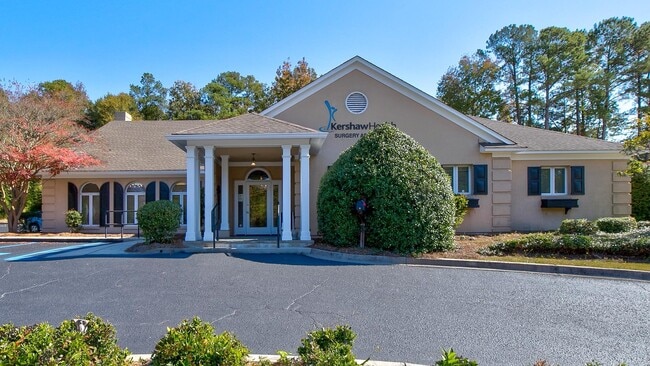
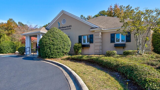
Property Record
1102 Roberts St, Camden, SC 29020
NEARBY LISTINGS FOR SALE OR LEASE
Property Detail
1102 Roberts St
C285-10-00-015
Plat Prepared For Camden Surgical Associ
Medicalbuilding
2467-98 1220-78 194-90 113-144
X
Kershaw
45055C0452F
South Carolina
2025
0.43 AC
2025
Kershaw County
970800
Columbia
5,648 SF
Columbia, SC
DEMOGRAPHICS near 1102 Roberts St
1 Mile
3 Mile
5 Mile
2024 Total Population
3,344
14,893
21,140
2029 Population
3,679
16,365
23,145
Pop Growth 2024-2029
+ 10.02%
+ 9.88%
+ 9.48%
Average Age
44
42
42
2024 Total Households
1,488
6,312
8,839
HH Growth 2024-2029
+ 9.74%
+ 9.73%
+ 9.34%
Median Household Inc
$35,273
$40,632
$42,213
Avg Household Size
2.20
2.30
2.30
2024 Avg HH Vehicles
2.00
2.00
2.00
Median Home Value
$156,168
$156,893
$163,834
Median Year Built
1979
1977
1978
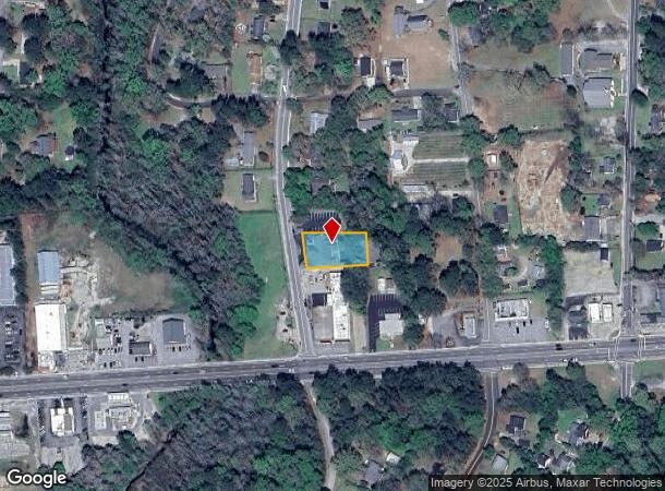
Nearby Places
Map Layers
Map Styles
 Street
 Aerial
- Restaurants
- Banks
- Shops
- Fitness
- Groceries
PUBLIC TRANSPORTATION
COMMUTER RAIL
DRIVE
WALK
Distance
5 min
2.2 mi
AIRPORT
Columbia Metro
DRIVE
WALK
Distance
Columbia Metro
67 min
45.9 mi
SALE & LEASE HISTORY
LISTING DATE
SALE/LEASE

Jan 26, 2023
For Sale
Nearby Properties
Address
Land Use
TOTAL SIZE
Lot Size
Zoning
Address
Land Use
TOTAL SIZE
Lot Size
Zoning
15.09 AC
MUNICIPAL
Address
Land Use
TOTAL SIZE
Lot Size
Zoning
141,018 SF
8.44 AC
MUNICIPAL
Address
Land Use
TOTAL SIZE
Lot Size
Zoning
3,456 SF
32.16 AC
GD
Address
Land Use
TOTAL SIZE
Lot Size
Zoning
47,718 SF
4.56 AC
MUNICIPAL
Address
Land Use
TOTAL SIZE
Lot Size
Zoning
85,915 SF
3.57 AC
MUNICIPAL
Address
Land Use
TOTAL SIZE
Lot Size
Zoning
37,794 SF
28.77 AC
GD
Address
Land Use
TOTAL SIZE
Lot Size
Zoning
60,023 SF
5.70 AC
B2
Address
Land Use
TOTAL SIZE
Lot Size
Zoning
75,873 SF
308.84 AC
GD
Address
Land Use
TOTAL SIZE
Lot Size
Zoning
36,380 SF
3.61 AC
MUNICIPAL
Address
Land Use
TOTAL SIZE
Lot Size
Zoning
75,636 SF
6.28 AC
MUNICIPAL
Address
Land Use
TOTAL SIZE
Lot Size
Zoning
15,214 SF
1.28 AC
MUNICIPAL
Address
Land Use
TOTAL SIZE
Lot Size
Zoning
66,678 SF
5.28 AC
R6
Address
Land Use
TOTAL SIZE
Lot Size
Zoning
20.23 AC
MUNICIPAL
Address
Land Use
TOTAL SIZE
Lot Size
Zoning
82,125 SF
8.42 AC
GD
Address
Land Use
TOTAL SIZE
Lot Size
Zoning
41.08 AC
I1
Address
Land Use
TOTAL SIZE
Lot Size
Zoning
8,480 SF
3.75 AC
GD
Address
Land Use
TOTAL SIZE
Lot Size
Zoning
80,614 SF
7.70 AC
MUNICIPAL
Address
Land Use
TOTAL SIZE
Lot Size
Zoning
91,301 SF
7.32 AC
MUNICIPAL
Address
Land Use
TOTAL SIZE
Lot Size
Zoning
29.23 AC
MUNICIPAL
Address
Land Use
TOTAL SIZE
Lot Size
Zoning
40,804 SF
3 AC
MUNICIPAL
Address
Land Use
TOTAL SIZE
Lot Size
Zoning
10,726 SF
1.50 AC
MUNICIPAL
Address
Land Use
TOTAL SIZE
Lot Size
Zoning
10,985 SF
4.95 AC
Address
Land Use
TOTAL SIZE
Lot Size
Zoning
5,726 SF
1.61 AC
Address
Land Use
TOTAL SIZE
Lot Size
Zoning
10,125 SF
1.09 AC
MUNICIPAL
Address
Land Use
TOTAL SIZE
Lot Size
Zoning
11,502 SF
1.44 AC
MUNICIPAL
Address
Land Use
TOTAL SIZE
Lot Size
Zoning
77,924 SF
14 AC
I1
Address
Land Use
TOTAL SIZE
Lot Size
Zoning
11,795 SF
97.07 AC
R15
Address
Land Use
TOTAL SIZE
Lot Size
Zoning
4,863 SF
0.99 AC
MUNICIPAL
Address
Land Use
TOTAL SIZE
Lot Size
Zoning
28,540 SF
3.90 AC
MUNICIPAL
Address
Land Use
TOTAL SIZE
Lot Size
Zoning
38,913 SF
4.90 AC
MUNICIPAL
The World's #1 Commercial Real Estate Marketplace
Connect with us
© 2025 CoStar Group
The information above has been obtained from sources believed reliable. While we do not doubt its accuracy we have not verified it and make no guarantee, warranty or representation about it. It is your responsibility to independently confirm its accuracy and completeness. Any projections, opinions, assumptions, or estimates used are for example only and do not represent the current or future performance of the property. The value of this transaction to you depends on tax and other factors which should be evaluated by your tax, financial, and legal advisors. You and your advisors should conduct a careful, independent investigation of the property to determine to your satisfaction the suitability of the property for your needs.