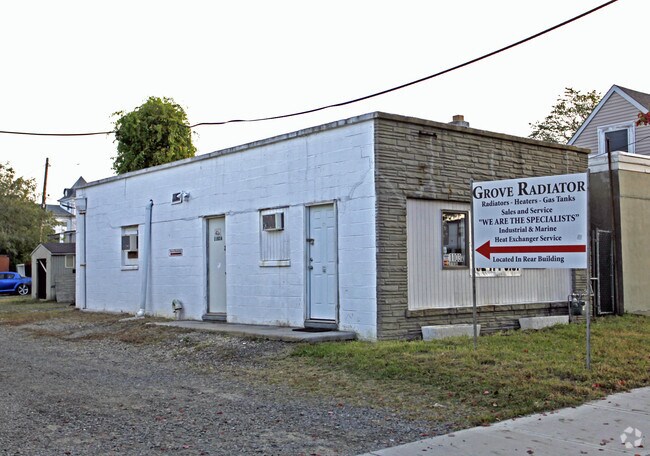
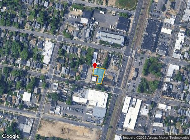
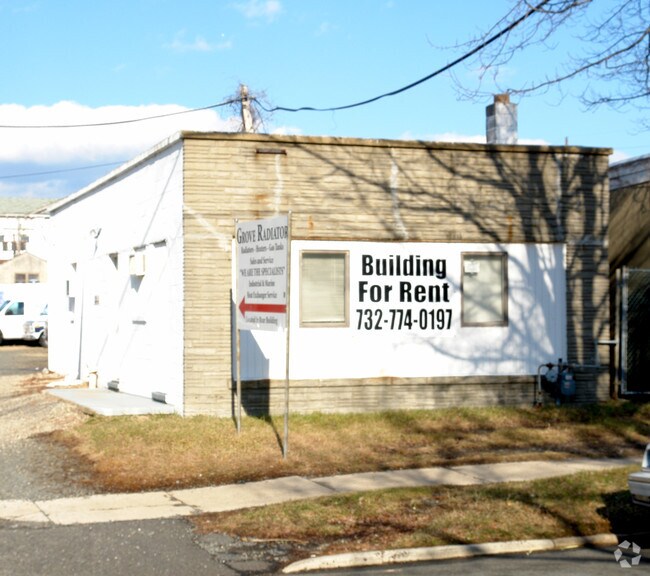
Property Record
1103 6Th Ave, Neptune, NJ 07753

NEARBY LISTINGS FOR SALE OR LEASE
Property Detail
1103 6Th Ave
35-00414-0000-00012
Monmouth
Warehouse
New Jersey
X
12
34025C0334G
0.27 AC
2024
Southern Monmouth
2025
Northern New Jersey
807500
Lakewood-New Brunswick, NJ
800 SF
DEMOGRAPHICS near 1103 6Th Ave
1 mile
3 mile
5 mile
2024 Total Population
22,397
80,155
136,514
2029 Population
22,801
81,386
138,414
Pop Growth 2024-2029
+ 1.80%
+ 1.54%
+ 1.39%
Average Age
43
44
44
2024 Total Households
10,147
35,367
58,792
HH Growth 2024-2029
+ 2.16%
+ 1.70%
+ 1.34%
Median Household Inc
$71,470
$85,253
$92,184
Avg Household Size
2.10
2.20
2.20
2024 Avg HH Vehicles
2.00
2.00
2.00
Median Home Value
$521,620
$484,525
$538,963
Median Year Built
1951
1960
1967
Nearby Places
Map Layers
Map Styles
 Street
 Aerial
Transit
 Traffic
 Biking
Places
Listings with unknown addresses are not visible on the map
- Restaurants
- Banks
- Shops
- Fitness
- Groceries
PUBLIC TRANSPORTATION
COMMUTER RAIL
Bradley Beach (North Jersey Coast Line - NJ Transit Commuter Rail (NJ Transit))
Drive
Walk
Distance
Bradley Beach (North Jersey Coast Line - NJ Transit Commuter Rail (NJ Transit))
0 min
3 min
0.1 mi
Asbury Park (North Jersey Coast Line - NJ Transit Commuter Rail (NJ Transit))
Drive
Walk
Distance
Asbury Park (North Jersey Coast Line - NJ Transit Commuter Rail (NJ Transit))
3 min
19 min
1.0 mi
Freight Ports
New York Container Terminal
Drive
Walk
Distance
New York Container Terminal
56 min
43.1 mi
Nearby Properties
Address
Land Use
TOTAL SIZE
Lot Size
Zoning
Address
Land Use
TOTAL SIZE
Lot Size
Zoning
26,282 SF
4.59 AC
C
Address
Land Use
TOTAL SIZE
Lot Size
Zoning
5,776 SF
25.50 AC
PB
Address
Land Use
TOTAL SIZE
Lot Size
Zoning
739,651 SF
27.89 AC
C
Address
Land Use
TOTAL SIZE
Lot Size
Zoning
113.60 AC
WBA
Address
Land Use
TOTAL SIZE
Lot Size
Zoning
65,668 SF
111.60 AC
C50
Address
Land Use
TOTAL SIZE
Lot Size
Zoning
1,846 SF
23.23 AC
R-2
Address
Land Use
TOTAL SIZE
Lot Size
Zoning
320,341 SF
57.85 AC
C
Address
Land Use
TOTAL SIZE
Lot Size
Zoning
1.61 AC
R1
Address
Land Use
TOTAL SIZE
Lot Size
Zoning
705 SF
2.01 AC
WPRA
Address
Land Use
TOTAL SIZE
Lot Size
Zoning
1,152 SF
87 SF
WPRA
Address
Land Use
TOTAL SIZE
Lot Size
Zoning
3,162 SF
0.48 AC
R-1
Address
Land Use
TOTAL SIZE
Lot Size
Zoning
108,641 SF
10.64 AC
C-6
Address
Land Use
TOTAL SIZE
Lot Size
Zoning
1,288 SF
25.49 AC
HD-R
Address
Land Use
TOTAL SIZE
Lot Size
Zoning
7,213 SF
0.96 AC
1
Address
Land Use
TOTAL SIZE
Lot Size
Zoning
5,407 SF
25.60 AC
C-3
Address
Land Use
TOTAL SIZE
Lot Size
Zoning
3,094 SF
277.60 AC
C
Address
Land Use
TOTAL SIZE
Lot Size
Zoning
224,683 SF
21.56 AC
CHS
Address
Land Use
TOTAL SIZE
Lot Size
Zoning
91,173 SF
4.07 AC
R3
Address
Land Use
TOTAL SIZE
Lot Size
Zoning
254,714 SF
3.40 AC
WPRA
Address
Land Use
TOTAL SIZE
Lot Size
Zoning
Address
Land Use
TOTAL SIZE
Lot Size
Zoning
1,487 SF
7.50 AC
R-B
Address
Land Use
TOTAL SIZE
Lot Size
Zoning
0.88 AC
STNB
Address
Land Use
TOTAL SIZE
Lot Size
Zoning
6,272 SF
1.14 AC
R-1
Address
Land Use
TOTAL SIZE
Lot Size
Zoning
8.82 AC
R2
Address
Land Use
TOTAL SIZE
Lot Size
Zoning
Address
Land Use
TOTAL SIZE
Lot Size
Zoning
27,328 SF
6.79 AC
HB12
Address
Land Use
TOTAL SIZE
Lot Size
Zoning
0.76 AC
R-1
Address
Land Use
TOTAL SIZE
Lot Size
Zoning
7,160 SF
0.44 AC
R-1
Address
Land Use
TOTAL SIZE
Lot Size
Zoning
7,170 SF
0.38 AC
R-1
Address
Land Use
TOTAL SIZE
Lot Size
Zoning
5,480 SF
0.40 AC
R-1
The World's #1 Commercial Real Estate Marketplace
Connect with us
© 2026 CoStar Group
The information above has been obtained from sources believed reliable. While we do not doubt its accuracy we have not verified it and make no guarantee, warranty or representation about it. It is your responsibility to independently confirm its accuracy and completeness. Any projections, opinions, assumptions, or estimates used are for example only and do not represent the current or future performance of the property. The value of this transaction to you depends on tax and other factors which should be evaluated by your tax, financial, and legal advisors. You and your advisors should conduct a careful, independent investigation of the property to determine to your satisfaction the suitability of the property for your needs.