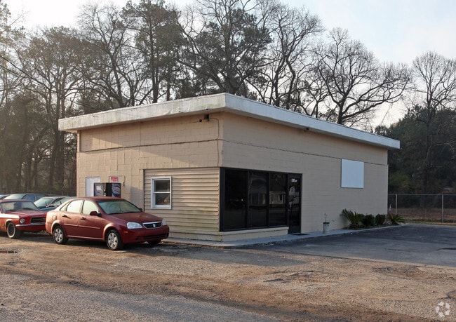
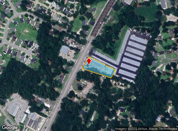
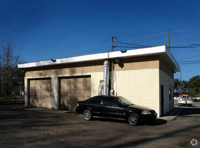
Property Record
1103 Bacons Bridge Rd, Summerville, SC 29485
NEARBY LISTINGS FOR SALE OR LEASE
Property Detail
1103 Bacons Bridge Rd
145-10-01-039
1103 BACONS BRIDGE RD COMMERCIAL
Autorepair
Dorchester
X
South Carolina
45035C0402E
0.96 AC
2025
Dorchester County
2025
Charleston/N Charleston
010808
Charleston-North Charleston, SC
1,150 SF
DEMOGRAPHICS near 1103 Bacons Bridge Rd
1 Mile
3 Mile
5 Mile
2024 Total Population
7,355
64,570
138,701
2029 Population
7,944
69,919
151,913
Pop Growth 2024-2029
+ 8.01%
+ 8.28%
+ 9.53%
Average Age
41
40
39
2024 Total Households
2,851
24,990
52,220
HH Growth 2024-2029
+ 7.79%
+ 8.10%
+ 9.39%
Median Household Inc
$72,298
$64,803
$72,652
Avg Household Size
2.50
2.50
2.60
2024 Avg HH Vehicles
2.00
2.00
2.00
Median Home Value
$277,025
$261,216
$268,771
Median Year Built
1983
1992
2000
Nearby Places
- Restaurants
- Banks
- Shops
- Fitness
- Groceries
PUBLIC TRANSPORTATION
AIRPORT
Charleston AFB/International
DRIVE
WALK
Distance
Charleston AFB/International
18 min
13.0 mi
Freight Ports
North Charleston Terminal
DRIVE
WALK
Distance
North Charleston Terminal
26 min
17.9 mi
Nearby Properties
Address
Land Use
TOTAL SIZE
Lot Size
Zoning
Address
Land Use
TOTAL SIZE
Lot Size
Zoning
212.62 AC
MUC_DC
Address
Land Use
TOTAL SIZE
Lot Size
Zoning
15.62 AC
BERKELEY C
Address
Land Use
TOTAL SIZE
Lot Size
Zoning
276,696 SF
17.87 AC
G-B_SV
Address
Land Use
TOTAL SIZE
Lot Size
Zoning
49.39 AC
PDD_NC
Address
Land Use
TOTAL SIZE
Lot Size
Zoning
12.06 AC
BERKELEY C
Address
Land Use
TOTAL SIZE
Lot Size
Zoning
273,176 SF
22.58 AC
MF-R_SV
Address
Land Use
TOTAL SIZE
Lot Size
Zoning
227,472 SF
13.51 AC
MF-R_SV
Address
Land Use
TOTAL SIZE
Lot Size
Zoning
186,798 SF
18.39 AC
MF-R_SV
Address
Land Use
TOTAL SIZE
Lot Size
Zoning
115,904 SF
6.42 AC
PUD_SV
Address
Land Use
TOTAL SIZE
Lot Size
Zoning
229,810 SF
13.43 AC
MF-R_SV
Address
Land Use
TOTAL SIZE
Lot Size
Zoning
105,332 SF
10.67 AC
MF-R_SV
Address
Land Use
TOTAL SIZE
Lot Size
Zoning
153,884 SF
12.10 AC
MF-R_SV
Address
Land Use
TOTAL SIZE
Lot Size
Zoning
4,388 SF
11.79 AC
UC-MX_SV
Address
Land Use
TOTAL SIZE
Lot Size
Zoning
51,900 SF
11.96 AC
G-B_SV
Address
Land Use
TOTAL SIZE
Lot Size
Zoning
157,860 SF
5.81 AC
G-B_SV
Address
Land Use
TOTAL SIZE
Lot Size
Zoning
142,639 SF
10.65 AC
MF-R_SV
Address
Land Use
TOTAL SIZE
Lot Size
Zoning
119,496 SF
9.38 AC
MF-R_SV
Address
Land Use
TOTAL SIZE
Lot Size
Zoning
154,880 SF
8.90 AC
MF-R_SV
Address
Land Use
TOTAL SIZE
Lot Size
Zoning
108,343 SF
9.55 AC
G-B_SV
Address
Land Use
TOTAL SIZE
Lot Size
Zoning
19,604 SF
15 AC
MF-R_SV
Address
Land Use
TOTAL SIZE
Lot Size
Zoning
12,037 SF
17.89 AC
Address
Land Use
TOTAL SIZE
Lot Size
Zoning
107,952 SF
8.30 AC
MF-R_SV
Address
Land Use
TOTAL SIZE
Lot Size
Zoning
102,330 SF
9.82 AC
MF-R_SV
Address
Land Use
TOTAL SIZE
Lot Size
Zoning
144,552 SF
55.27 AC
PL_SV
Address
Land Use
TOTAL SIZE
Lot Size
Zoning
92,661 SF
5.89 AC
CG_DC
Address
Land Use
TOTAL SIZE
Lot Size
Zoning
4.15 AC
I_DC
Address
Land Use
TOTAL SIZE
Lot Size
Zoning
295.99 AC
PUD_SV
Address
Land Use
TOTAL SIZE
Lot Size
Zoning
86,667 SF
11.92 AC
G-B_SV
Address
Land Use
TOTAL SIZE
Lot Size
Zoning
72,483 SF
4.37 AC
MF-R_SV
Address
Land Use
TOTAL SIZE
Lot Size
Zoning
1,685 SF
6.61 AC
R-4_DC
The World's #1 Commercial Real Estate Marketplace
Connect with us
© 2025 CoStar Group
The information above has been obtained from sources believed reliable. While we do not doubt its accuracy we have not verified it and make no guarantee, warranty or representation about it. It is your responsibility to independently confirm its accuracy and completeness. Any projections, opinions, assumptions, or estimates used are for example only and do not represent the current or future performance of the property. The value of this transaction to you depends on tax and other factors which should be evaluated by your tax, financial, and legal advisors. You and your advisors should conduct a careful, independent investigation of the property to determine to your satisfaction the suitability of the property for your needs.