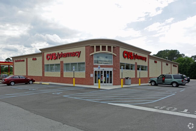
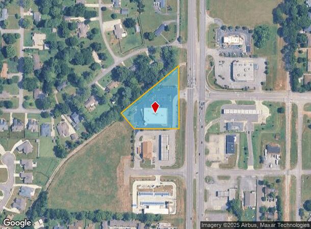
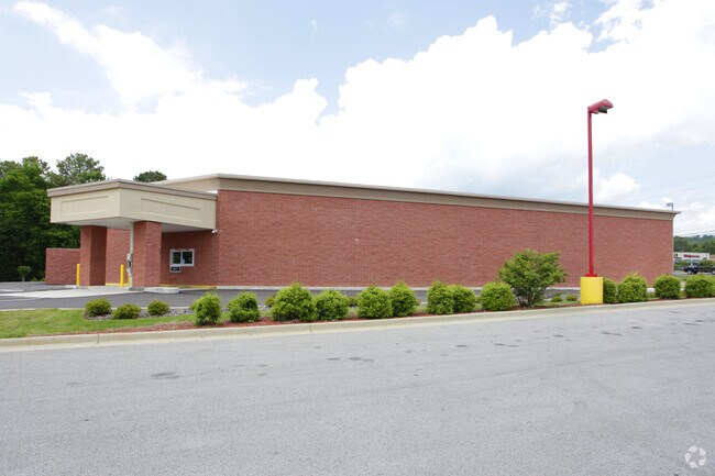
Property Record
11030 Memorial Pkwy Sw, Huntsville, AL 35803
NEARBY LISTINGS FOR SALE OR LEASE
Property Detail
11030 Memorial Pkwy Sw
Huntsville, AL
UNIT 2 HENDERSON RUN, A CONDOMINIUM PB # 20120104000005460
23-03-06-3-001-090.005-CONDO
Madison
Storebuilding
Alabama
2025
1.99 AC
2025
South Madison County
002804
Huntsville
13,375 SF
DEMOGRAPHICS near 11030 Memorial Pkwy Sw
1 Mile
3 Mile
5 Mile
2024 Total Population
6,640
38,773
65,578
2029 Population
7,280
42,618
72,222
Pop Growth 2024-2029
+ 9.64%
+ 9.92%
+ 10.13%
Average Age
44
43
42
2024 Total Households
2,902
16,711
27,832
HH Growth 2024-2029
+ 10.06%
+ 10.31%
+ 10.50%
Median Household Inc
$75,032
$90,887
$86,743
Avg Household Size
2.20
2.20
2.30
2024 Avg HH Vehicles
2.00
2.00
2.00
Median Home Value
$214,647
$247,907
$272,633
Median Year Built
1979
1982
1984
Nearby Places
- Restaurants
- Banks
- Shops
- Fitness
- Groceries
PUBLIC TRANSPORTATION
AIRPORT
Huntsville International-Carl T Jones Field
DRIVE
WALK
Distance
Huntsville International-Carl T Jones Field
31 min
20.2 mi
Freight Ports
Port of Mobile
DRIVE
WALK
Distance
Port of Mobile
398 min
352.3 mi
Nearby Properties
Address
Land Use
TOTAL SIZE
Lot Size
Zoning
Address
Land Use
TOTAL SIZE
Lot Size
Zoning
Address
Land Use
TOTAL SIZE
Lot Size
Zoning
97,422 SF
10.77 AC
Address
Land Use
TOTAL SIZE
Lot Size
Zoning
21,361 SF
10.99 AC
Address
Land Use
TOTAL SIZE
Lot Size
Zoning
4,379 SF
18 AC
Address
Land Use
TOTAL SIZE
Lot Size
Zoning
3,168 SF
25.32 AC
Address
Land Use
TOTAL SIZE
Lot Size
Zoning
11,772 SF
18.18 AC
Address
Land Use
TOTAL SIZE
Lot Size
Zoning
62,541 SF
25 AC
Address
Land Use
TOTAL SIZE
Lot Size
Zoning
83,720 SF
109 AC
Address
Land Use
TOTAL SIZE
Lot Size
Zoning
5,785 SF
12.86 AC
Address
Land Use
TOTAL SIZE
Lot Size
Zoning
4,954 SF
14 AC
Address
Land Use
TOTAL SIZE
Lot Size
Zoning
1,325 SF
14.84 AC
Address
Land Use
TOTAL SIZE
Lot Size
Zoning
54,064 SF
13.46 AC
Address
Land Use
TOTAL SIZE
Lot Size
Zoning
1,740 SF
9.50 AC
Address
Land Use
TOTAL SIZE
Lot Size
Zoning
1,565 SF
11.18 AC
Address
Land Use
TOTAL SIZE
Lot Size
Zoning
130,448 SF
16.93 AC
Address
Land Use
TOTAL SIZE
Lot Size
Zoning
3,604 SF
9.24 AC
Address
Land Use
TOTAL SIZE
Lot Size
Zoning
Address
Land Use
TOTAL SIZE
Lot Size
Zoning
198,119 SF
21.01 AC
Address
Land Use
TOTAL SIZE
Lot Size
Zoning
4,719 SF
6.94 AC
Address
Land Use
TOTAL SIZE
Lot Size
Zoning
29,984 SF
23 AC
Address
Land Use
TOTAL SIZE
Lot Size
Zoning
84,320 SF
7.73 AC
Address
Land Use
TOTAL SIZE
Lot Size
Zoning
4,590 SF
2.27 AC
Address
Land Use
TOTAL SIZE
Lot Size
Zoning
32,400 SF
5.34 AC
Address
Land Use
TOTAL SIZE
Lot Size
Zoning
8,317 SF
1.17 AC
Address
Land Use
TOTAL SIZE
Lot Size
Zoning
128,296 SF
13.25 AC
Address
Land Use
TOTAL SIZE
Lot Size
Zoning
10,836 SF
10 AC
Address
Land Use
TOTAL SIZE
Lot Size
Zoning
46,180 SF
3.80 AC
Address
Land Use
TOTAL SIZE
Lot Size
Zoning
102,859 SF
12.04 AC
Address
Land Use
TOTAL SIZE
Lot Size
Zoning
18,044 SF
6.05 AC
Address
Land Use
TOTAL SIZE
Lot Size
Zoning
7,200 SF
4.90 AC
The World's #1 Commercial Real Estate Marketplace
Connect with us
© 2025 CoStar Group
The information above has been obtained from sources believed reliable. While we do not doubt its accuracy we have not verified it and make no guarantee, warranty or representation about it. It is your responsibility to independently confirm its accuracy and completeness. Any projections, opinions, assumptions, or estimates used are for example only and do not represent the current or future performance of the property. The value of this transaction to you depends on tax and other factors which should be evaluated by your tax, financial, and legal advisors. You and your advisors should conduct a careful, independent investigation of the property to determine to your satisfaction the suitability of the property for your needs.