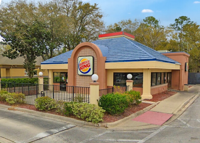
Property Record
11031 Old Saint Augustine Rd, Jacksonville, FL 32257


Current Lease Availabilities
Property Detail
11031 Old Saint Augustine Rd
155665-0300
09-4S-27E 1.060 PT GOVT LOTS 3,4 RECD O/R 21576-564
Restaurantbuilding
Duval
PUD
Florida
B and X Area of moderate flood hazard, usually the area between the limits of the 100-year and 500-year floods.
3,4
2025
0.99 AC
2026
Mandarin
016729
Jacksonville (Florida)
2,873 SF
Jacksonville, FL
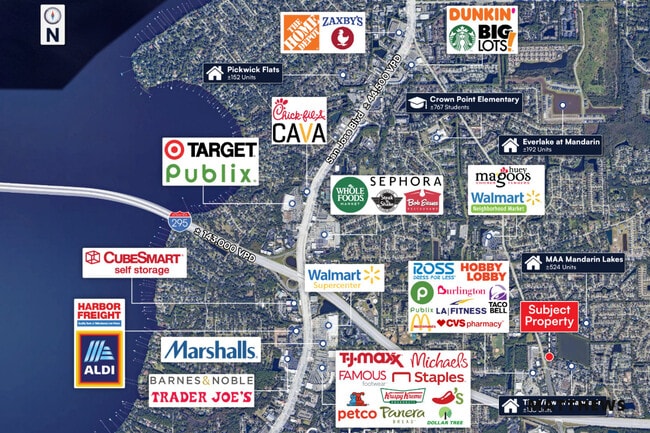
NEARBY LISTINGS FOR SALE OR LEASE
DEMOGRAPHICS near 11031 Old Saint Augustine Rd
1 mile
3 mile
5 mile
2025 Total Population
13,195
72,489
145,943
2030 Population
13,769
76,162
155,352
Pop Growth 2025-2030
+ 4.35%
+ 5.07%
+ 6.45%
Average Age
41
42
41
2025 Total Households
5,603
29,099
60,197
HH Growth 2025-2030
+ 4.41%
+ 5.27%
+ 6.58%
Median Household Inc
$70,059
$90,726
$86,879
Avg Household Size
2.30
2.40
2.40
2025 Avg HH Vehicles
2.00
2.00
2.00
Median Home Value
$307,909
$364,585
$381,963
Median Year Built
1985
1987
1989
Nearby Places
Map Layers
Map Styles
 Street
 Aerial
Layers
 Traffic
 Biking
Places
Listings with unknown addresses are not visible on the map
- Restaurants
- Banks
- Shops
- Fitness
- Groceries
PUBLIC TRANSPORTATION
AIRPORT
Jacksonville International
Drive
Walk
Distance
Jacksonville International
45 min
33.9 mi
Freight Ports
Jacksonville Port
Drive
Walk
Distance
Jacksonville Port
30 min
16.4 mi
Nearby Properties
Address
Land Use
TOTAL SIZE
Lot Size
Zoning
Address
Land Use
TOTAL SIZE
Lot Size
Zoning
438,224 SF
35.14 AC
RMD-D
Address
Land Use
TOTAL SIZE
Lot Size
Zoning
287,406 SF
32.10 AC
CCG-1
Address
Land Use
TOTAL SIZE
Lot Size
Zoning
193,858 SF
8.67 AC
PUD
Address
Land Use
TOTAL SIZE
Lot Size
Zoning
266,087 SF
35.07 AC
RMD-D
Address
Land Use
TOTAL SIZE
Lot Size
Zoning
304,017 SF
20.58 AC
RMD-D
Address
Land Use
TOTAL SIZE
Lot Size
Zoning
291,833 SF
16.91 AC
CRO
Address
Land Use
TOTAL SIZE
Lot Size
Zoning
236,068 SF
18.87 AC
PUD
Address
Land Use
TOTAL SIZE
Lot Size
Zoning
404,315 SF
19.27 AC
RMD-D
Address
Land Use
TOTAL SIZE
Lot Size
Zoning
327,854 SF
26.24 AC
RMD-D
Address
Land Use
TOTAL SIZE
Lot Size
Zoning
304,277 SF
25.03 AC
CCG-2
Address
Land Use
TOTAL SIZE
Lot Size
Zoning
207,736 SF
18.55 AC
RMD-C
Address
Land Use
TOTAL SIZE
Lot Size
Zoning
165,266 SF
17.26 AC
CCG-1
Address
Land Use
TOTAL SIZE
Lot Size
Zoning
273,060 SF
23.70 AC
CCG-1
Address
Land Use
TOTAL SIZE
Lot Size
Zoning
240,240 SF
13.91 AC
PUD
Address
Land Use
TOTAL SIZE
Lot Size
Zoning
248,748 SF
17.60 AC
RMD-D
Address
Land Use
TOTAL SIZE
Lot Size
Zoning
96,065 SF
4.11 AC
PUD
Address
Land Use
TOTAL SIZE
Lot Size
Zoning
213,374 SF
14.77 AC
PUD
Address
Land Use
TOTAL SIZE
Lot Size
Zoning
148,931 SF
16.93 AC
RMD-D
Address
Land Use
TOTAL SIZE
Lot Size
Zoning
263,361 SF
36.89 AC
PUD
Address
Land Use
TOTAL SIZE
Lot Size
Zoning
177,088 SF
15.02 AC
RMD-D
Address
Land Use
TOTAL SIZE
Lot Size
Zoning
265,371 SF
18.26 AC
IH
Address
Land Use
TOTAL SIZE
Lot Size
Zoning
330,139 SF
73.17 AC
PBF-1
Address
Land Use
TOTAL SIZE
Lot Size
Zoning
167,580 SF
13.16 AC
RMD-D
Address
Land Use
TOTAL SIZE
Lot Size
Zoning
246,534 SF
18.99 AC
RMD-D
Address
Land Use
TOTAL SIZE
Lot Size
Zoning
264,352 SF
20.49 AC
PUD
Address
Land Use
TOTAL SIZE
Lot Size
Zoning
388,745 SF
49.78 AC
PBF-1
Address
Land Use
TOTAL SIZE
Lot Size
Zoning
202,348 SF
18.15 AC
IL
Address
Land Use
TOTAL SIZE
Lot Size
Zoning
224,180 SF
18.48 AC
PUD
Address
Land Use
TOTAL SIZE
Lot Size
Zoning
150,805 SF
26.63 AC
CRO
Address
Land Use
TOTAL SIZE
Lot Size
Zoning
114,215 SF
14.08 AC
PUD
The World's #1 Commercial Real Estate Marketplace
Connect with us
© 2026 CoStar Group
The information above has been obtained from sources believed reliable. While we do not doubt its accuracy we have not verified it and make no guarantee, warranty or representation about it. It is your responsibility to independently confirm its accuracy and completeness. Any projections, opinions, assumptions, or estimates used are for example only and do not represent the current or future performance of the property. The value of this transaction to you depends on tax and other factors which should be evaluated by your tax, financial, and legal advisors. You and your advisors should conduct a careful, independent investigation of the property to determine to your satisfaction the suitability of the property for your needs.