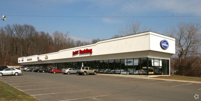
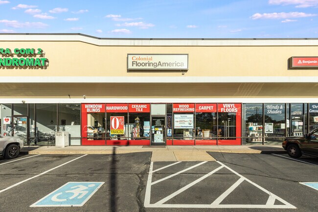
Property Record
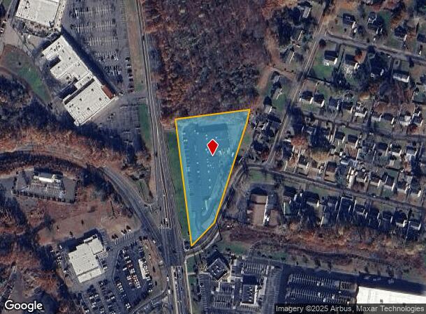
1104 N Colony Rd, Wallingford, CT 06492
NEARBY LISTINGS FOR SALE OR LEASE
Property Detail
1104 N Colony Rd
WALL-000024-000000-000030
New Haven
Regionalshoppingcenterormallwithanchorstore
Connecticut
X
30
09009C0306H
2.32 AC
2025
Wallingford
2025
Westchester/So Connecticut
175400
New Haven, CT
21,676 SF
DEMOGRAPHICS near 1104 N Colony Rd
1 mile
3 mile
5 mile
2024 Total Population
3,586
57,081
115,268
2029 Population
3,565
56,883
114,851
Pop Growth 2024-2029
(0.59%)
(0.35%)
(0.36%)
Average Age
42
41
42
2024 Total Households
1,509
22,793
45,728
HH Growth 2024-2029
(0.66%)
(0.40%)
(0.43%)
Median Household Inc
$79,128
$69,121
$78,186
Avg Household Size
2.30
2.40
2.40
2024 Avg HH Vehicles
2.00
2.00
2.00
Median Home Value
$226,274
$235,576
$255,945
Median Year Built
1973
1960
1964
Nearby Places
Map Layers
Map Styles
 Street
 Aerial
Transit
 Traffic
 Biking
Places
Listings with unknown addresses are not visible on the map
- Restaurants
- Banks
- Shops
- Fitness
- Groceries
PUBLIC TRANSPORTATION
AIRPORT
Bradley International
Drive
Walk
Distance
Bradley International
42 min
37.0 mi
SALE & LEASE HISTORY
LISTING DATE
SALE/LEASE

Oct 11, 2021
For Sale
Nearby Properties
Address
Land Use
TOTAL SIZE
Lot Size
Zoning
Address
Land Use
TOTAL SIZE
Lot Size
Zoning
63,356 SF
154.26 AC
RM40
Address
Land Use
TOTAL SIZE
Lot Size
Zoning
32.85 AC
RU40
Address
Land Use
TOTAL SIZE
Lot Size
Zoning
276,631 SF
27.60 AC
R-1
Address
Land Use
TOTAL SIZE
Lot Size
Zoning
105,252 SF
9.13 AC
I40
Address
Land Use
TOTAL SIZE
Lot Size
Zoning
34.10 AC
C-3
Address
Land Use
TOTAL SIZE
Lot Size
Zoning
245,122 SF
32.60 AC
R-1
Address
Land Use
TOTAL SIZE
Lot Size
Zoning
44.46 AC
R18
Address
Land Use
TOTAL SIZE
Lot Size
Zoning
10.38 AC
M-1
Address
Land Use
TOTAL SIZE
Lot Size
Zoning
329,296 SF
35.55 AC
IX
Address
Land Use
TOTAL SIZE
Lot Size
Zoning
291,405 SF
104.81 AC
WI
Address
Land Use
TOTAL SIZE
Lot Size
Zoning
119,598 SF
18.43 AC
RF40
Address
Land Use
TOTAL SIZE
Lot Size
Zoning
23,920 SF
137.43 AC
R18
Address
Land Use
TOTAL SIZE
Lot Size
Zoning
11.02 AC
S-R
Address
Land Use
TOTAL SIZE
Lot Size
Zoning
172,027 SF
18.04 AC
RF40
Address
Land Use
TOTAL SIZE
Lot Size
Zoning
162,601 SF
11.44 AC
R-1
Address
Land Use
TOTAL SIZE
Lot Size
Zoning
72,256 SF
R18
Address
Land Use
TOTAL SIZE
Lot Size
Zoning
13.42 AC
RM6
Address
Land Use
TOTAL SIZE
Lot Size
Zoning
3,952 SF
21.76 AC
R-1
Address
Land Use
TOTAL SIZE
Lot Size
Zoning
26.45 AC
RF40
Address
Land Use
TOTAL SIZE
Lot Size
Zoning
153,180 SF
3.07 AC
TODH
Address
Land Use
TOTAL SIZE
Lot Size
Zoning
187,914 SF
16.13 AC
IX
Address
Land Use
TOTAL SIZE
Lot Size
Zoning
1.67 AC
TODP
Address
Land Use
TOTAL SIZE
Lot Size
Zoning
38,735 SF
Address
Land Use
TOTAL SIZE
Lot Size
Zoning
123,730 SF
40.31 AC
R18
Address
Land Use
TOTAL SIZE
Lot Size
Zoning
203,692 SF
21.22 AC
IX
Address
Land Use
TOTAL SIZE
Lot Size
Zoning
22,284 SF
128.20 AC
RU40
Address
Land Use
TOTAL SIZE
Lot Size
Zoning
18.70 AC
RF40
Address
Land Use
TOTAL SIZE
Lot Size
Zoning
166,724 SF
21.79 AC
M-2
Address
Land Use
TOTAL SIZE
Lot Size
Zoning
12 AC
RU40
Address
Land Use
TOTAL SIZE
Lot Size
Zoning
9.75 AC
RF40
The World's #1 Commercial Real Estate Marketplace
Connect with us
© 2026 CoStar Group
The information above has been obtained from sources believed reliable. While we do not doubt its accuracy we have not verified it and make no guarantee, warranty or representation about it. It is your responsibility to independently confirm its accuracy and completeness. Any projections, opinions, assumptions, or estimates used are for example only and do not represent the current or future performance of the property. The value of this transaction to you depends on tax and other factors which should be evaluated by your tax, financial, and legal advisors. You and your advisors should conduct a careful, independent investigation of the property to determine to your satisfaction the suitability of the property for your needs.