Property Record
11043 Crystal Springs Rd, Jacksonville, FL 32221


NEARBY LISTINGS FOR SALE OR LEASE
-
-
View all Jacksonville listings for lease on LoopNet.com
Property Detail
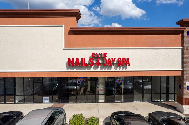
11043 Crystal Springs Rd
006763-0550
White City S/D
Regionalshoppingcenterormallwithanchorstore
5-70 19-2S-25E 3.71 WHITE CITY PT RECD O/R 14770-590 BLK 33, 5-93 JACKSONVILLE HEIGHTS PT TRACTS 6,7 RECD O/R 14770-590 BLK 2
X
Duval
12031C0340H
Florida
2025
3.72 AC
2026
Riverside
011903
Jacksonville (Florida)
36,354 SF
Jacksonville, FL
DEMOGRAPHICS near 11043 Crystal Springs Rd
1 Mile
3 Mile
5 Mile
2024 Total Population
3,148
29,380
61,881
2029 Population
3,303
31,032
65,008
Pop Growth 2024-2029
+ 4.92%
+ 5.62%
+ 5.05%
Average Age
39
38
38
2024 Total Households
1,109
10,208
22,113
HH Growth 2024-2029
+ 4.87%
+ 5.63%
+ 5.09%
Median Household Inc
$80,890
$75,454
$66,829
Avg Household Size
2.80
2.80
2.70
2024 Avg HH Vehicles
2.00
2.00
2.00
Median Home Value
$257,427
$238,849
$208,785
Median Year Built
2001
2001
1995
Nearby Places
Map Layers
Map Styles
 Street
 Aerial
- Restaurants
- Banks
- Shops
- Fitness
- Groceries
PUBLIC TRANSPORTATION
AIRPORT
Jacksonville International
DRIVE
WALK
Distance
Jacksonville International
33 min
22.2 mi
Freight Ports
Jacksonville Port
DRIVE
WALK
Distance
Jacksonville Port
25 min
16.0 mi
SALE & LEASE HISTORY
LISTING DATE
SALE/LEASE

Sep 25, 2016
For Lease
Nearby Properties
Address
Land Use
TOTAL SIZE
Lot Size
Zoning
Address
Land Use
TOTAL SIZE
Lot Size
Zoning
185,662 SF
1,416.80 AC
PBF-3
Address
Land Use
TOTAL SIZE
Lot Size
Zoning
505,748 SF
94.71 AC
IL
Address
Land Use
TOTAL SIZE
Lot Size
Zoning
270,762 SF
39.15 AC
PUD
Address
Land Use
TOTAL SIZE
Lot Size
Zoning
509,686 SF
43.32 AC
IL
Address
Land Use
TOTAL SIZE
Lot Size
Zoning
139,435 SF
7.15 AC
CCG-2
Address
Land Use
TOTAL SIZE
Lot Size
Zoning
481,686 SF
43.54 AC
IL
Address
Land Use
TOTAL SIZE
Lot Size
Zoning
570.50 AC
PUD
Address
Land Use
TOTAL SIZE
Lot Size
Zoning
269,178 SF
129.93 AC
PBF-2
Address
Land Use
TOTAL SIZE
Lot Size
Zoning
2,288 SF
373.54 AC
PBF-1
Address
Land Use
TOTAL SIZE
Lot Size
Zoning
65,052 SF
15.97 AC
PUD
Address
Land Use
TOTAL SIZE
Lot Size
Zoning
30,789 SF
2.10 AC
PUD
Address
Land Use
TOTAL SIZE
Lot Size
Zoning
160,778 SF
25.46 AC
IL
Address
Land Use
TOTAL SIZE
Lot Size
Zoning
108,217 SF
178.52 AC
PBF-1
Address
Land Use
TOTAL SIZE
Lot Size
Zoning
6,792 SF
53.56 AC
PUD
Address
Land Use
TOTAL SIZE
Lot Size
Zoning
365.57 AC
PUD
Address
Land Use
TOTAL SIZE
Lot Size
Zoning
153,549 SF
15.96 AC
PBF-1
Address
Land Use
TOTAL SIZE
Lot Size
Zoning
29,022 SF
3.17 AC
PUD
Address
Land Use
TOTAL SIZE
Lot Size
Zoning
33,424 SF
2.97 AC
PUD
Address
Land Use
TOTAL SIZE
Lot Size
Zoning
53,527 SF
10.89 AC
CCG-1
Address
Land Use
TOTAL SIZE
Lot Size
Zoning
84.65 AC
PUD
Address
Land Use
TOTAL SIZE
Lot Size
Zoning
53,405 SF
6.04 AC
PUD
Address
Land Use
TOTAL SIZE
Lot Size
Zoning
307.14 AC
PUD
Address
Land Use
TOTAL SIZE
Lot Size
Zoning
23,532 SF
3.58 AC
CCG-2
Address
Land Use
TOTAL SIZE
Lot Size
Zoning
50,506 SF
9.44 AC
PBF-2
Address
Land Use
TOTAL SIZE
Lot Size
Zoning
153,671 SF
27.09 AC
IL
Address
Land Use
TOTAL SIZE
Lot Size
Zoning
26,961 SF
1.36 AC
PUD
Address
Land Use
TOTAL SIZE
Lot Size
Zoning
25.88 AC
CCG-1
Address
Land Use
TOTAL SIZE
Lot Size
Zoning
45,252 SF
16.91 AC
CCG-1
Address
Land Use
TOTAL SIZE
Lot Size
Zoning
806 SF
125.05 AC
PUD
The World's #1 Commercial Real Estate Marketplace
Connect with us
© 2025 CoStar Group
The information above has been obtained from sources believed reliable. While we do not doubt its accuracy we have not verified it and make no guarantee, warranty or representation about it. It is your responsibility to independently confirm its accuracy and completeness. Any projections, opinions, assumptions, or estimates used are for example only and do not represent the current or future performance of the property. The value of this transaction to you depends on tax and other factors which should be evaluated by your tax, financial, and legal advisors. You and your advisors should conduct a careful, independent investigation of the property to determine to your satisfaction the suitability of the property for your needs.