Property Record
1105 Highland Glen Rd, Westwood, MA 02090


NEARBY LISTINGS FOR SALE OR LEASE
-
-
View all Westwood listings for sale on LoopNet.com
Property Detail
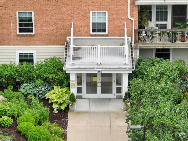
1105 Highland Glen Rd
WWOO-000020-000000-000126
Norfolk
Apartment
Massachusetts
X
126
25021C0178F
8.18 AC
2025
Outer Route 1 South
2025
Boston
412100
Boston-Cambridge-Newton, MA-NH
130,344 SF
DEMOGRAPHICS near 1105 Highland Glen Rd
1 Mile
3 Mile
5 Mile
2024 Total Population
5,937
45,997
126,500
2029 Population
5,943
45,719
125,839
Pop Growth 2024-2029
+ 0.10%
(0.60%)
(0.52%)
Average Age
42
42
42
2024 Total Households
2,063
17,482
46,980
HH Growth 2024-2029
+ 0.10%
(0.78%)
(0.60%)
Median Household Inc
$194,245
$122,439
$139,470
Avg Household Size
2.80
2.50
2.60
2024 Avg HH Vehicles
2.00
2.00
2.00
Median Home Value
$864,505
$739,838
$747,236
Median Year Built
1958
1962
1962
Nearby Places
Map Layers
Map Styles
 Street
 Aerial
- Restaurants
- Banks
- Shops
- Fitness
- Groceries
Nearby Properties
Address
Land Use
TOTAL SIZE
Lot Size
Zoning
Address
Land Use
TOTAL SIZE
Lot Size
Zoning
380,030 SF
24.87 AC
Address
Land Use
TOTAL SIZE
Lot Size
Zoning
413,827 SF
9.49 AC
RDO
Address
Land Use
TOTAL SIZE
Lot Size
Zoning
380,030 SF
24.87 AC
Address
Land Use
TOTAL SIZE
Lot Size
Zoning
45,836 SF
23.25 AC
Address
Land Use
TOTAL SIZE
Lot Size
Zoning
221,803 SF
36.46 AC
Address
Land Use
TOTAL SIZE
Lot Size
Zoning
5,349 SF
8.74 AC
Address
Land Use
TOTAL SIZE
Lot Size
Zoning
132,917 SF
24 AC
RE
Address
Land Use
TOTAL SIZE
Lot Size
Zoning
141,322 SF
36.84 AC
Address
Land Use
TOTAL SIZE
Lot Size
Zoning
242,198 SF
53.28 AC
Address
Land Use
TOTAL SIZE
Lot Size
Zoning
294,771 SF
17.85 AC
Address
Land Use
TOTAL SIZE
Lot Size
Zoning
150,802 SF
3.09 AC
LM
Address
Land Use
TOTAL SIZE
Lot Size
Zoning
218,676 SF
22.54 AC
Address
Land Use
TOTAL SIZE
Lot Size
Zoning
11.70 AC
Address
Land Use
TOTAL SIZE
Lot Size
Zoning
92,278 SF
10.58 AC
Address
Land Use
TOTAL SIZE
Lot Size
Zoning
361,239 SF
37.28 AC
Address
Land Use
TOTAL SIZE
Lot Size
Zoning
529.60 AC
R2
Address
Land Use
TOTAL SIZE
Lot Size
Zoning
33,778 SF
18.86 AC
Address
Land Use
TOTAL SIZE
Lot Size
Zoning
314.70 AC
R2
Address
Land Use
TOTAL SIZE
Lot Size
Zoning
138,380 SF
17.26 AC
Address
Land Use
TOTAL SIZE
Lot Size
Zoning
54,792 SF
30.05 AC
Address
Land Use
TOTAL SIZE
Lot Size
Zoning
29,094 SF
9.03 AC
Address
Land Use
TOTAL SIZE
Lot Size
Zoning
52,716 SF
12.28 AC
Address
Land Use
TOTAL SIZE
Lot Size
Zoning
19,422 SF
13.50 AC
Address
Land Use
TOTAL SIZE
Lot Size
Zoning
48,693 SF
9.02 AC
Address
Land Use
TOTAL SIZE
Lot Size
Zoning
34,567 SF
29.18 AC
G
Address
Land Use
TOTAL SIZE
Lot Size
Zoning
152,821 SF
2.76 AC
LM
Address
Land Use
TOTAL SIZE
Lot Size
Zoning
31,206 SF
6.10 AC
Address
Land Use
TOTAL SIZE
Lot Size
Zoning
113,973 SF
8.70 AC
Address
Land Use
TOTAL SIZE
Lot Size
Zoning
147,498 SF
9.09 AC
The World's #1 Commercial Real Estate Marketplace
Connect with us
© 2025 CoStar Group
The information above has been obtained from sources believed reliable. While we do not doubt its accuracy we have not verified it and make no guarantee, warranty or representation about it. It is your responsibility to independently confirm its accuracy and completeness. Any projections, opinions, assumptions, or estimates used are for example only and do not represent the current or future performance of the property. The value of this transaction to you depends on tax and other factors which should be evaluated by your tax, financial, and legal advisors. You and your advisors should conduct a careful, independent investigation of the property to determine to your satisfaction the suitability of the property for your needs.