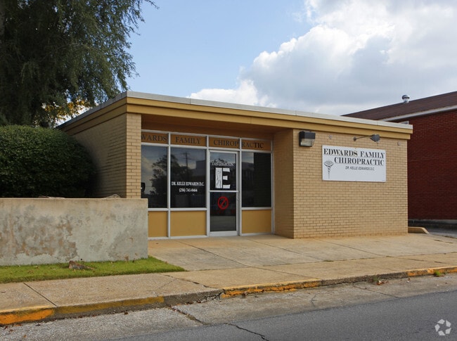
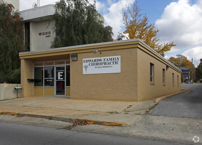
Property Record
1105 Leighton Ave, Anniston, AL 36207
NEARBY LISTINGS FOR SALE OR LEASE
Property Detail
1105 Leighton Ave
Anniston-Oxford-Jacksonville, AL
Anniston City Land Company
21-03-05-3-005-038.000
SEC 5 TSP 16S RNG 8E ANNISTON CITY LAND CO BLK 34 N 45 LOT 8 ANNISTON AL
Medicalbuilding
Calhoun
X
Alabama
01015C0312E
8
2025
0.20 AC
2025
Gadsden/Anniston Area
000200
Other Market Areas
1,843 SF
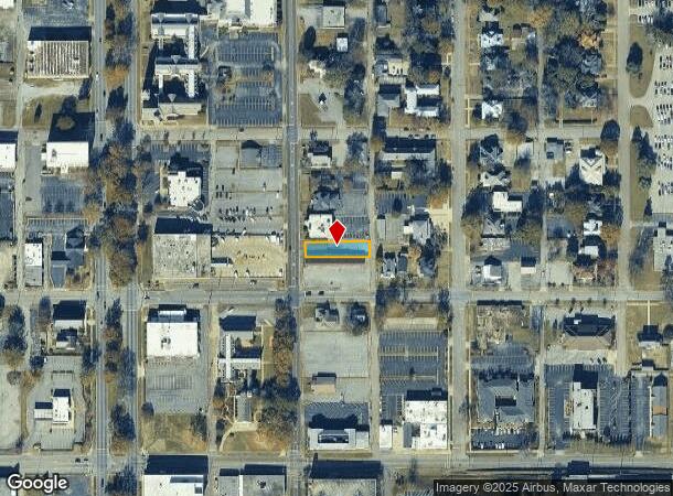
DEMOGRAPHICS near 1105 Leighton Ave
1 Mile
3 Mile
5 Mile
2024 Total Population
6,889
24,393
46,544
2029 Population
6,983
24,514
46,245
Pop Growth 2024-2029
+ 1.36%
+ 0.50%
(0.64%)
Average Age
42
42
42
2024 Total Households
2,870
10,318
19,460
HH Growth 2024-2029
+ 1.53%
+ 0.47%
(0.68%)
Median Household Inc
$29,653
$32,813
$40,127
Avg Household Size
2.10
2.20
2.20
2024 Avg HH Vehicles
1.00
2.00
2.00
Median Home Value
$78,709
$87,827
$112,490
Median Year Built
1958
1967
1972
Nearby Places
Map Layers
Map Styles
 Street
 Aerial
- Restaurants
- Banks
- Shops
- Fitness
- Groceries
PUBLIC TRANSPORTATION
COMMUTER RAIL
Anniston Amtrak Station (Crescent - Amtrak)
DRIVE
WALK
Distance
Anniston Amtrak Station (Crescent - Amtrak)
3 min
20 min
1.1 mi
Freight Ports
Port of Panama City
DRIVE
WALK
Distance
Port of Panama City
364 min
292.9 mi
SALE & LEASE HISTORY
LISTING DATE
SALE/LEASE

Jul 18, 2025
For Sale
Nearby Properties
Address
Land Use
TOTAL SIZE
Lot Size
Zoning
Address
Land Use
TOTAL SIZE
Lot Size
Zoning
319,650 SF
10.69 AC
Address
Land Use
TOTAL SIZE
Lot Size
Zoning
12,496 SF
7.39 AC
Address
Land Use
TOTAL SIZE
Lot Size
Zoning
4,520 SF
8.20 AC
Address
Land Use
TOTAL SIZE
Lot Size
Zoning
73,027 SF
1.60 AC
Address
Land Use
TOTAL SIZE
Lot Size
Zoning
21,766 SF
3.06 AC
Address
Land Use
TOTAL SIZE
Lot Size
Zoning
5.32 AC
Address
Land Use
TOTAL SIZE
Lot Size
Zoning
18.90 AC
Address
Land Use
TOTAL SIZE
Lot Size
Zoning
17,254 SF
22 AC
Address
Land Use
TOTAL SIZE
Lot Size
Zoning
341,374 SF
15.88 AC
Address
Land Use
TOTAL SIZE
Lot Size
Zoning
346,532 SF
41 AC
Address
Land Use
TOTAL SIZE
Lot Size
Zoning
31,832 SF
16 AC
Address
Land Use
TOTAL SIZE
Lot Size
Zoning
14,082 SF
3.85 AC
Address
Land Use
TOTAL SIZE
Lot Size
Zoning
5,581 SF
1.01 AC
Address
Land Use
TOTAL SIZE
Lot Size
Zoning
42,158 SF
5.20 AC
Address
Land Use
TOTAL SIZE
Lot Size
Zoning
3.67 AC
Address
Land Use
TOTAL SIZE
Lot Size
Zoning
71,060 SF
2.20 AC
Address
Land Use
TOTAL SIZE
Lot Size
Zoning
103,550 SF
9.15 AC
Address
Land Use
TOTAL SIZE
Lot Size
Zoning
6.94 AC
Address
Land Use
TOTAL SIZE
Lot Size
Zoning
Address
Land Use
TOTAL SIZE
Lot Size
Zoning
6,400 SF
12.24 AC
Address
Land Use
TOTAL SIZE
Lot Size
Zoning
30,901 SF
4.30 AC
Address
Land Use
TOTAL SIZE
Lot Size
Zoning
6,912 SF
12.68 AC
Address
Land Use
TOTAL SIZE
Lot Size
Zoning
194,310 SF
9.11 AC
Address
Land Use
TOTAL SIZE
Lot Size
Zoning
34,564 SF
1.60 AC
Address
Land Use
TOTAL SIZE
Lot Size
Zoning
10,479 SF
9.56 AC
Address
Land Use
TOTAL SIZE
Lot Size
Zoning
85,305 SF
1.11 AC
Address
Land Use
TOTAL SIZE
Lot Size
Zoning
24,132 SF
5.02 AC
Address
Land Use
TOTAL SIZE
Lot Size
Zoning
80,640 SF
9.30 AC
Address
Land Use
TOTAL SIZE
Lot Size
Zoning
Address
Land Use
TOTAL SIZE
Lot Size
Zoning
13,757 SF
1.29 AC
The World's #1 Commercial Real Estate Marketplace
Connect with us
© 2025 CoStar Group
The information above has been obtained from sources believed reliable. While we do not doubt its accuracy we have not verified it and make no guarantee, warranty or representation about it. It is your responsibility to independently confirm its accuracy and completeness. Any projections, opinions, assumptions, or estimates used are for example only and do not represent the current or future performance of the property. The value of this transaction to you depends on tax and other factors which should be evaluated by your tax, financial, and legal advisors. You and your advisors should conduct a careful, independent investigation of the property to determine to your satisfaction the suitability of the property for your needs.