Property Record
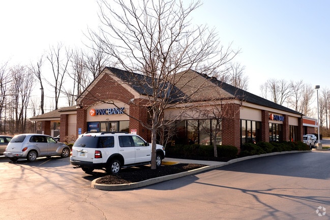
1105 State Route 28, Milford, OH 45150


NEARBY LISTINGS FOR SALE OR LEASE
Property Detail
1105 State Route 28
18-24-02A-151
Jones Military Survey #991
Financialbuilding
06TY .143 TO 157.
X
Clermont
39025C0130G
Ohio
2024
0.67 AC
2024
Milford/Wards Corner
040703
Cincinnati/Dayton
3,076 SF
Cincinnati, OH-KY-IN
DEMOGRAPHICS near 1105 State Route 28
1 Mile
3 Mile
5 Mile
2024 Total Population
7,219
42,769
74,108
2029 Population
7,387
43,779
75,563
Pop Growth 2024-2029
+ 2.33%
+ 2.36%
+ 1.96%
Average Age
41
41
41
2024 Total Households
2,888
16,163
27,995
HH Growth 2024-2029
+ 2.29%
+ 2.33%
+ 2.00%
Median Household Inc
$69,384
$84,302
$87,469
Avg Household Size
2.40
2.60
2.60
2024 Avg HH Vehicles
2.00
2.00
2.00
Median Home Value
$229,475
$238,031
$256,918
Median Year Built
1984
1984
1983
Nearby Places
Map Layers
Map Styles
 Street
 Aerial
- Restaurants
- Banks
- Shops
- Fitness
- Groceries
PUBLIC TRANSPORTATION
AIRPORT
Cincinnati/Northern Kentucky International
DRIVE
WALK
Distance
Cincinnati/Northern Kentucky International
49 min
34.0 mi
SALE & LEASE HISTORY
LISTING DATE
SALE/LEASE

Oct 08, 2020
For Sale
Nearby Properties
Address
Land Use
TOTAL SIZE
Lot Size
Zoning
Address
Land Use
TOTAL SIZE
Lot Size
Zoning
145,346 SF
108.11 AC
Address
Land Use
TOTAL SIZE
Lot Size
Zoning
315,096 SF
9.48 AC
Address
Land Use
TOTAL SIZE
Lot Size
Zoning
2,555 SF
23.68 AC
Address
Land Use
TOTAL SIZE
Lot Size
Zoning
43,511 SF
12.36 AC
Address
Land Use
TOTAL SIZE
Lot Size
Zoning
6,432 SF
16.37 AC
Address
Land Use
TOTAL SIZE
Lot Size
Zoning
37,328 SF
9.35 AC
Address
Land Use
TOTAL SIZE
Lot Size
Zoning
6.76 AC
Address
Land Use
TOTAL SIZE
Lot Size
Zoning
20,432 SF
20.32 AC
Address
Land Use
TOTAL SIZE
Lot Size
Zoning
12.61 AC
Address
Land Use
TOTAL SIZE
Lot Size
Zoning
210,444 SF
29.04 AC
Address
Land Use
TOTAL SIZE
Lot Size
Zoning
3,042 SF
24.24 AC
Address
Land Use
TOTAL SIZE
Lot Size
Zoning
53,033 SF
17.48 AC
Address
Land Use
TOTAL SIZE
Lot Size
Zoning
23.24 AC
Address
Land Use
TOTAL SIZE
Lot Size
Zoning
200,000 SF
41.92 AC
Address
Land Use
TOTAL SIZE
Lot Size
Zoning
53,033 SF
32.99 AC
Address
Land Use
TOTAL SIZE
Lot Size
Zoning
31,200 SF
3.92 AC
Address
Land Use
TOTAL SIZE
Lot Size
Zoning
27.51 AC
Address
Land Use
TOTAL SIZE
Lot Size
Zoning
Address
Land Use
TOTAL SIZE
Lot Size
Zoning
74,252 SF
20.47 AC
Address
Land Use
TOTAL SIZE
Lot Size
Zoning
7,000 SF
0.18 AC
M1
Address
Land Use
TOTAL SIZE
Lot Size
Zoning
14,400 SF
41.92 AC
Address
Land Use
TOTAL SIZE
Lot Size
Zoning
50,720 SF
6.29 AC
Address
Land Use
TOTAL SIZE
Lot Size
Zoning
86,550 SF
7.13 AC
Address
Land Use
TOTAL SIZE
Lot Size
Zoning
1,748 SF
9.23 AC
Address
Land Use
TOTAL SIZE
Lot Size
Zoning
7,192 SF
19.87 AC
Address
Land Use
TOTAL SIZE
Lot Size
Zoning
3,932 SF
42.43 AC
Address
Land Use
TOTAL SIZE
Lot Size
Zoning
7,376 SF
6.01 AC
Address
Land Use
TOTAL SIZE
Lot Size
Zoning
110,569 SF
7.88 AC
Address
Land Use
TOTAL SIZE
Lot Size
Zoning
15,065 SF
1.62 AC
Address
Land Use
TOTAL SIZE
Lot Size
Zoning
21,732 SF
9.41 AC
The World's #1 Commercial Real Estate Marketplace
Connect with us
© 2025 CoStar Group
The information above has been obtained from sources believed reliable. While we do not doubt its accuracy we have not verified it and make no guarantee, warranty or representation about it. It is your responsibility to independently confirm its accuracy and completeness. Any projections, opinions, assumptions, or estimates used are for example only and do not represent the current or future performance of the property. The value of this transaction to you depends on tax and other factors which should be evaluated by your tax, financial, and legal advisors. You and your advisors should conduct a careful, independent investigation of the property to determine to your satisfaction the suitability of the property for your needs.