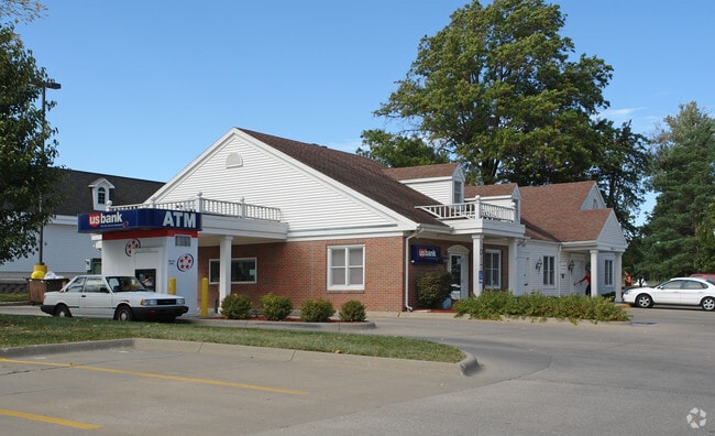
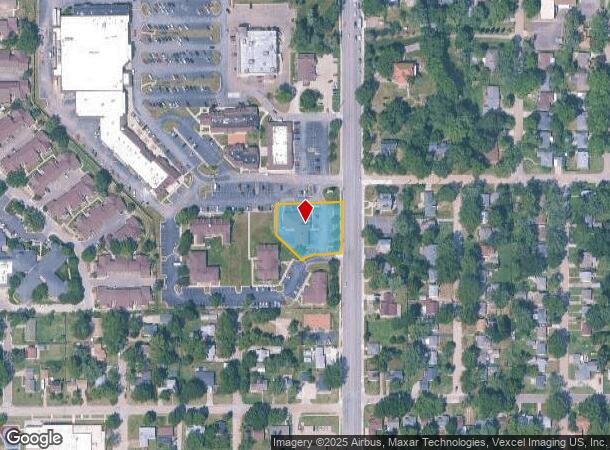
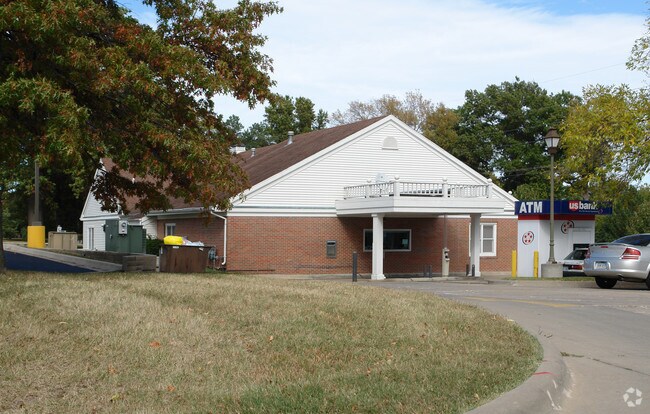
Property Record
1105 Sw Gage Blvd, Topeka, KS 66604
NEARBY LISTINGS FOR SALE OR LEASE
Property Detail
1105 Sw Gage Blvd
Topeka, KS
Fleming Place Sub
098-34-0-40-01-039-000
FLEMING PLACE SUB , BLOCK A , LOT 4 , BLK A LOT 4 FLEMING PLACE SUB LESS PT IN PRIVATE DRIVE ALONG SOUTH SID E OF RT SECTION 34 TOWNSHIP 11 RANGE 15
Financialbuilding
Shawnee
X
Kansas
20177C0215E
4
2024
0.68 AC
2025
Topeka
002401
Kansas City
3,717 SF
DEMOGRAPHICS near 1105 Sw Gage Blvd
1 Mile
3 Mile
5 Mile
2024 Total Population
8,704
59,906
124,928
2029 Population
8,567
59,543
124,006
Pop Growth 2024-2029
(1.57%)
(0.61%)
(0.74%)
Average Age
44
40
40
2024 Total Households
4,380
27,426
53,302
HH Growth 2024-2029
(1.67%)
(0.67%)
(0.80%)
Median Household Inc
$55,960
$48,895
$49,663
Avg Household Size
1.90
2.10
2.20
2024 Avg HH Vehicles
2.00
2.00
2.00
Median Home Value
$120,208
$117,314
$126,064
Median Year Built
1955
1961
1967
Nearby Places
Map Layers
Map Styles
 Street
 Aerial
- Restaurants
- Banks
- Shops
- Fitness
- Groceries
PUBLIC TRANSPORTATION
COMMUTER RAIL
DRIVE
WALK
Distance
8 min
3.8 mi
Nearby Properties
Address
Land Use
TOTAL SIZE
Lot Size
Zoning
Address
Land Use
TOTAL SIZE
Lot Size
Zoning
249,598 SF
150.21 AC
U1
Address
Land Use
TOTAL SIZE
Lot Size
Zoning
513,835 SF
13.39 AC
M1
Address
Land Use
TOTAL SIZE
Lot Size
Zoning
52,453 SF
17.12 AC
C5,OI2
Address
Land Use
TOTAL SIZE
Lot Size
Zoning
309,298 SF
7.34 AC
M1
Address
Land Use
TOTAL SIZE
Lot Size
Zoning
117,839 SF
121.95 AC
R1
Address
Land Use
TOTAL SIZE
Lot Size
Zoning
64,058 SF
3.31 AC
C4,OI2
Address
Land Use
TOTAL SIZE
Lot Size
Zoning
336,669 SF
58.82 AC
PUD,C4
Address
Land Use
TOTAL SIZE
Lot Size
Zoning
3.31 AC
OI2
Address
Land Use
TOTAL SIZE
Lot Size
Zoning
80,630 SF
107.16 AC
R1
Address
Land Use
TOTAL SIZE
Lot Size
Zoning
285,005 SF
3.10 AC
C4,C5,I1
Address
Land Use
TOTAL SIZE
Lot Size
Zoning
43,282 SF
19.33 AC
PUD,M2
Address
Land Use
TOTAL SIZE
Lot Size
Zoning
137,637 SF
10.43 AC
M2
Address
Land Use
TOTAL SIZE
Lot Size
Zoning
32,544 SF
17.25 AC
PUD
Address
Land Use
TOTAL SIZE
Lot Size
Zoning
90,929 SF
8.68 AC
PUD,OI3,I1
Address
Land Use
TOTAL SIZE
Lot Size
Zoning
114,523 SF
6.92 AC
OI3
Address
Land Use
TOTAL SIZE
Lot Size
Zoning
218,962 SF
49.63 AC
R1
Address
Land Use
TOTAL SIZE
Lot Size
Zoning
152,049 SF
25.61 AC
R1
Address
Land Use
TOTAL SIZE
Lot Size
Zoning
98,898 SF
1.91 AC
C5
Address
Land Use
TOTAL SIZE
Lot Size
Zoning
107,592 SF
14.98 AC
C4,I1,OI2
Address
Land Use
TOTAL SIZE
Lot Size
Zoning
94,830 SF
17.09 AC
PUD,M4
Address
Land Use
TOTAL SIZE
Lot Size
Zoning
208,685 SF
38.23 AC
R1
Address
Land Use
TOTAL SIZE
Lot Size
Zoning
127,947 SF
7.12 AC
C5
Address
Land Use
TOTAL SIZE
Lot Size
Zoning
123,795 SF
16.45 AC
PUD,R1,I1,
Address
Land Use
TOTAL SIZE
Lot Size
Zoning
70,578 SF
10.16 AC
PUD,C2
Address
Land Use
TOTAL SIZE
Lot Size
Zoning
54,654 SF
0.56 AC
C5
Address
Land Use
TOTAL SIZE
Lot Size
Zoning
175,246 SF
80.42 AC
R1
Address
Land Use
TOTAL SIZE
Lot Size
Zoning
112,413 SF
0.73 AC
C5
Address
Land Use
TOTAL SIZE
Lot Size
Zoning
101,766 SF
2.39 AC
C5,I1
Address
Land Use
TOTAL SIZE
Lot Size
Zoning
101,166 SF
3.31 AC
C5
Address
Land Use
TOTAL SIZE
Lot Size
Zoning
22,484 SF
75.33 AC
R1
The World's #1 Commercial Real Estate Marketplace
Connect with us
© 2025 CoStar Group
The information above has been obtained from sources believed reliable. While we do not doubt its accuracy we have not verified it and make no guarantee, warranty or representation about it. It is your responsibility to independently confirm its accuracy and completeness. Any projections, opinions, assumptions, or estimates used are for example only and do not represent the current or future performance of the property. The value of this transaction to you depends on tax and other factors which should be evaluated by your tax, financial, and legal advisors. You and your advisors should conduct a careful, independent investigation of the property to determine to your satisfaction the suitability of the property for your needs.