Property Record
11053 Interstate 25 Frontage Rd, Firestone, CO 80504


Property Detail
11053 Interstate 25 Frontage Rd
Greeley, CO
Del Taco Firestone Sub
R4238006
FIR DTF L1A BLK1 DEL TACO FIRESTONE
Miscellaneous
Weld
X
Colorado
08123C1890F
1a
2024
0.90 AC
2025
Greeley
002105
Denver
2,234 SF
NEARBY LISTINGS FOR SALE OR LEASE
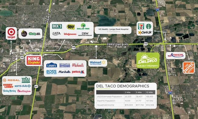
DEMOGRAPHICS near 11053 Interstate 25 Frontage Rd
1 mile
3 mile
5 mile
2024 Total Population
4,401
27,055
47,911
2029 Population
5,193
31,895
55,361
Pop Growth 2024-2029
+ 18.00%
+ 17.89%
+ 15.55%
Average Age
35
37
38
2024 Total Households
1,564
9,073
16,773
HH Growth 2024-2029
+ 18.41%
+ 18.33%
+ 15.50%
Median Household Inc
$94,530
$111,174
$105,582
Avg Household Size
2.80
3.00
2.80
2024 Avg HH Vehicles
2.00
2.00
2.00
Median Home Value
$424,571
$461,540
$468,914
Median Year Built
2006
2006
2005
Nearby Places
Map Layers
Map Styles
 Street
 Aerial
Transit
 Traffic
 Biking
Places
Listings with unknown addresses are not visible on the map
- Restaurants
- Banks
- Shops
- Fitness
- Groceries
PUBLIC TRANSPORTATION
AIRPORT
Denver International
Drive
Walk
Distance
Denver International
42 min
37.2 mi
Freight Ports
Tulsa Port Of Catoosa
Drive
Walk
Distance
Tulsa Port Of Catoosa
748 min
731.4 mi
SALE & LEASE HISTORY
LISTING DATE
SALE/LEASE

Jan 30, 2023
For Sale
Aug 04, 2022
For Sale
Nearby Properties
Address
Land Use
TOTAL SIZE
Lot Size
Zoning
Address
Land Use
TOTAL SIZE
Lot Size
Zoning
537,643 SF
40.16 AC
Address
Land Use
TOTAL SIZE
Lot Size
Zoning
161,333 SF
74.39 AC
Address
Land Use
TOTAL SIZE
Lot Size
Zoning
123,729 SF
27 AC
Address
Land Use
TOTAL SIZE
Lot Size
Zoning
227,793 SF
12.47 AC
Address
Land Use
TOTAL SIZE
Lot Size
Zoning
429,053 SF
19.92 AC
Address
Land Use
TOTAL SIZE
Lot Size
Zoning
189,849 SF
13.10 AC
Address
Land Use
TOTAL SIZE
Lot Size
Zoning
47,531 SF
5.99 AC
Address
Land Use
TOTAL SIZE
Lot Size
Zoning
129,681 SF
12.96 AC
Address
Land Use
TOTAL SIZE
Lot Size
Zoning
73,074 SF
8.29 AC
Address
Land Use
TOTAL SIZE
Lot Size
Zoning
109,676 SF
6.37 AC
Address
Land Use
TOTAL SIZE
Lot Size
Zoning
94,076 SF
6.04 AC
Address
Land Use
TOTAL SIZE
Lot Size
Zoning
92,749 SF
7.62 AC
Address
Land Use
TOTAL SIZE
Lot Size
Zoning
103,740 SF
11 AC
Address
Land Use
TOTAL SIZE
Lot Size
Zoning
40,980 SF
3.12 AC
Address
Land Use
TOTAL SIZE
Lot Size
Zoning
54,261 SF
7.50 AC
Address
Land Use
TOTAL SIZE
Lot Size
Zoning
107,268 SF
10.89 AC
Address
Land Use
TOTAL SIZE
Lot Size
Zoning
29,185 SF
6.67 AC
Address
Land Use
TOTAL SIZE
Lot Size
Zoning
42,765 SF
23.90 AC
Address
Land Use
TOTAL SIZE
Lot Size
Zoning
87,231 SF
5.55 AC
Address
Land Use
TOTAL SIZE
Lot Size
Zoning
71,373 SF
65.55 AC
Address
Land Use
TOTAL SIZE
Lot Size
Zoning
4,152 SF
77.17 AC
Address
Land Use
TOTAL SIZE
Lot Size
Zoning
48,515 SF
9.18 AC
Address
Land Use
TOTAL SIZE
Lot Size
Zoning
40,322 SF
5.07 AC
Address
Land Use
TOTAL SIZE
Lot Size
Zoning
55,134 SF
4 AC
Address
Land Use
TOTAL SIZE
Lot Size
Zoning
95,150 SF
6.62 AC
Address
Land Use
TOTAL SIZE
Lot Size
Zoning
175,961 SF
7.41 AC
Address
Land Use
TOTAL SIZE
Lot Size
Zoning
47,438 SF
10 AC
Address
Land Use
TOTAL SIZE
Lot Size
Zoning
83,752 SF
4.75 AC
Address
Land Use
TOTAL SIZE
Lot Size
Zoning
86,375 SF
6.24 AC
Address
Land Use
TOTAL SIZE
Lot Size
Zoning
52,625 SF
3.73 AC
The World's #1 Commercial Real Estate Marketplace
Connect with us
© 2026 CoStar Group
The information above has been obtained from sources believed reliable. While we do not doubt its accuracy we have not verified it and make no guarantee, warranty or representation about it. It is your responsibility to independently confirm its accuracy and completeness. Any projections, opinions, assumptions, or estimates used are for example only and do not represent the current or future performance of the property. The value of this transaction to you depends on tax and other factors which should be evaluated by your tax, financial, and legal advisors. You and your advisors should conduct a careful, independent investigation of the property to determine to your satisfaction the suitability of the property for your needs.