Property Record
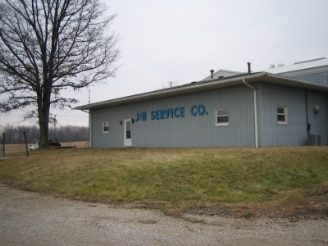
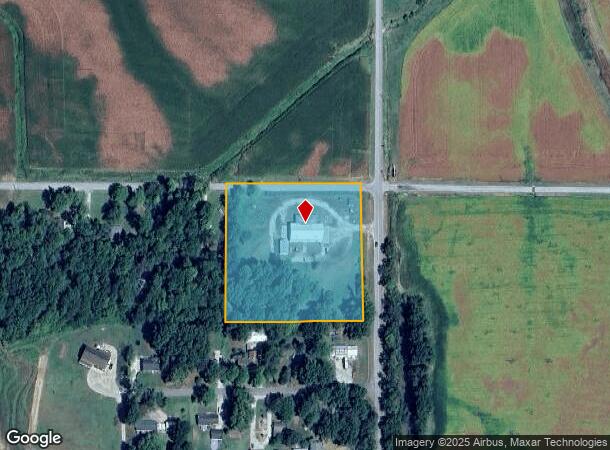
11055 Nobles Chapel Rd, Elberfeld, IN 47613
NEARBY LISTINGS FOR SALE OR LEASE
Property Detail
11055 Nobles Chapel Rd
87-04-18-400-023.000-007
PT E1/2 SE. S18 T4 R9. 4.045 A.
Manufacturinglight
Warrick
X
Indiana
18051C0450E
4.05 AC
2024
Warrick County
2024
Evansville
030200
Evansville, IN-KY
6,440 SF
DEMOGRAPHICS near 11055 Nobles Chapel Rd
1 Mile
3 Mile
5 Mile
2024 Total Population
488
2,154
4,050
2029 Population
504
2,203
4,103
Pop Growth 2024-2029
+ 3.28%
+ 2.27%
+ 1.31%
Average Age
40
41
41
2024 Total Households
191
838
1,551
HH Growth 2024-2029
+ 3.66%
+ 2.27%
+ 1.23%
Median Household Inc
$98,546
$98,499
$96,350
Avg Household Size
2.50
2.60
2.60
2024 Avg HH Vehicles
3.00
3.00
3.00
Median Home Value
$196,874
$232,828
$260,082
Median Year Built
1971
1971
1974
Nearby Places
- Restaurants
- Banks
- Shops
- Fitness
- Groceries
PUBLIC TRANSPORTATION
AIRPORT
Evansville Regional
DRIVE
WALK
Distance
Evansville Regional
28 min
15.2 mi
Freight Ports
Port of Toledo
DRIVE
WALK
Distance
Port of Toledo
439 min
377.0 mi
Nearby Properties
Address
Land Use
TOTAL SIZE
Lot Size
Zoning
Address
Land Use
TOTAL SIZE
Lot Size
Zoning
110,526 SF
15 AC
Address
Land Use
TOTAL SIZE
Lot Size
Zoning
80,000 SF
6.97 AC
Address
Land Use
TOTAL SIZE
Lot Size
Zoning
33,864 SF
9.58 AC
Address
Land Use
TOTAL SIZE
Lot Size
Zoning
10,430 SF
5.90 AC
Address
Land Use
TOTAL SIZE
Lot Size
Zoning
Address
Land Use
TOTAL SIZE
Lot Size
Zoning
42,200 SF
4.99 AC
Address
Land Use
TOTAL SIZE
Lot Size
Zoning
9,220 SF
1.75 AC
Address
Land Use
TOTAL SIZE
Lot Size
Zoning
7,200 SF
5.32 AC
Address
Land Use
TOTAL SIZE
Lot Size
Zoning
8,400 SF
38.96 AC
Address
Land Use
TOTAL SIZE
Lot Size
Zoning
21.85 AC
M-2
Address
Land Use
TOTAL SIZE
Lot Size
Zoning
15,654 SF
4.66 AC
Address
Land Use
TOTAL SIZE
Lot Size
Zoning
4,232 SF
0.09 AC
Address
Land Use
TOTAL SIZE
Lot Size
Zoning
Address
Land Use
TOTAL SIZE
Lot Size
Zoning
160 AC
Address
Land Use
TOTAL SIZE
Lot Size
Zoning
1,424 SF
139.84 AC
Address
Land Use
TOTAL SIZE
Lot Size
Zoning
6,932 SF
0.84 AC
Address
Land Use
TOTAL SIZE
Lot Size
Zoning
16,555 SF
4.48 AC
Address
Land Use
TOTAL SIZE
Lot Size
Zoning
3,000 SF
0.78 AC
Address
Land Use
TOTAL SIZE
Lot Size
Zoning
6,634 SF
0.15 AC
Address
Land Use
TOTAL SIZE
Lot Size
Zoning
2,334 SF
1.64 AC
Address
Land Use
TOTAL SIZE
Lot Size
Zoning
28,225 SF
1.88 AC
Address
Land Use
TOTAL SIZE
Lot Size
Zoning
3,165 SF
0.18 AC
Address
Land Use
TOTAL SIZE
Lot Size
Zoning
2,651 SF
0.08 AC
Address
Land Use
TOTAL SIZE
Lot Size
Zoning
63.02 AC
Address
Land Use
TOTAL SIZE
Lot Size
Zoning
Address
Land Use
TOTAL SIZE
Lot Size
Zoning
Address
Land Use
TOTAL SIZE
Lot Size
Zoning
10 AC
Address
Land Use
TOTAL SIZE
Lot Size
Zoning
Address
Land Use
TOTAL SIZE
Lot Size
Zoning
The World's #1 Commercial Real Estate Marketplace
Connect with us
© 2025 CoStar Group
The information above has been obtained from sources believed reliable. While we do not doubt its accuracy we have not verified it and make no guarantee, warranty or representation about it. It is your responsibility to independently confirm its accuracy and completeness. Any projections, opinions, assumptions, or estimates used are for example only and do not represent the current or future performance of the property. The value of this transaction to you depends on tax and other factors which should be evaluated by your tax, financial, and legal advisors. You and your advisors should conduct a careful, independent investigation of the property to determine to your satisfaction the suitability of the property for your needs.