Property Record
1106 Vance Jackson Rd, San Antonio, TX 78201


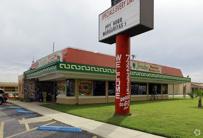
Property Detail
1106 Vance Jackson Rd
San Antonio-New Braunfels, TX
NCB 7185 BLK 1 LOT 33
07185-001-0331
BEXAR
Restaurantbuilding
Texas
B and X Area of moderate flood hazard, usually the area between the limits of the 100-year and 500-year floods.
331
2025
0.43 AC
2025
Northwest
180201
San Antonio
3,926 SF
NEARBY LISTINGS FOR SALE OR LEASE
DEMOGRAPHICS near 1106 Vance Jackson Rd
1 mile
3 mile
5 mile
2025 Total Population
19,218
147,409
412,305
2030 Population
20,034
154,196
433,592
Pop Growth 2025-2030
+ 4.25%
+ 4.60%
+ 5.16%
Average Age
40
39
38
2025 Total Households
7,540
58,597
167,058
HH Growth 2025-2030
+ 4.51%
+ 4.83%
+ 5.53%
Median Household Inc
$45,507
$51,085
$52,861
Avg Household Size
2.50
2.40
2.30
2025 Avg HH Vehicles
2.00
2.00
2.00
Median Home Value
$179,814
$224,300
$235,528
Median Year Built
1961
1962
1972
Nearby Places
Map Layers
Map Styles
 Street
 Aerial
Layers
 Traffic
 Biking
Places
Listings with unknown addresses are not visible on the map
- Restaurants
- Banks
- Shops
- Fitness
- Groceries
PUBLIC TRANSPORTATION
COMMUTER RAIL
San Antonio Amtrak Station (Sunset Limited - Amtrak, Texas Eagle - Amtrak)
Drive
Walk
Distance
San Antonio Amtrak Station (Sunset Limited - Amtrak, Texas Eagle - Amtrak)
12 min
6.9 mi
AIRPORT
San Antonio International
Drive
Walk
Distance
San Antonio International
10 min
6.0 mi
Freight Ports
Calhoun Port
Drive
Walk
Distance
Calhoun Port
188 min
154.4 mi
Nearby Properties
Address
Land Use
TOTAL SIZE
Lot Size
Zoning
Address
Land Use
TOTAL SIZE
Lot Size
Zoning
1,414,945 SF
16.77 AC
Address
Land Use
TOTAL SIZE
Lot Size
Zoning
609,267 SF
30.47 AC
Address
Land Use
TOTAL SIZE
Lot Size
Zoning
429,561 SF
25.70 AC
Address
Land Use
TOTAL SIZE
Lot Size
Zoning
97.47 AC
Address
Land Use
TOTAL SIZE
Lot Size
Zoning
278,352 SF
10 AC
Address
Land Use
TOTAL SIZE
Lot Size
Zoning
482,412 SF
22.97 AC
Address
Land Use
TOTAL SIZE
Lot Size
Zoning
506,058 SF
25.23 AC
Address
Land Use
TOTAL SIZE
Lot Size
Zoning
356,368 SF
18.58 AC
Address
Land Use
TOTAL SIZE
Lot Size
Zoning
137,036 SF
4.73 AC
Address
Land Use
TOTAL SIZE
Lot Size
Zoning
122,292 SF
12.83 AC
Address
Land Use
TOTAL SIZE
Lot Size
Zoning
293,420 SF
9.24 AC
Address
Land Use
TOTAL SIZE
Lot Size
Zoning
256,678 SF
4.42 AC
Address
Land Use
TOTAL SIZE
Lot Size
Zoning
138,674 SF
11.14 AC
Address
Land Use
TOTAL SIZE
Lot Size
Zoning
207,445 SF
9.55 AC
Address
Land Use
TOTAL SIZE
Lot Size
Zoning
Address
Land Use
TOTAL SIZE
Lot Size
Zoning
279,112 SF
10.62 AC
Address
Land Use
TOTAL SIZE
Lot Size
Zoning
307,052 SF
9.91 AC
Address
Land Use
TOTAL SIZE
Lot Size
Zoning
97,800 SF
0.85 AC
Address
Land Use
TOTAL SIZE
Lot Size
Zoning
206,623 SF
2.70 AC
Address
Land Use
TOTAL SIZE
Lot Size
Zoning
166,170 SF
25.56 AC
Address
Land Use
TOTAL SIZE
Lot Size
Zoning
184,262 SF
6.13 AC
Address
Land Use
TOTAL SIZE
Lot Size
Zoning
181,290 SF
5.57 AC
Address
Land Use
TOTAL SIZE
Lot Size
Zoning
217,700 SF
11.90 AC
Address
Land Use
TOTAL SIZE
Lot Size
Zoning
134,802 SF
8.02 AC
Address
Land Use
TOTAL SIZE
Lot Size
Zoning
195,411 SF
5.15 AC
Address
Land Use
TOTAL SIZE
Lot Size
Zoning
175,347 SF
4.71 AC
Address
Land Use
TOTAL SIZE
Lot Size
Zoning
Address
Land Use
TOTAL SIZE
Lot Size
Zoning
75,169 SF
17.44 AC
Address
Land Use
TOTAL SIZE
Lot Size
Zoning
97,280 SF
3 AC
Address
Land Use
TOTAL SIZE
Lot Size
Zoning
168,619 SF
8.38 AC
The World's #1 Commercial Real Estate Marketplace
Connect with us
© 2026 CoStar Group
The information above has been obtained from sources believed reliable. While we do not doubt its accuracy we have not verified it and make no guarantee, warranty or representation about it. It is your responsibility to independently confirm its accuracy and completeness. Any projections, opinions, assumptions, or estimates used are for example only and do not represent the current or future performance of the property. The value of this transaction to you depends on tax and other factors which should be evaluated by your tax, financial, and legal advisors. You and your advisors should conduct a careful, independent investigation of the property to determine to your satisfaction the suitability of the property for your needs.