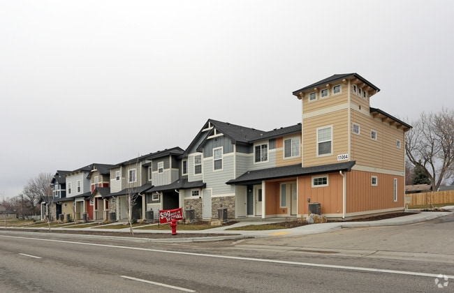
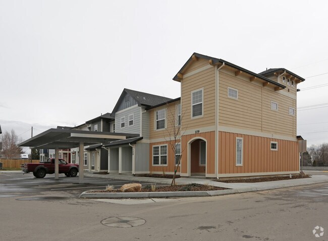
Property Record
11064 W Ustick Rd, Boise, ID 83713

Save to a Folder
{{folder.Name}}
{{folder.ListingIds.length}} Properties
{{folder.ListingIds.length}} Property
Create a New Folder
Property Detail
11064 W Ustick Rd
S0534438601
PAR #8601 @ S SIDE SE4 SEC 34 4N 1E #438600-B
Commercialbuilding
Ada
R-2D
Idaho
B and X Area of moderate flood hazard, usually the area between the limits of the 100-year and 500-year floods.
1.41 AC
2025
West Valley
2025
Boise City/Nampa
002416
Boise City, ID
22,748 SF
NEARBY LISTINGS FOR SALE OR LEASE
DEMOGRAPHICS near 11064 W Ustick Rd
1 mile
3 mile
5 mile
2025 Total Population
16,284
100,607
255,079
2030 Population
16,826
105,054
266,710
Pop Growth 2025-2030
+ 3.33%
+ 4.42%
+ 4.56%
Average Age
41
41
41
2025 Total Households
6,290
39,301
100,111
HH Growth 2025-2030
+ 3.78%
+ 4.86%
+ 5.01%
Median Household Inc
$75,965
$85,816
$86,656
Avg Household Size
2.50
2.50
2.50
2025 Avg HH Vehicles
2.00
2.00
2.00
Median Home Value
$419,034
$462,250
$490,413
Median Year Built
1989
1994
1995
Nearby Places
Map Layers
Map Styles
 Street
 Aerial
Layers
 Traffic
 Biking
Places
Listings with unknown addresses are not visible on the map
- Restaurants
- Banks
- Shops
- Fitness
- Groceries
PUBLIC TRANSPORTATION
AIRPORT
Boise Air Trml/Gowen Field
Drive
Walk
Distance
Boise Air Trml/Gowen Field
16 min
9.6 mi
Nearby Properties
Address
Land Use
TOTAL SIZE
Lot Size
Zoning
Address
Land Use
TOTAL SIZE
Lot Size
Zoning
533,727 SF
22.89 AC
C-G
Address
Land Use
TOTAL SIZE
Lot Size
Zoning
646,787 SF
27.37 AC
C-2D
Address
Land Use
TOTAL SIZE
Lot Size
Zoning
789,114 SF
11.38 AC
C-G
Address
Land Use
TOTAL SIZE
Lot Size
Zoning
505,966 SF
51.08 AC
L-O
Address
Land Use
TOTAL SIZE
Lot Size
Zoning
334,124 SF
11.21 AC
R-3D
Address
Land Use
TOTAL SIZE
Lot Size
Zoning
269,509 SF
12 AC
R-40
Address
Land Use
TOTAL SIZE
Lot Size
Zoning
335,459 SF
11.23 AC
R-40
Address
Land Use
TOTAL SIZE
Lot Size
Zoning
301,800 SF
12.70 AC
R-3D
Address
Land Use
TOTAL SIZE
Lot Size
Zoning
243,949 SF
13.81 AC
R-40
Address
Land Use
TOTAL SIZE
Lot Size
Zoning
305,889 SF
9.91 AC
R-40
Address
Land Use
TOTAL SIZE
Lot Size
Zoning
310,580 SF
2.44 AC
C-G
Address
Land Use
TOTAL SIZE
Lot Size
Zoning
171,454 SF
10.66 AC
C-G
Address
Land Use
TOTAL SIZE
Lot Size
Zoning
203,377 SF
21.13 AC
C-G
Address
Land Use
TOTAL SIZE
Lot Size
Zoning
207,033 SF
10.67 AC
L-OD
Address
Land Use
TOTAL SIZE
Lot Size
Zoning
230,810 SF
20.09 AC
C-G
Address
Land Use
TOTAL SIZE
Lot Size
Zoning
249,800 SF
12.99 AC
C-2D
Address
Land Use
TOTAL SIZE
Lot Size
Zoning
147,239 SF
7.56 AC
C-G
Address
Land Use
TOTAL SIZE
Lot Size
Zoning
319,052 SF
24.33 AC
C-2D
Address
Land Use
TOTAL SIZE
Lot Size
Zoning
238,300 SF
34.70 AC
I-L
Address
Land Use
TOTAL SIZE
Lot Size
Zoning
167,416 SF
18.57 AC
C-G
Address
Land Use
TOTAL SIZE
Lot Size
Zoning
150,584 SF
6.77 AC
M
Address
Land Use
TOTAL SIZE
Lot Size
Zoning
211,460 SF
11.75 AC
C-G
Address
Land Use
TOTAL SIZE
Lot Size
Zoning
162,432 SF
8.31 AC
R-3D
Address
Land Use
TOTAL SIZE
Lot Size
Zoning
72,579 SF
4.48 AC
M-1D
Address
Land Use
TOTAL SIZE
Lot Size
Zoning
207,060 SF
9.88 AC
I-L
Address
Land Use
TOTAL SIZE
Lot Size
Zoning
184,577 SF
11.39 AC
C-G
Address
Land Use
TOTAL SIZE
Lot Size
Zoning
85,483 SF
2.42 AC
C-G
Address
Land Use
TOTAL SIZE
Lot Size
Zoning
203,635 SF
4.76 AC
L-OD
Address
Land Use
TOTAL SIZE
Lot Size
Zoning
176,494 SF
10.16 AC
R-1C
Address
Land Use
TOTAL SIZE
Lot Size
Zoning
253,440 SF
15.19 AC
I-L
The World's #1 Commercial Real Estate Marketplace
Connect with us
© 2026 CoStar Group
The information above has been obtained from sources believed reliable. While we do not doubt its accuracy we have not verified it and make no guarantee, warranty or representation about it. It is your responsibility to independently confirm its accuracy and completeness. Any projections, opinions, assumptions, or estimates used are for example only and do not represent the current or future performance of the property. The value of this transaction to you depends on tax and other factors which should be evaluated by your tax, financial, and legal advisors. You and your advisors should conduct a careful, independent investigation of the property to determine to your satisfaction the suitability of the property for your needs.