Property Record
1107 132Nd Ave, Wayland, MI 49348
NEARBY LISTINGS FOR SALE OR LEASE
-
-
No Photo
-
View all Wayland listings for sale on LoopNet.com
Property Detail
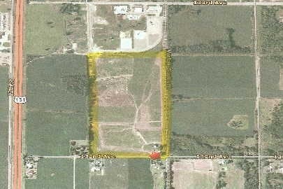
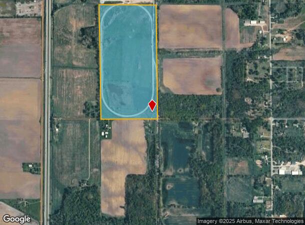
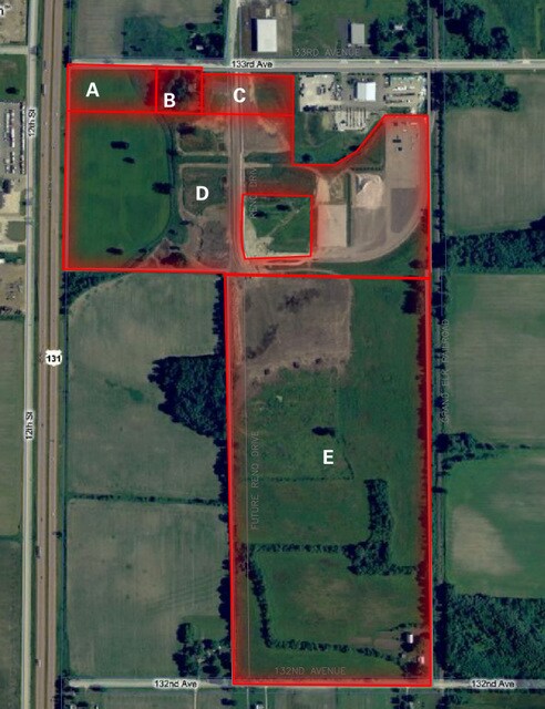
1107 132Nd Ave
24-007-005-00
E 1/2 SW 1/4 -- EX E 50' SEC 7 T3N R11W
Industrialgeneral
Allegan
X
Michigan
26005C0270G
78.41 AC
2024
Outlying Allegan County
2025
West Michigan
030502
Holland, MI
1,302 SF
DEMOGRAPHICS near 1107 132Nd Ave
1 Mile
3 Mile
5 Mile
2024 Total Population
206
6,660
10,148
2029 Population
207
6,746
10,221
Pop Growth 2024-2029
+ 0.49%
+ 1.29%
+ 0.72%
Average Age
39
38
39
2024 Total Households
75
2,508
3,762
HH Growth 2024-2029
0.00%
+ 1.24%
+ 0.69%
Median Household Inc
$72,272
$70,436
$73,789
Avg Household Size
2.60
2.60
2.60
2024 Avg HH Vehicles
2.00
2.00
2.00
Median Home Value
$238,889
$184,649
$214,737
Median Year Built
1989
1985
1983
Nearby Places
Map Layers
Map Styles
 Street
 Aerial
- Restaurants
- Banks
- Shops
- Fitness
- Groceries
PUBLIC TRANSPORTATION
AIRPORT
Gerald R Ford International
DRIVE
WALK
Distance
Gerald R Ford International
37 min
25.1 mi
Kalamazoo/Battle Creek International
DRIVE
WALK
Distance
Kalamazoo/Battle Creek International
49 min
36.6 mi
Freight Ports
Port Milwaukee
DRIVE
WALK
Distance
Port Milwaukee
300 min
255.9 mi
Nearby Properties
Address
Land Use
TOTAL SIZE
Lot Size
Zoning
Address
Land Use
TOTAL SIZE
Lot Size
Zoning
460,060 SF
122.91 AC
Address
Land Use
TOTAL SIZE
Lot Size
Zoning
104,783 SF
41.55 AC
Address
Land Use
TOTAL SIZE
Lot Size
Zoning
99,487 SF
14.18 AC
Address
Land Use
TOTAL SIZE
Lot Size
Zoning
64,863 SF
10.14 AC
Address
Land Use
TOTAL SIZE
Lot Size
Zoning
69,034 SF
22.50 AC
Address
Land Use
TOTAL SIZE
Lot Size
Zoning
62,500 SF
18.89 AC
Address
Land Use
TOTAL SIZE
Lot Size
Zoning
81,396 SF
12.32 AC
Address
Land Use
TOTAL SIZE
Lot Size
Zoning
60.53 AC
Address
Land Use
TOTAL SIZE
Lot Size
Zoning
70,748 SF
20.74 AC
Address
Land Use
TOTAL SIZE
Lot Size
Zoning
170,318 SF
7.11 AC
Address
Land Use
TOTAL SIZE
Lot Size
Zoning
121,440 SF
8.89 AC
Address
Land Use
TOTAL SIZE
Lot Size
Zoning
37,449 SF
7.38 AC
Address
Land Use
TOTAL SIZE
Lot Size
Zoning
17,903 SF
2.05 AC
Address
Land Use
TOTAL SIZE
Lot Size
Zoning
Address
Land Use
TOTAL SIZE
Lot Size
Zoning
7,104 SF
2.03 AC
Address
Land Use
TOTAL SIZE
Lot Size
Zoning
7,948 SF
4.91 AC
Address
Land Use
TOTAL SIZE
Lot Size
Zoning
5,144 SF
160 AC
AG
Address
Land Use
TOTAL SIZE
Lot Size
Zoning
71,798 SF
11.11 AC
Address
Land Use
TOTAL SIZE
Lot Size
Zoning
9,584 SF
2.47 AC
Address
Land Use
TOTAL SIZE
Lot Size
Zoning
6,500 SF
9.88 AC
Address
Land Use
TOTAL SIZE
Lot Size
Zoning
20,231 SF
4.27 AC
Address
Land Use
TOTAL SIZE
Lot Size
Zoning
3,921 SF
120 AC
AG
Address
Land Use
TOTAL SIZE
Lot Size
Zoning
139.40 AC
Address
Land Use
TOTAL SIZE
Lot Size
Zoning
15,048 SF
5.20 AC
Address
Land Use
TOTAL SIZE
Lot Size
Zoning
11,600 SF
5.25 AC
Address
Land Use
TOTAL SIZE
Lot Size
Zoning
36,868 SF
2.81 AC
Address
Land Use
TOTAL SIZE
Lot Size
Zoning
183.22 AC
Address
Land Use
TOTAL SIZE
Lot Size
Zoning
28,156 SF
3.26 AC
Address
Land Use
TOTAL SIZE
Lot Size
Zoning
4,872 SF
1.75 AC
Address
Land Use
TOTAL SIZE
Lot Size
Zoning
15,275 SF
11.65 AC
The World's #1 Commercial Real Estate Marketplace
Connect with us
© 2025 CoStar Group
The information above has been obtained from sources believed reliable. While we do not doubt its accuracy we have not verified it and make no guarantee, warranty or representation about it. It is your responsibility to independently confirm its accuracy and completeness. Any projections, opinions, assumptions, or estimates used are for example only and do not represent the current or future performance of the property. The value of this transaction to you depends on tax and other factors which should be evaluated by your tax, financial, and legal advisors. You and your advisors should conduct a careful, independent investigation of the property to determine to your satisfaction the suitability of the property for your needs.