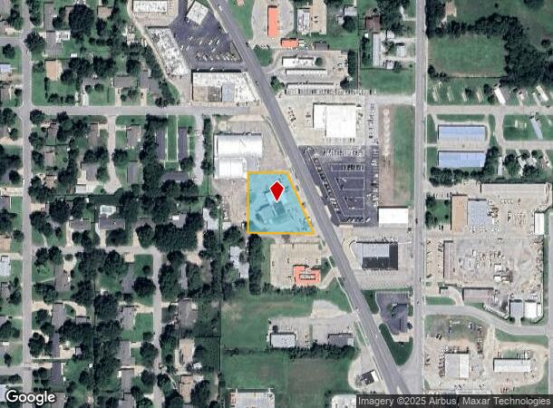
Property Record
1107 Washington Rd, Newton, KS 67114


NEARBY LISTINGS FOR SALE OR LEASE
Property Detail
1107 Washington Rd
094-20-0-40-15-029.00-0
S20, T23, R01E, BEG 817N & 345.3W SE COR SE1/4 ,NW224.2 TO PT 1022N & 436.2W SE COR SE1/4, W147(S), S205, E240(S) TO POB
Warehouse
Harvey
X
Kansas
20079C0214E
0.91 AC
2024
Newton/Hesston
2025
Wichita
030400
Wichita, KS
4,016 SF
DEMOGRAPHICS near 1107 Washington Rd
1 Mile
3 Mile
5 Mile
2024 Total Population
6,290
19,685
21,550
2029 Population
6,260
19,575
21,422
Pop Growth 2024-2029
(0.48%)
(0.56%)
(0.59%)
Average Age
40
41
41
2024 Total Households
2,492
7,893
8,604
HH Growth 2024-2029
(0.52%)
(0.62%)
(0.65%)
Median Household Inc
$61,349
$60,477
$61,329
Avg Household Size
2.40
2.40
2.40
2024 Avg HH Vehicles
2.00
2.00
2.00
Median Home Value
$126,197
$124,357
$130,877
Median Year Built
1963
1962
1963
Nearby Places
Map Layers
Map Styles
 Street
 Aerial
- Restaurants
- Banks
- Shops
- Fitness
- Groceries
PUBLIC TRANSPORTATION
COMMUTER RAIL
DRIVE
WALK
Distance
3 min
1.2 mi
AIRPORT
Wichita Dwight D Eisenhower Ntl
DRIVE
WALK
Distance
Wichita Dwight D Eisenhower Ntl
40 min
31.1 mi
Nearby Properties
Address
Land Use
TOTAL SIZE
Lot Size
Zoning
Address
Land Use
TOTAL SIZE
Lot Size
Zoning
216,365 SF
56.60 AC
Address
Land Use
TOTAL SIZE
Lot Size
Zoning
3,400 SF
46.30 AC
Address
Land Use
TOTAL SIZE
Lot Size
Zoning
33,598 SF
4 AC
Address
Land Use
TOTAL SIZE
Lot Size
Zoning
145,392 SF
33 AC
R3
Address
Land Use
TOTAL SIZE
Lot Size
Zoning
81,340 SF
12.31 AC
Address
Land Use
TOTAL SIZE
Lot Size
Zoning
53,443 SF
11.52 AC
Address
Land Use
TOTAL SIZE
Lot Size
Zoning
61,740 SF
2.39 AC
Address
Land Use
TOTAL SIZE
Lot Size
Zoning
19,697 SF
0.15 AC
Address
Land Use
TOTAL SIZE
Lot Size
Zoning
51,225 SF
5.70 AC
R1
Address
Land Use
TOTAL SIZE
Lot Size
Zoning
49,910 SF
17.05 AC
R1
Address
Land Use
TOTAL SIZE
Lot Size
Zoning
52,180 SF
6.20 AC
R1
Address
Land Use
TOTAL SIZE
Lot Size
Zoning
49,644 SF
10.60 AC
R1
Address
Land Use
TOTAL SIZE
Lot Size
Zoning
36,685 SF
6.10 AC
Address
Land Use
TOTAL SIZE
Lot Size
Zoning
17,253 SF
2.30 AC
PO
Address
Land Use
TOTAL SIZE
Lot Size
Zoning
64,131 SF
1.60 AC
PO
Address
Land Use
TOTAL SIZE
Lot Size
Zoning
32,973 SF
1.40 AC
Address
Land Use
TOTAL SIZE
Lot Size
Zoning
27,268 SF
4.90 AC
Address
Land Use
TOTAL SIZE
Lot Size
Zoning
8,670 SF
37.26 AC
Address
Land Use
TOTAL SIZE
Lot Size
Zoning
21,337 SF
1 AC
R1
Address
Land Use
TOTAL SIZE
Lot Size
Zoning
17,926 SF
0.14 AC
Address
Land Use
TOTAL SIZE
Lot Size
Zoning
16,735 SF
7.10 AC
R1
Address
Land Use
TOTAL SIZE
Lot Size
Zoning
29,115 SF
0.60 AC
Address
Land Use
TOTAL SIZE
Lot Size
Zoning
2,558 SF
2.82 AC
Address
Land Use
TOTAL SIZE
Lot Size
Zoning
13,246 SF
1.20 AC
Address
Land Use
TOTAL SIZE
Lot Size
Zoning
42,160 SF
0.92 AC
PO
Address
Land Use
TOTAL SIZE
Lot Size
Zoning
93,229 SF
18.28 AC
Address
Land Use
TOTAL SIZE
Lot Size
Zoning
15,116 SF
2.50 AC
Address
Land Use
TOTAL SIZE
Lot Size
Zoning
18,431 SF
1.10 AC
Address
Land Use
TOTAL SIZE
Lot Size
Zoning
13,140 SF
1.50 AC
R3
Address
Land Use
TOTAL SIZE
Lot Size
Zoning
19,915 SF
0.15 AC
The World's #1 Commercial Real Estate Marketplace
Connect with us
© 2025 CoStar Group
The information above has been obtained from sources believed reliable. While we do not doubt its accuracy we have not verified it and make no guarantee, warranty or representation about it. It is your responsibility to independently confirm its accuracy and completeness. Any projections, opinions, assumptions, or estimates used are for example only and do not represent the current or future performance of the property. The value of this transaction to you depends on tax and other factors which should be evaluated by your tax, financial, and legal advisors. You and your advisors should conduct a careful, independent investigation of the property to determine to your satisfaction the suitability of the property for your needs.